Geographic Information System is a system intends to capture, Store, manage, manipulate, analyze the data.
 Transforming your GIS data by converting KML to SQLite can simplify analysis, sharing, and integration into various GIS applications. Whether you’re a beginner or an experienced user, this tutorial will guide you through the process in easy steps.
Key Concept of Converting Files
The Converter Tool in MAPOG Map Analysis allows you to change your data from one format to another effortlessly. You input your data in one form, and it transforms it into the required format for your analysis. This versatility enables you to download and use data in various formats, making it adaptable for different applications.
Steps to Convert KML to SQLite with MAPOG
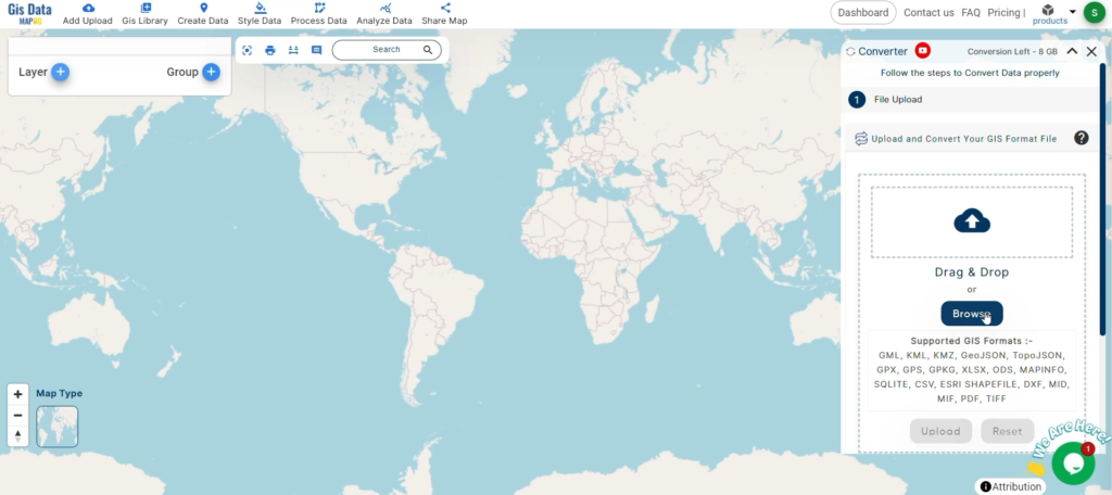
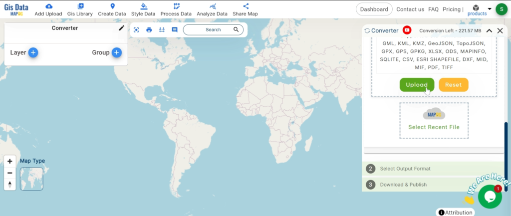
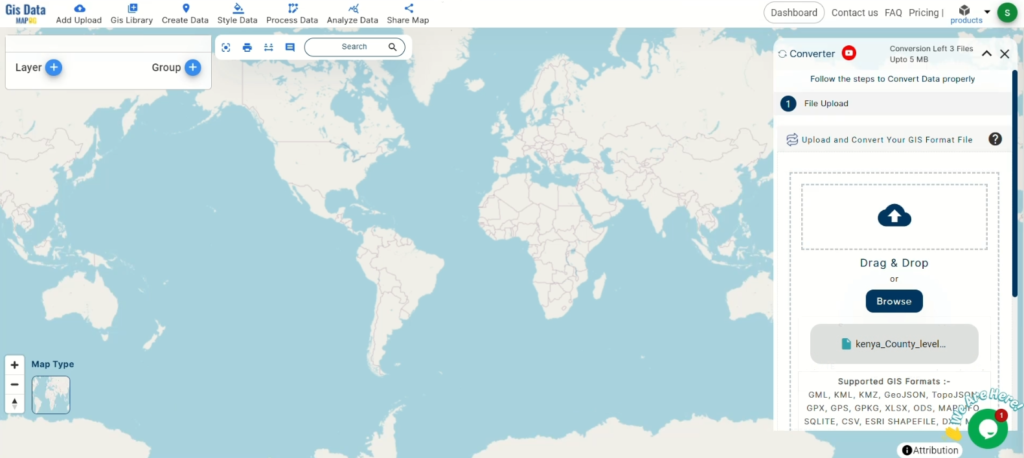
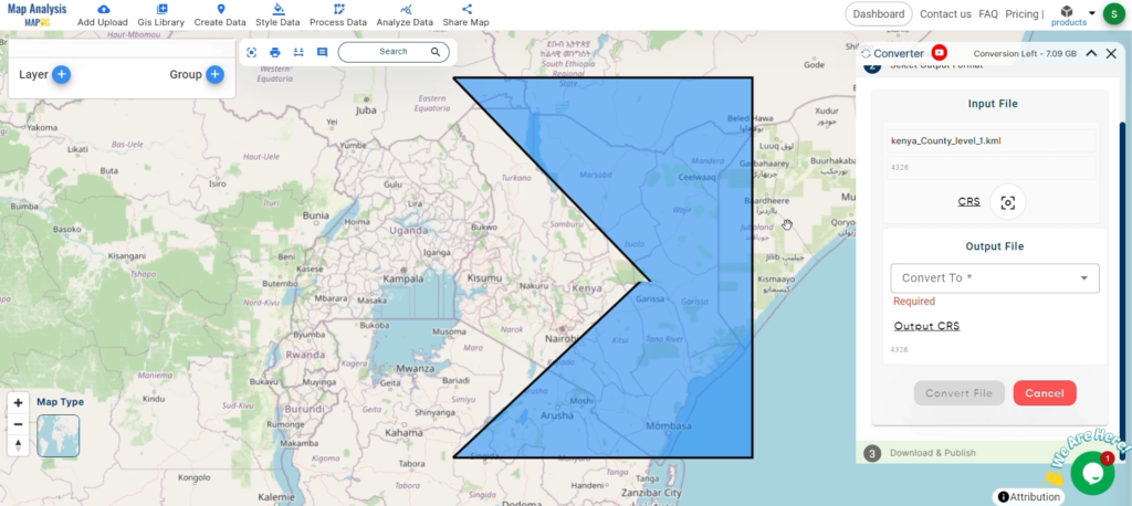
Step 1: Upload the Data
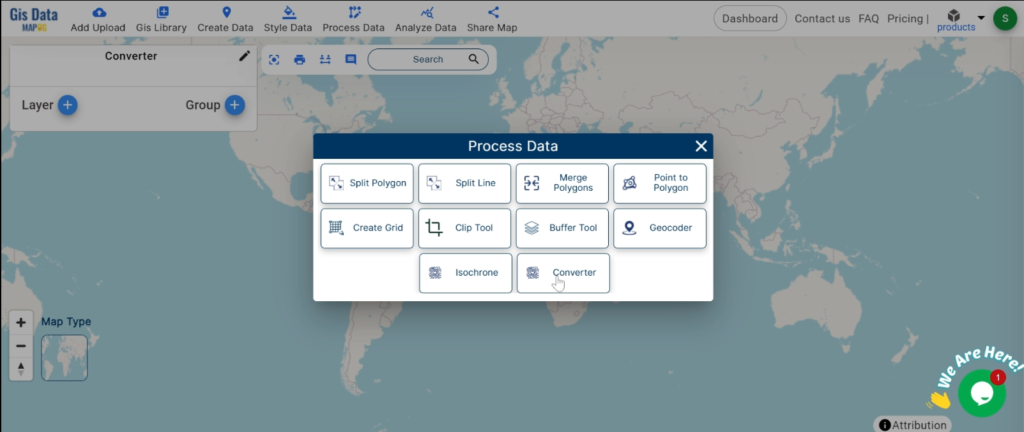
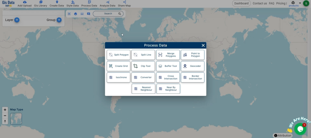
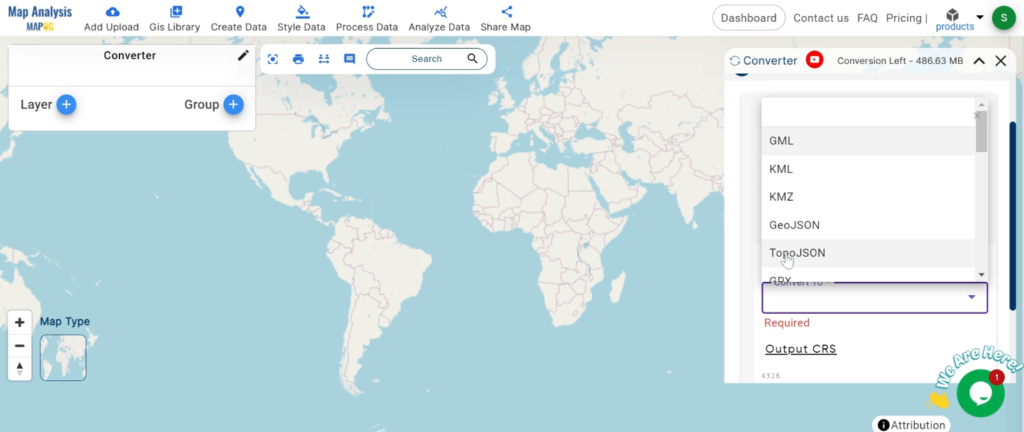
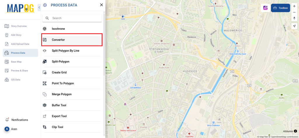
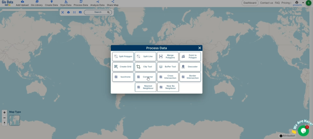
Access the Converter Tool: Click on the “Process Data” menu and choose the “Converter Tool” option.
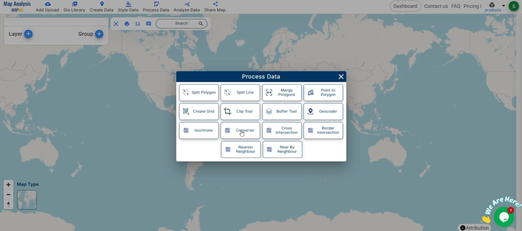
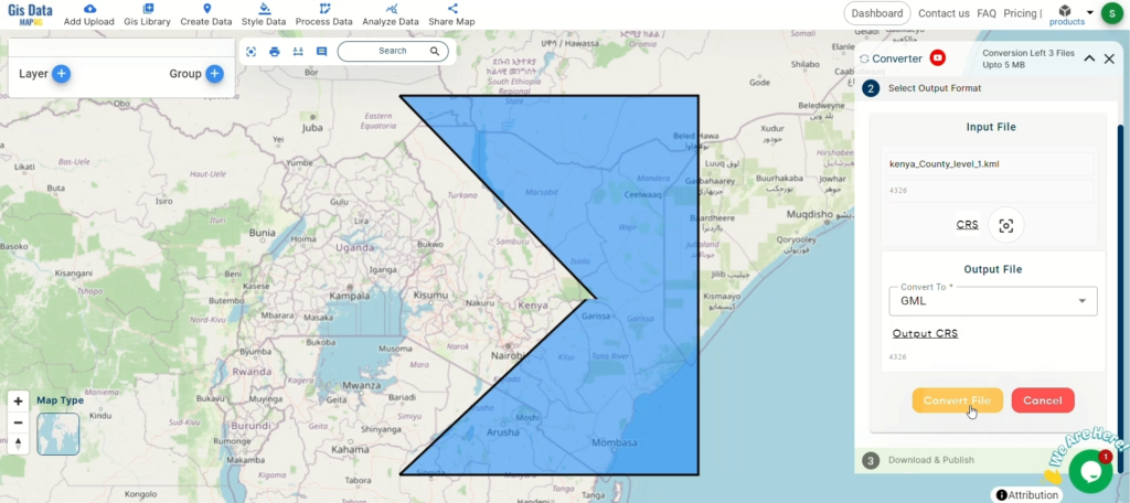
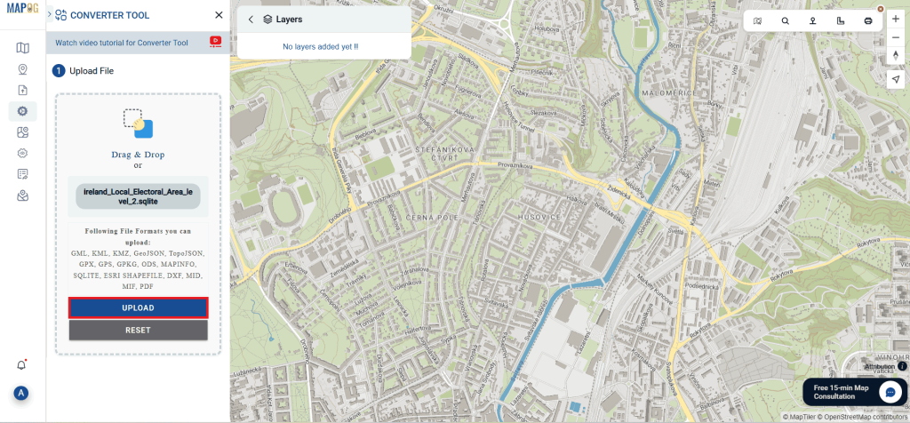
Upload KML File: This is your starting point where you provide the data that needs conversion.
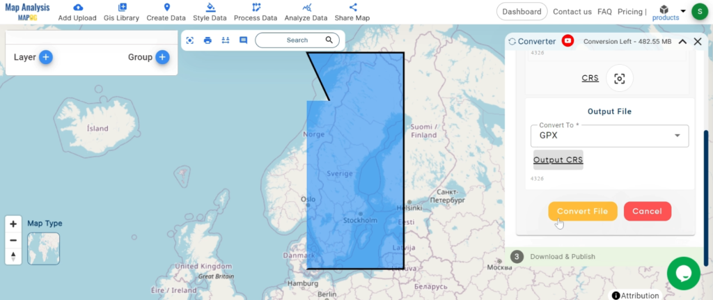
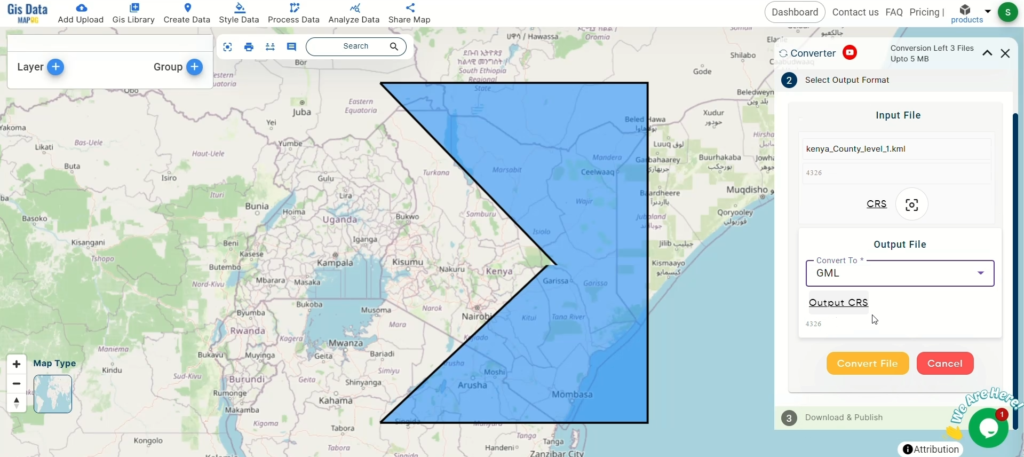
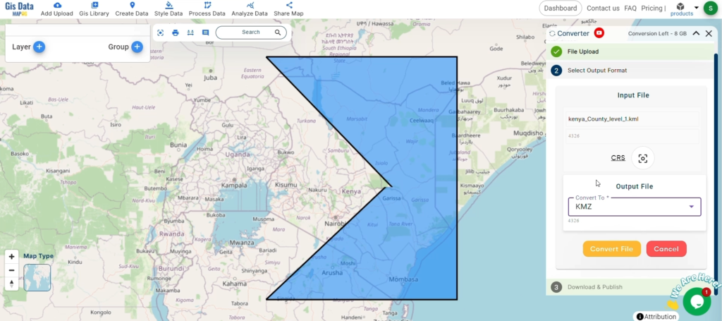
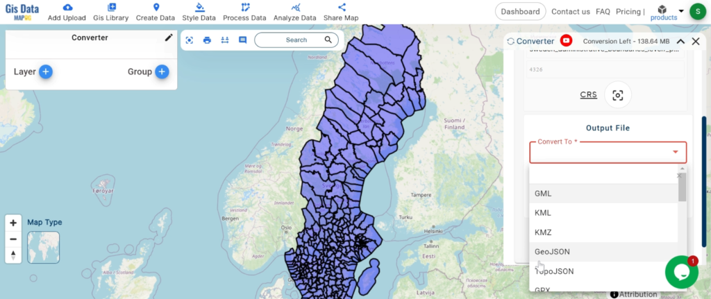
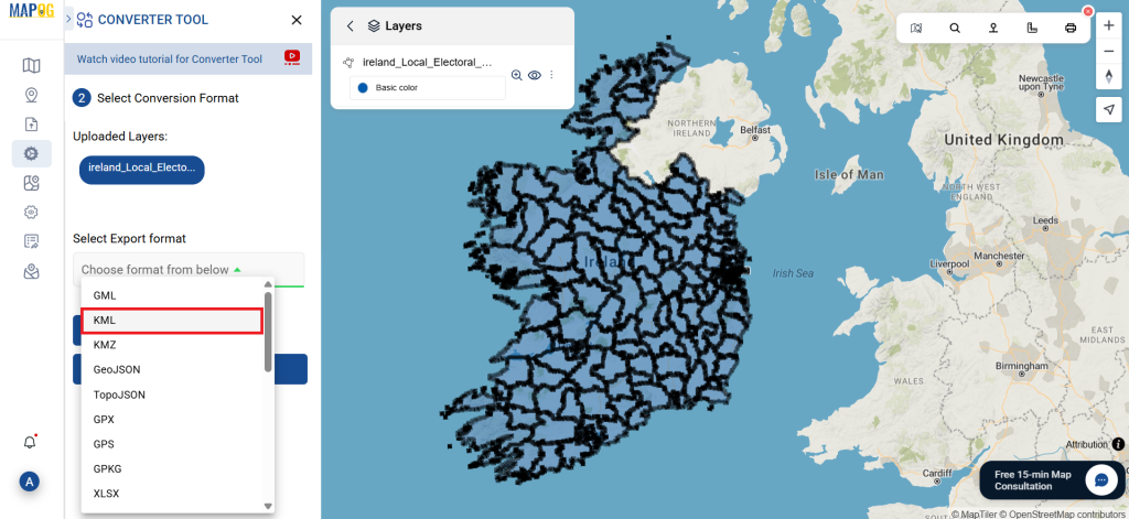
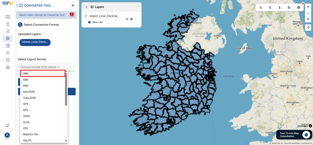
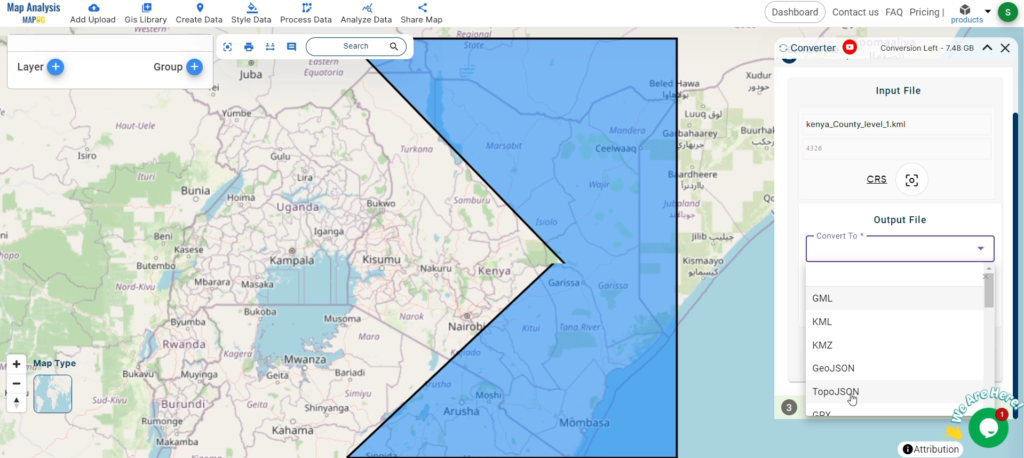
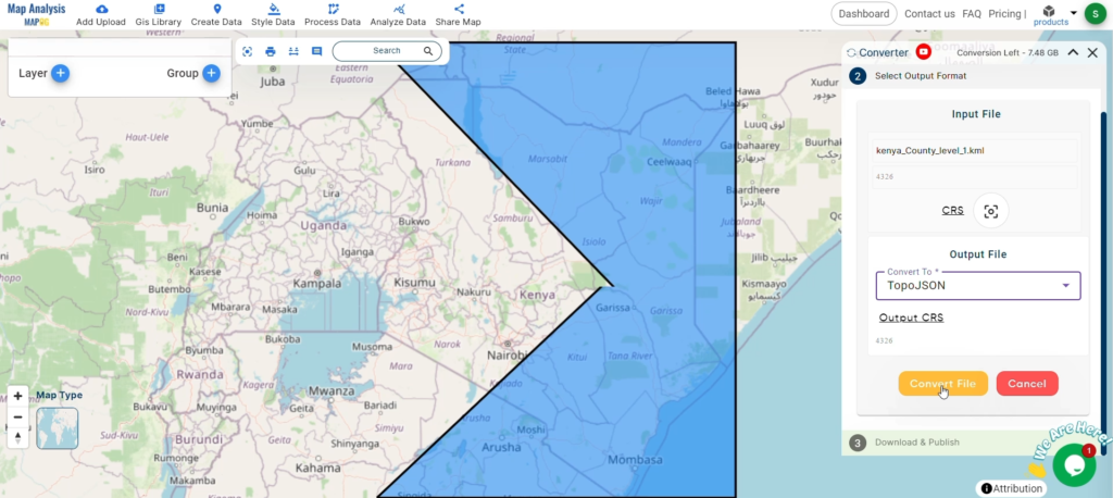
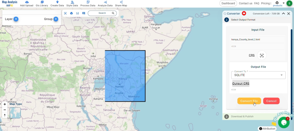
Step 2: Select the Format for Conversion
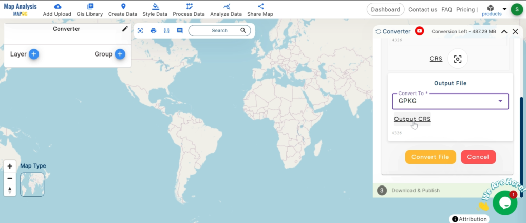
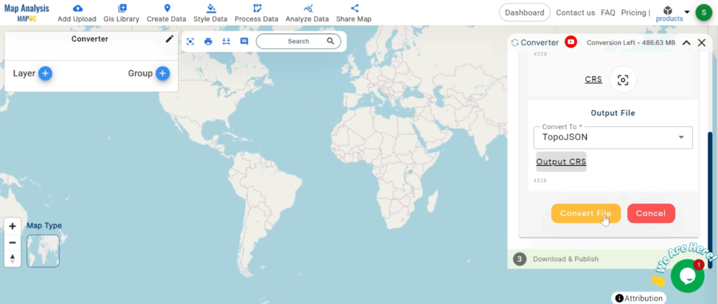
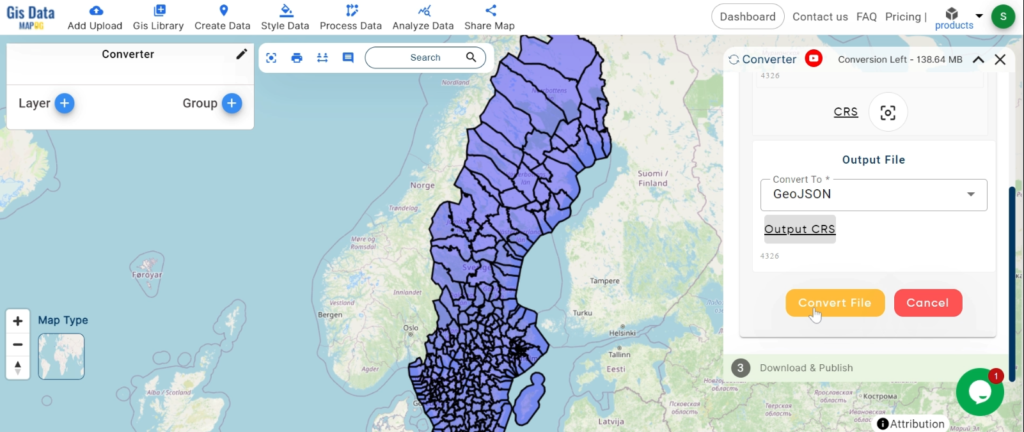
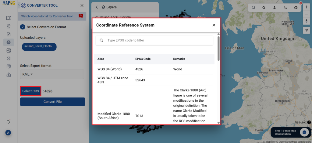
Choose the Output File Format: Select SQLite as the output file format. The tool offers various formats, but for this guide, we focus on converting to SQLite.

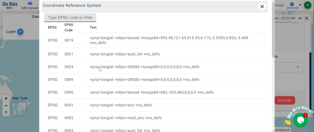
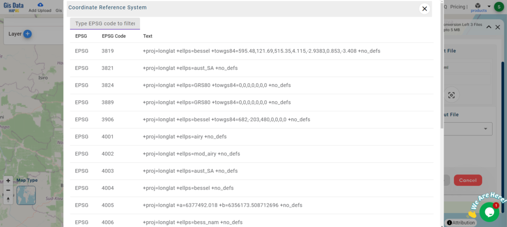
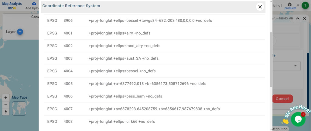
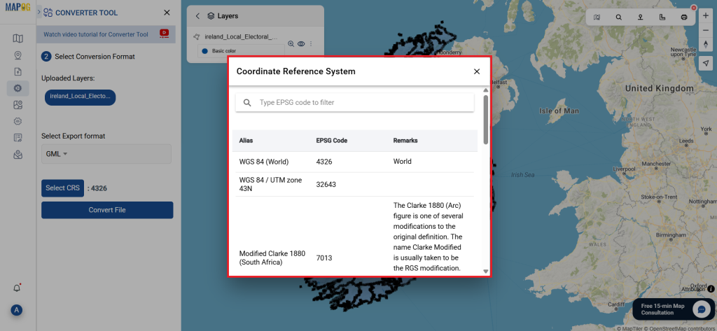
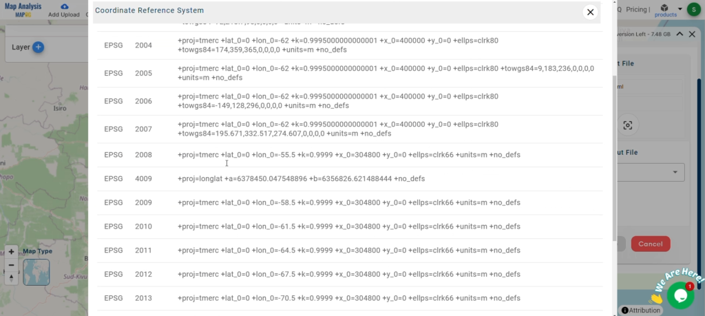
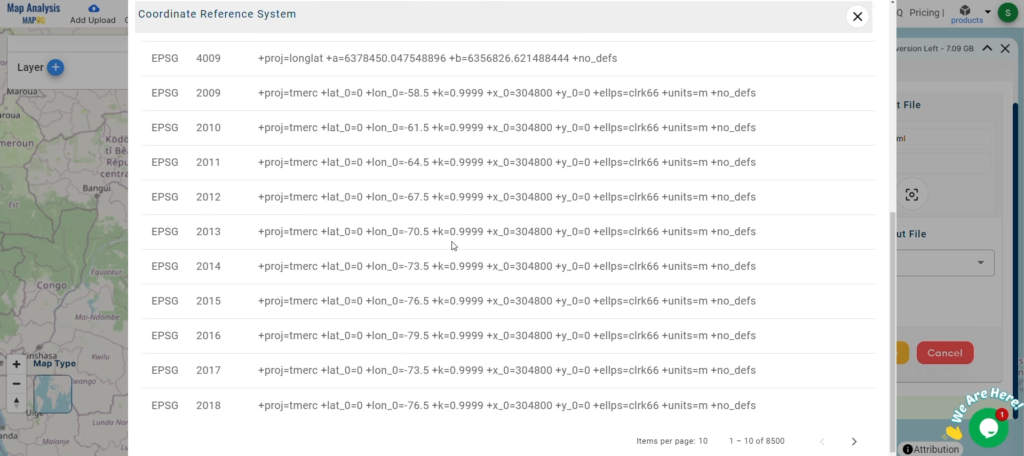
Set the CRS (Coordinate Reference System): You can also set the CRS at this stage to ensure your data aligns correctly with your spatial analysis requirements.
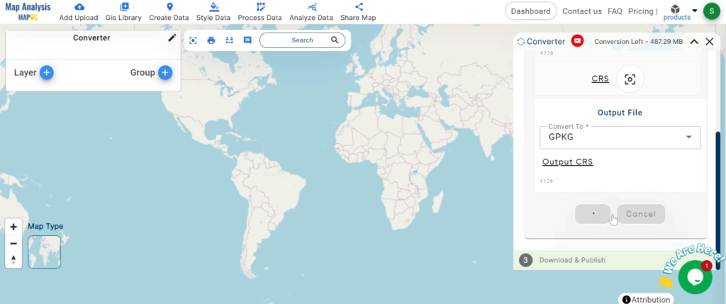
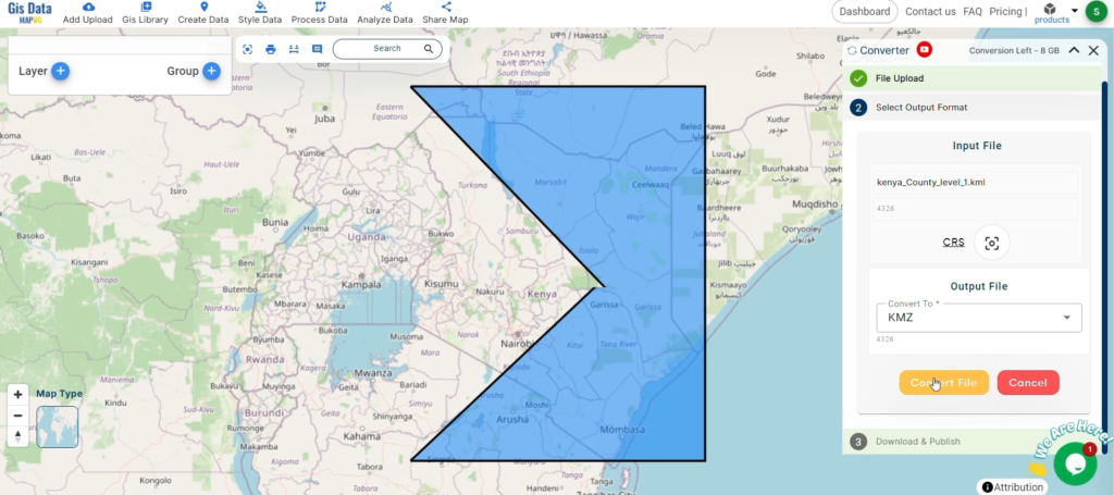
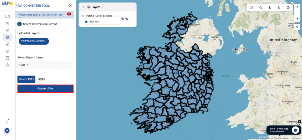
Step 3: Run the Conversion
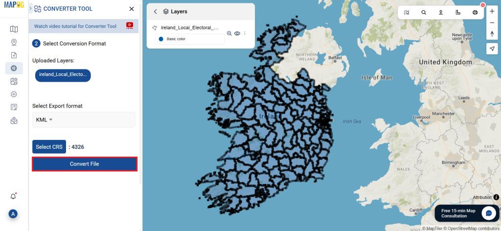
Start the Conversion Process: Click ‘Convert’ and let the tool work its magic. The Converter Tool processes your data, transforming it from KML to SQLite format.
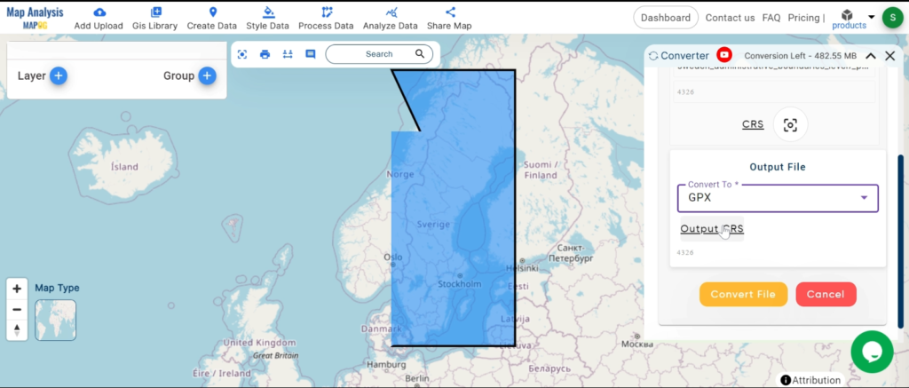
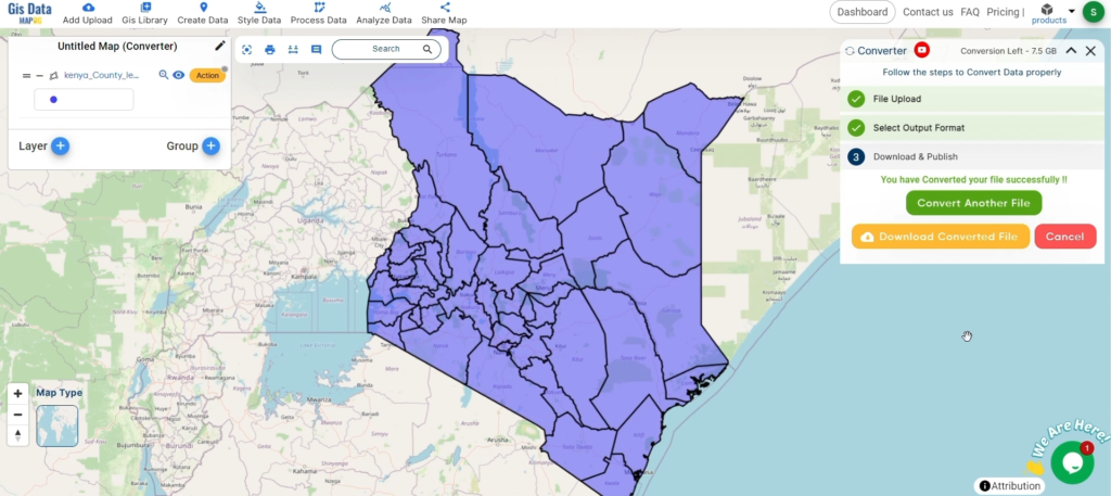
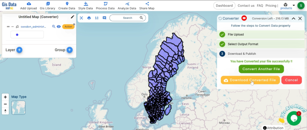
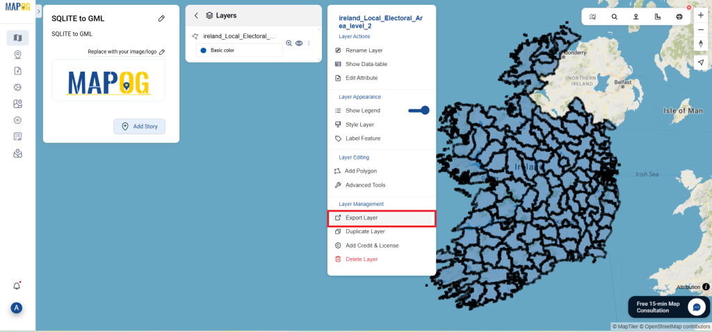
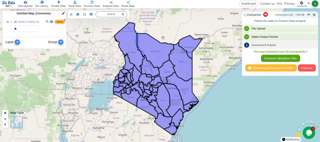
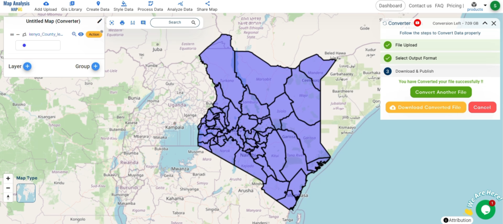
Step 4: Review and Download
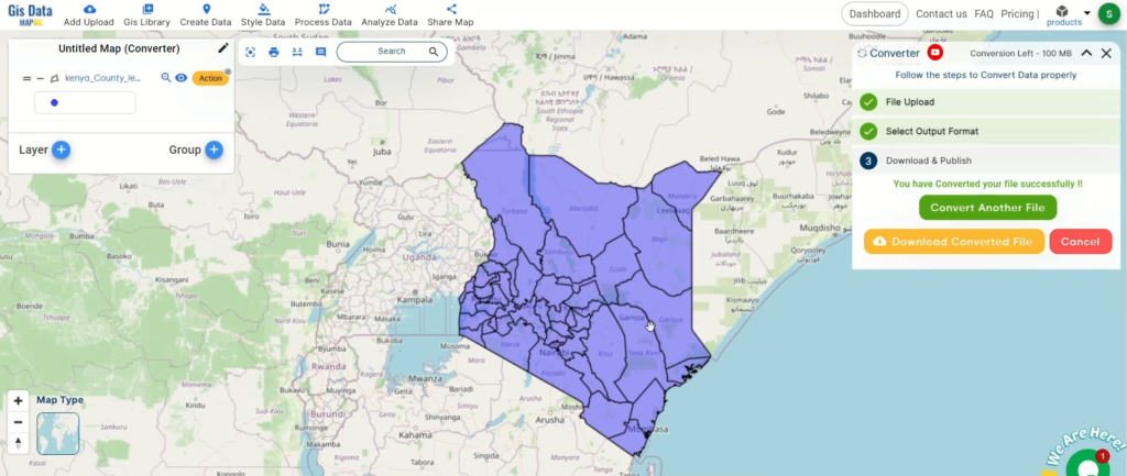
Review the Converted Data: Check your converted SQLite data to ensure it looks correct. This step is crucial to verify that the conversion has been successful and the data integrity is maintained.

Download the Converted File: Once satisfied, download the converted file.
Conclusion
And there you have it! You’ve successfully used the Converter Tool in MAPOG Map Analysis to convert your KML files to SQLite. This conversion simplifies the process of handling different data formats and makes your workflow more efficient and effective. For any queries, please contact us at support@mapog.com.