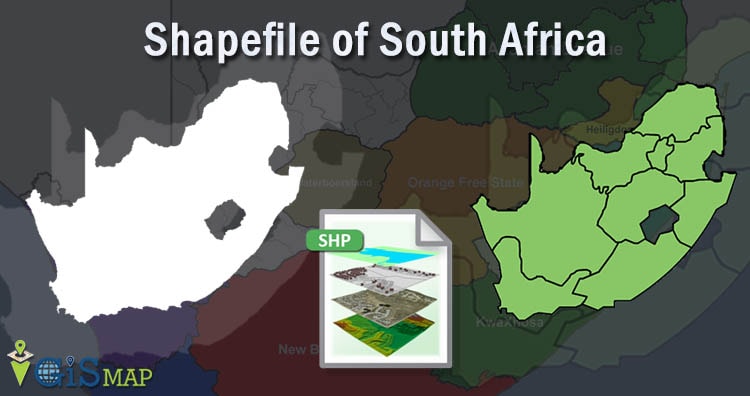
Shapefile is vector data format for geographic information system(GIS). It is developed by ESRI – Environmental Systems Research Institute. It is a simple, non – topological format used for storing geometric location and attributes of Geographic data. Shapefile represent geographic data into points, lines or polygons.
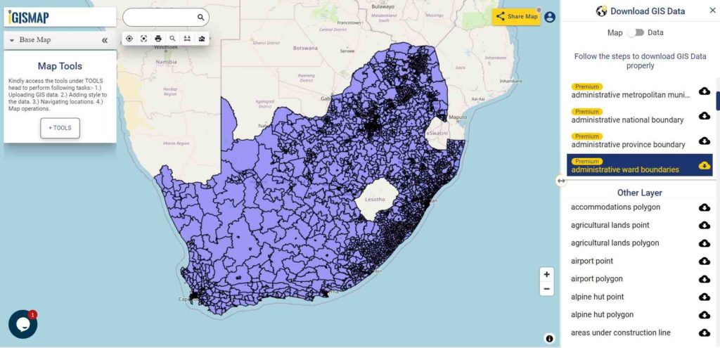
Hello GIS enthusiasts, IGISMAP has now published the latest GIS vector data of South Africa administrative levels. Links for downloading the shapefiles of the important administrative divisions of South Africa are provided in the following. You can also download these data in KML, GeoJSON or CSV formats.
Note:
All data available are in GCS datum EPSG:4326 WGS84 CRS (Coordinate Reference System).
You need to login for downloading the shapefile.
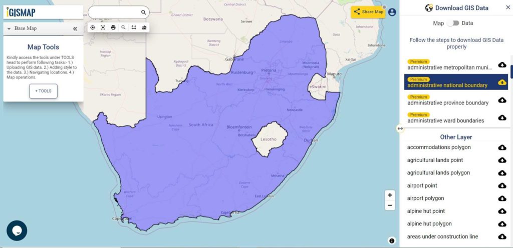
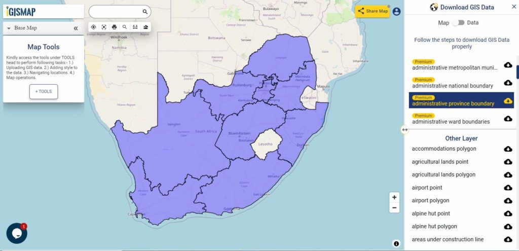
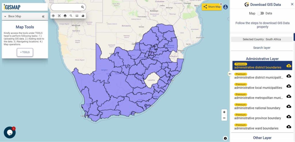
Download Free Shapefile Data of South Africa
South Africa, officially the Republic of South Africa (RSA), is the southernmost country in Africa. South Africa is bounded to the south by 2,798 kilometers (1,739 mi) of coastline that stretch along the South Atlantic and Indian Oceans to the north by the neighboring countries of Namibia, Botswana, and Zimbabwe; and to the east and northeast by Mozambique and Eswatini and it surrounds the enclaved country of Lesotho. It is the southernmost country on the mainland of the Old World, and the most populous country located entirely south of the equator. The largest city is Johannesburg.
Please note that the Argentina data provided here is license under Open Data Commons Open Database License (ODbL). Please review the same before using it. If you want data under different license you can also look over to the post : Download Free Shapefile Maps – Country Boundary Polygon, Rail-Road, Water polyline etc
Disclaimer : If you find any shapefile data of country provided is in correct do contact us or comment below, so that we will correct the same in our system.
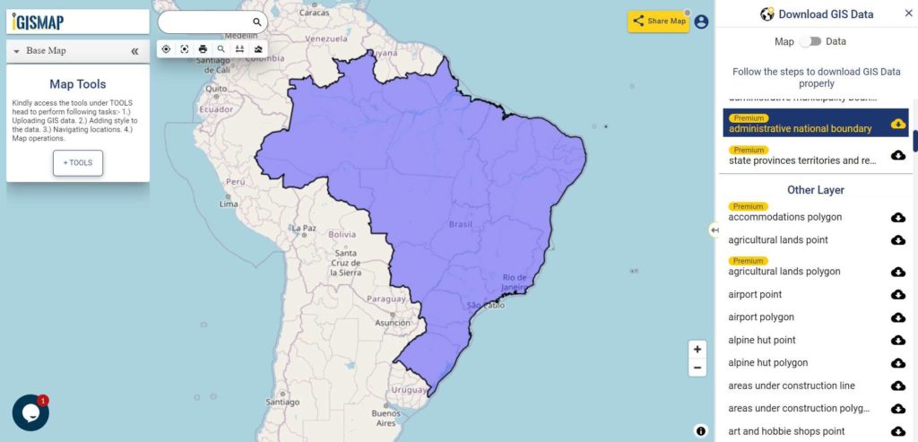
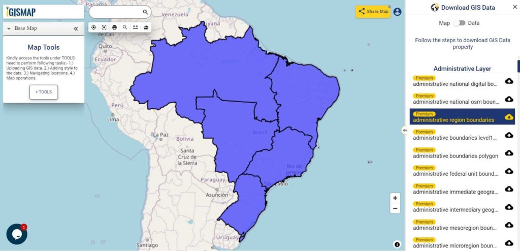
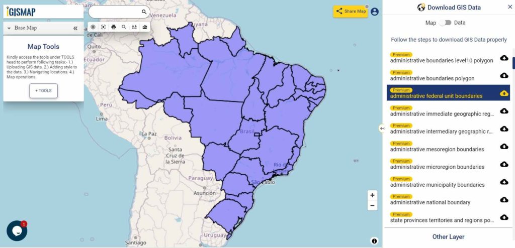
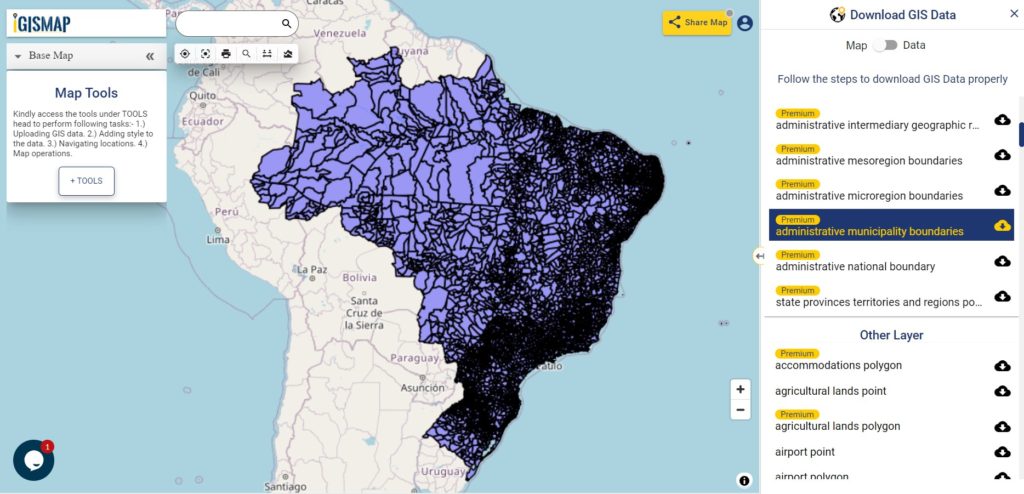
Hello GIS enthusiasts, IGISMAP has now published the latest GIS vector data of Brazil administrative levels. Links for downloading the shapefiles of the important administrative divisions of Brazil are provided in the following. You can also download these data in KML, GeoJSON or CSV formats.
Note:
All data available are in GCS datum EPSG:4326 WGS84 CRS (Coordinate Reference System).
You need to login for downloading the shapefile.
Download Free Shapefile Data of Brazil
Brazil officially the Federative Republic of Brazil (Portuguese: República Federativa do Brasil), is the largest country in both South America and Latin America. At 8.5 million square kilometers (3,300,000 sq mi) and with over 214 million people, Brazil is the world’s fifth-largest country by area and the sixth most populous. Its capital is Brasília, and its most populous city is São Paulo.
Disclaimer : If you find any shapefile data of country provided is in correct do contact us or comment below, so that we will correct the same in our system.
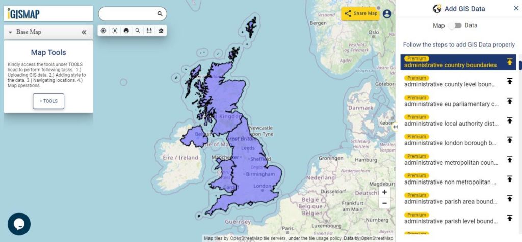
Hello GIS enthusiasts, IGISMAP has now published the latest GIS vector data of United Kingdom administrative levels. Links for downloading the shapefiles of the important administrative divisions of United Kingdom are provided in the following. You can also download these data in KML, GeoJSON or CSV formats.
Note:
All data available are in GCS datum EPSG:4326 WGS84 CRS (Coordinate Reference System).
You need to login for downloading the shapefile.
Download Free Shapefile Data of United Kingdom
The United Kingdom of Great Britain and Northern Ireland, commonly known as the United Kingdom (UK) or Britain is a sovereign state to the northwest of continental Europe, consists of:
England
Scotland
Wales
Northern Ireland
The United Kingdom includes the island of Great Britain, the north-eastern part of the island of Ireland, and many smaller islands within the British Isles. Northern Ireland shares a land border with the Republic of Ireland. Otherwise, the United Kingdom is surrounded by the Atlantic Ocean, with the North Sea to the east, the English Channel to the south and the Celtic Sea to the south-west, giving it the 12th-longest coastline in the world. The Irish Sea separates Great Britain and Ireland. The total area of the United Kingdom is 93,628 square miles (242,500 km2), with an estimated population in 2020 of 68 million.
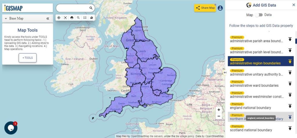
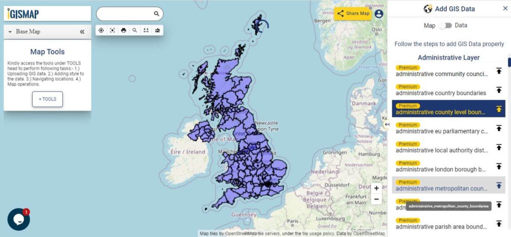
Download United Kingdom Regions And Counties Shapefile Data
The regions, formerly known as the government office regions, are the highest tier of sub-national division in England, established in 1994 which is divided into 9 regions.
County level division of pan UK includes Metropolitan counties, Non metropolitan counties, Unitary authorities and London Boroughs. Following data available in IGISMAP consist of 202 polygon features of county level boundaries.
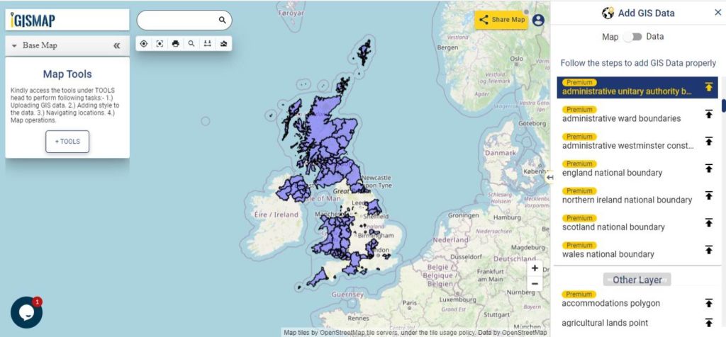
Download United Kingdom Unitary Authorities Shapefile Data
Unitary Authority divisions are associated with England, thus commonly known as Unitary authorities of England. The unitary authorities of England are those local authorities which are responsible for the provision of all local government services within a district. Following data of Unitary Authority boundaries is a combined data of Local Authority District polygons of Scotland, Wales and Northern Ireland with the Unitary Authority polygons which is a sum of 138 polygon features.
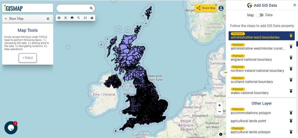
The wards and electoral divisions in the United Kingdom are electoral districts at sub-national level represented by one or more councillors. The ward is the primary unit of English electoral geography for civil parishes and borough and district councils, electoral ward is the unit used by Welsh principal councils, while the electoral division is the unit used by English county councils and some unitary authorities. Each ward/division has an average electorate of about 5,500 people, but ward-population counts can vary substantially. As at the end of 2014 there were 9,456 electoral wards/divisions in the UK.
Disclaimer : If you find any shapefile data of country provided is in correct do contact us or comment below, so that we will correct the same in our system as well we will try to correct the same in OSM.
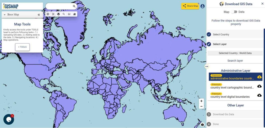
Looking for Shapefile data of globally distributed features and boundaries for research or project, then you are at the right place. Here you can download global Country Level Boundaries shapefile and features for free.
Note:
All data available are in GCS datum EPSG:4326 WGS84 CRS (Coordinate Reference System).
You need to login for downloading the shapefile.
Download World Countries Boundaries Shapefile Data
You can extract the countries or features of other data using Crop Layer tool available in the map canvas itself or you extract the feature in your desktop QGIS software. Follow this link to learn how to extract features in QGIS.
All data are updated periodically once in a quarter year. Similarly you may ask or hire us to download a map of water, roads, polygon, buildings, parks of a specific Area from open street map.
Disclaimer : If you find any shapefile data of country provided is in correct do contact us or comment below, so that we will correct the same in our system.
Hello GIS enthusiasts, IGISMAP has now published the latest GIS vector data of Mexico administrative levels. Links for downloading the shapefiles of the important administrative divisions of Mexico are provided in the following. You can also download these data in KML, GeoJSON or CSV formats.
Note:
All data available are in GCS datum EPSG:4326 WGS84 CRS (Coordinate Reference System).
You need to login for downloading the shapefile.
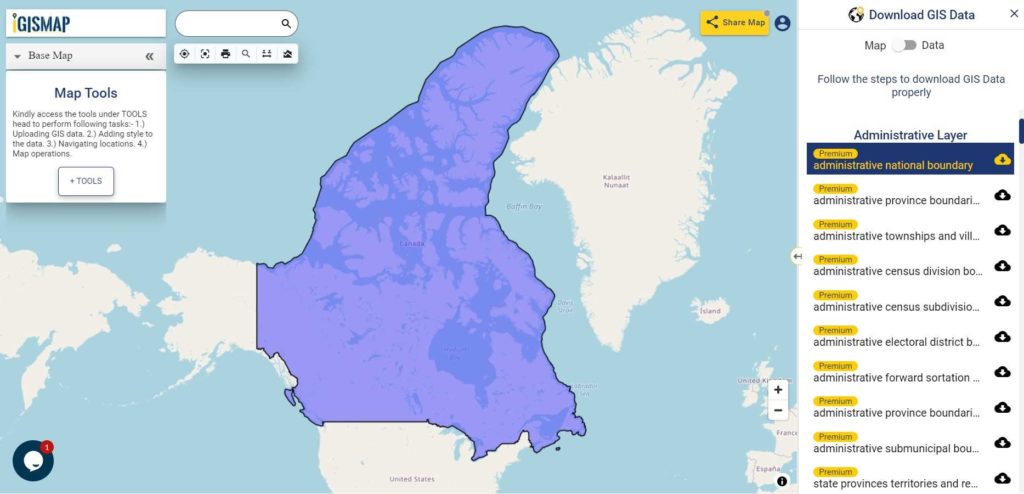
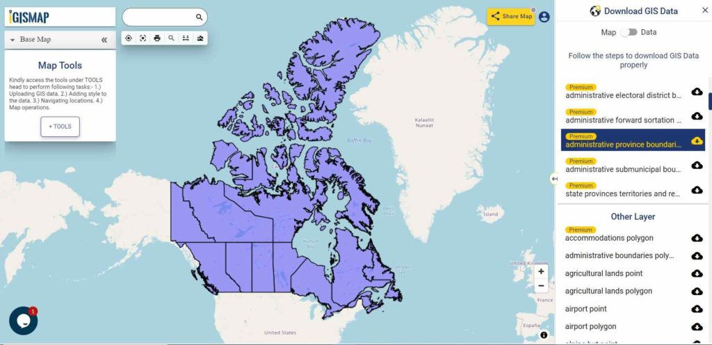
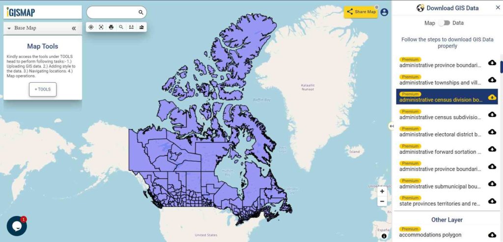
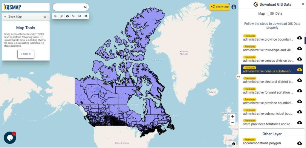
Download Free Shapefile Data of Canada
Canada is a country in North America. Its ten provinces and three territories extend from the Atlantic Ocean to the Pacific Ocean and northward into the Arctic Ocean, covering over 9.98 million square kilometers (3.85 million square miles), making it the world’s second-largest country by total area. Its southern and western border with the United States, stretching 8,891 kilometers (5,525 mi), is the world’s longest binational land border. Canada’s capital is Ottawa, and its three largest metropolitan areas are Toronto, Montreal, and Vancouver.
Disclaimer : If you find any shapefile data of country provided is in correct do contact us or comment below, so that we will correct the same in our system.
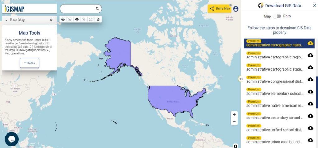
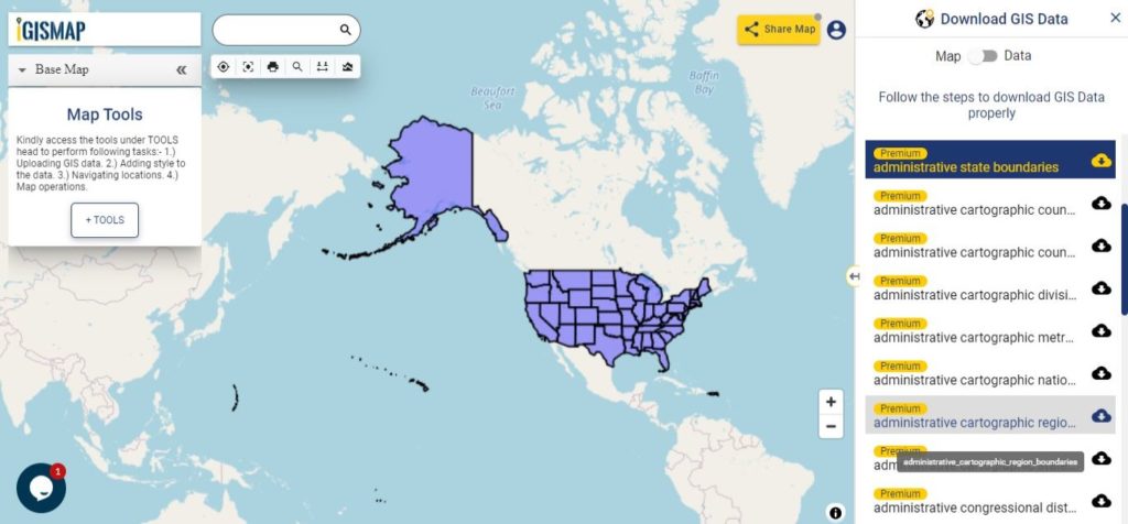
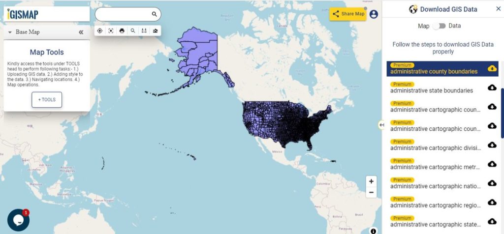
Hello GIS enthusiasts, IGISMAP has now published the latest GIS vector data of USA administrative levels. Links for downloading the shapefiles of the important administrative divisions of USA are provided in the following. You can also download these data in KML, GeoJSON or CSV formats.
Note:
All data available are in GCS datum EPSG:4326 WGS84 CRS (Coordinate Reference System).
You need to login for downloading the shapefile.
Download Shapefile Data of USA
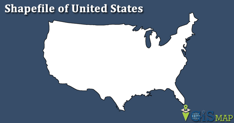
The United States of America (U.S.A. or USA), commonly known as the United States (U.S. or US) or America, is a country primarily located in North America. It consists of 50 states, a federal district, five major unincorporated territories, 326 Indian reservations, and some minor possessions. At 3.8 million square miles (9.8 million square kilometers), it is the world’s third- or fourth-largest country by total area. The United States shares significant land borders with Canada to the north and Mexico to the south as well as limited maritime borders with the Bahamas, Cuba, and Russia. With a population of more than 331 million people, it is the third most populous country in the world. The national capital is Washington, D.C., and the most populous city is New York City.
The United States of America is a federal republic consisting of 50 states, a federal district (Washington, D.C., the capital city of the United States), five major territories, and various minor islands. The 48 contiguous states and Washington, D.C., are in North America between Canada and Mexico. Alaska is an exclave in the far northwestern part of North America, connected only to Canada, and Hawaii is an archipelago in the mid-Pacific. Territories of the United States are scattered throughout the Pacific Ocean and the Caribbean Sea.
According to the numerous decisions of the United States Supreme Court, the 50 individual states and the United States as a whole are each sovereign jurisdictions.[4] The states are not administrative divisions of the country; the Tenth Amendment to the United States Constitution allows states to exercise all powers of government not delegated to the federal government.
In the United States, a county is an administrative or political subdivision of a state that consists of a geographic region with specific boundaries and usually some level of governmental authority. Most counties have subdivisions which may include townships, municipalities and unincorporated areas. The number of counties per state ranges from the three counties of Delaware to the 254 counties of Texas. The following is a list of the 3,233 counties and county-equivalents in the 50 states and District of Columbia sorted by U.S. state, plus an additional 100 county-equivalents in the U.S. territories sorted by territory.
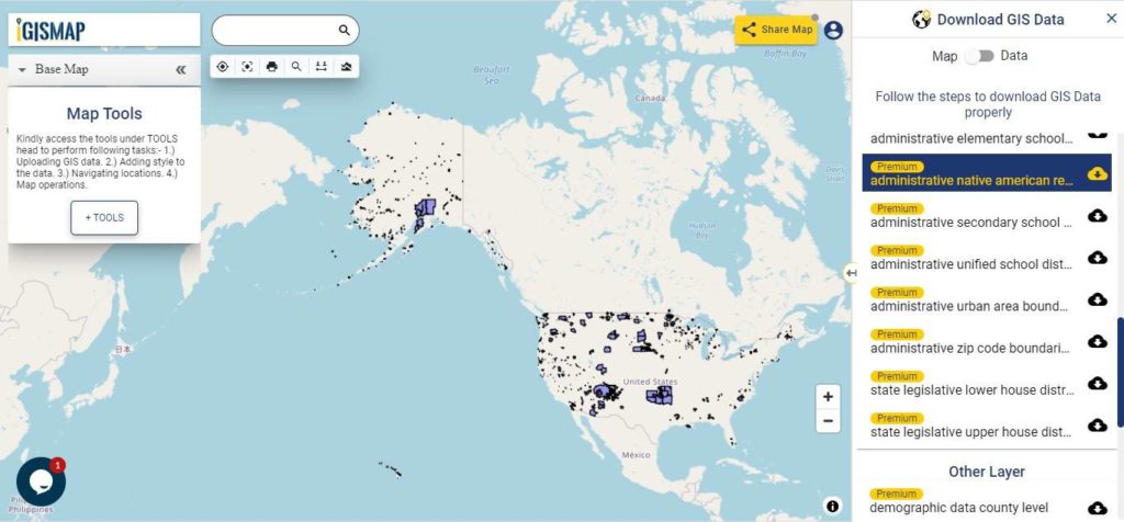
Download USA Native American Reservation Lands Shapefile Data
The Indian reservation system was created to keep Native Americans off of lands that European Americans wished to settle. The reservation system allowed indigenous people to govern themselves and to maintain some of their cultural and social traditions. The Dawes Act of 1887 destroyed the reservation system by subdividing tribal lands into individual plots.
Following classes of land reservation are established in USA
Indian Reservation Area
Alaska Native Village Statistical Areas
Hawaiian Home Lands
Oklahoma Tribal Statistical Areas
State Recognized Reservations
State Designated Tribal Statistical Areas
Tribal Designated Statistical Areas
There are 326 Indian Reservations in the United States.[1] Most of the tribal land base in the United States was set aside by the federal government as Native American Reservations. In California, about half of its reservations are called rancherías. In New Mexico, most reservations are called Pueblos. In some western states, notably Nevada, there are Native American areas called Indian colonies.
Alaska Natives previously had many small reserves scattered around Alaska; however, all but one (the Annette Island Reserve of Tsimshian) were repealed with the passage of the Alaska Native Claims Settlement Act in 1971.
There are Hawaiian home land, area held in trust for Native Hawaiians by the state of Hawaii under the Hawaiian Homes Commission Act of 1921.
Oklahoma Tribal Statistical Area is a statistical entity identified and delineated by federally recognized American Indian tribes in Oklahoma as part of the U.S. Census Bureau’s 2010 Census and ongoing American Community Survey.
A state designated American Indian reservation is the land area designated by a state for state-recognized American Indian tribes who lack federal recognition.
A tribal designated statistical area is a statistical entity identified and delineated for the Census Bureau by a federally recognized American Indian tribe that does not currently have a federally established Indian reservation.
Disclaimer : If you find any shapefile data of country provided is in correct do contact us or comment below, so that we will correct the same in our system as well we will try to correct the same in OSM.
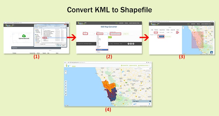
In this post we are going to discuss the procedures for KML to Shapefile conversion. KML is the file extensions used in Google applications, specifically Google Earth and Google Maps. Shapefile is a geospatial vector data format for geographic information system (GIS) software. It is developed and regulated by ESRI as a mostly open specification for data interoperability among ESRI and other GIS software products.
Conversion of GIS data like KML to Shapefile can be done easily using
For KML to Shapefile conversion go to MAPOG Converter Tool, after logging in with your registered email and password. If you are a new user, click the Sign Up button in the Login popup and register to IGISMAP by filling the details.
There are three main steps for using GIS Converter:
Upload the data
Choose the format to which it should be converted
Download the converted file.
Step one is to upload your KML file which you want to convert. You can upload your file from system or select from the Recent Files.
Upload KML
Here we have uploaded the KML file of New York state in USA.
Step two is to select choose the output format of the converted file, in this case its Shapefile. You can also set the Coordinate Reference System of your preference. As a default CRS will set to WGS 84 (World) [EPSG:4326]. Click on the Convert File.
Select Shapefile as Output Format
Your KML file will then get converted to Shapefile file after a few seconds and will be available for downloading.
Download and Publish Shapefile File
You can also choose to style the layer or continue with further conversion process by clicking the Convert Another File button.
The Converted File can also be downloaded from the Converted Files section of the dashboard.
Converted Files section from the dashboard contains the list of the details of all the conversion done in your account, providing both input and output data available for download their corresponding formats.
If you face any problem during implementing this tutorial, please let us know by dropping a mail at support@igismap.com. Feel free to comment in the below comment box.
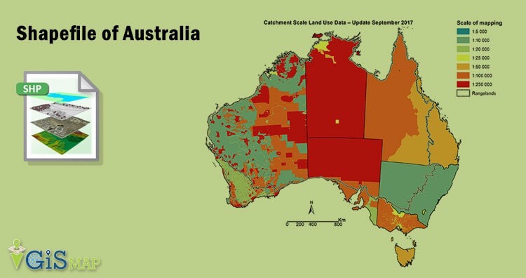
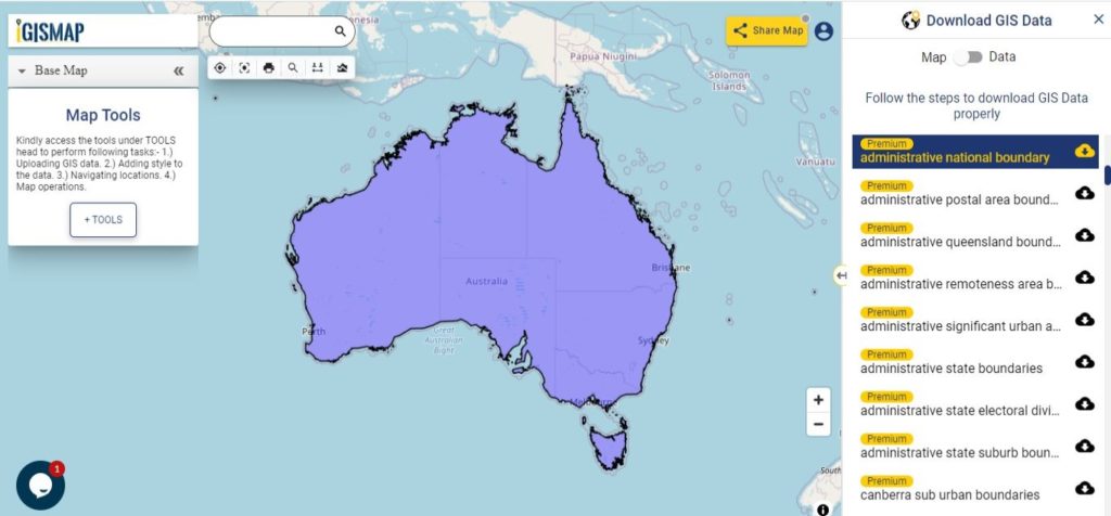
Hello GIS enthusiasts, IGISMAP has now published the latest GIS vector data of Australia administrative levels. Links for downloading the shapefiles of the important administrative divisions of Australia are provided in the following. You can also download these data in KML, GeoJSON or CSV formats.
Note:
All data available are in GCS datum EPSG:4326 WGS84 CRS (Coordinate Reference System).
You need to login for downloading the shapefile.
Download Free Shapefile Data of Australia
Australia is the sixth largest country of the world by total area. It is a continent surrounded by Indian and Pacific oceans. Australia as a continent also exist as country, where Australia Continent does have Australia, partially Indonesia and Papua New Guinea. Australia is one of the world’s most highly urbanized countries. Major cities of Australia are Sydney, Melbourne, Brisbane, Perth, Adelaide. Canberra is its capital city, which can be seen in the shapefile downloadable from below links.
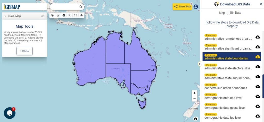
The states and territories are federated administrative divisions in Australia, ruled by regional governments that constitute the second level of governance between the federal government and local governments. The Federation of Australia constitutionally consists of six federated states and ten federal territories, out of which three are internal territories contiguous to the Australian mainland; and the other seven are external territories and other offshore dependent territories.
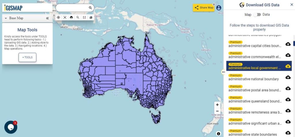
Download Australia Local Government Areas Shapefile Data
Local government is the third level of government in Australia, administered with limited autonomy under the states and territories, and in turn beneath the federal government. The Australian local government is generally run by a council, and its territory of public administration is referred to generically by the Australian Bureau of Statistics as the local government area or LGA, each of which encompasses multiple suburbs or localities often of different postcodes; however, stylized terms such as “city”, “borough” and “shire” also have a geographic or historical interpretation. As of August 2016, there were 547 local councils in Australia.
Disclaimer : If you find any shapefile data of country provided is in correct do contact us or comment below, so that we will correct the same in our system as well we will try to correct the same in openstreetmap.
Download Free Shapefile Maps – Shapefile is one of the most common and extensively use vector file format of GIS (Geographical Information System), developed by ESRI as an open Specification, which consist of collection of files viz .shp, .shx and .dbf extension with same prefix name. You might be hunting to Download free shapefile for completing either your small industrial work for POC or for academic project use or for any NGO work.
Here you will find the links of best resources to Download Shapefile for free, either its polygon, polyline and point feature shapefile, covering different subjects like Administrative Area Boundaries, Roads, Railways, population etc across the world. You may also look to download Digital Terrain DEM.
Note: The Data Shapefile Downloaded from provided below link here, may or may not be authentic, accurate or incomplete. To check data correctness and accuracy, you need to research and recheck before using it. Also Shapefiles are downloaded for free from different organization or websites link and should be used according to
their respective terms and conditions, so please read T&C before using it for any purpose.
If you are looking for any shapefile of country which is not listed above please comment below so that we can search in our pitara of shapefile. If we found we can upload it on the same.
Download Free Shapefile Maps – Country Boundary Polygon, Rail-Road, Water polyline etc
Website is developed by Robert Hijmans, which provides free Shapefile to download, covering around 244 countries. You can directly select the country and category of shapefile and press on OK button to start download. Subject Category option you will find here are Administrative Areas (Boundaries), Inland Water, Roads, RailRoads, Elevation, Land cover, population, Climate and Gazetteer.
GADM is a spatial database of Global Administrative Areas, which covers all countries data defining boundaries such as provinces, taluk, departments, counties, krong etc. GADM listed around 253 countries currently, the different files formats are available along with shapefile such as Esri File Geodatabase, Geopackage(Spatial Lite), R(Spatial Polygon Dataframes), Google Earth .kmz and ESRI personal geodatabase. The coordinate reference system of each file is in longitude/latitude and the datum is WGS84.
“Natural Earth is a public Domain Map data-set available at at 1:10m(Large scale data), 1:50m(medium scale data), and 1:110 million scales (Small Scale data).” Cultural, physical and raster category data can be downloaded from each scale. Data can be downloaded as shapefile (shp) or GeoDB or as SQLite. Natural Earth is maintained by Nathaneiel V. KELSO and Tom Patterson. Here is the screenshot of shapefile from QGIS (Quantum GIS) tool of 1:10m all shapefile layers uploaded at once.
Geofabrik provides the current data from the Openstreetmap database, which is available either for free as well as premium shapefiles. Data can be downloaded as .osm and .shp.zip file. Select the continent from the link provided for which you need to download the data. Further you can either select the country for filtering out more and hit the .shp.zip link to download the data.
This service is created by Jochen Topf and Christoph Hormann. Following data sets and its subcategories shapefiles can be downloaded from this website. a.) Coastline Data processing: It covers land polygons of the world area i.e continents and islands, Water polygon i.e polygon for ocean, seas and other water bodies and coastlines as line strings. b.) Generalized data sets: This section provides you to download Generalized coastline polygon shapefiles. c.) Antarctic icesheet: Antarctic icesheet polygons and icesheet outlines can be obtained from here.
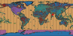
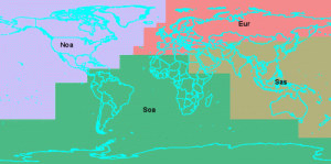
World data shapefile can be downloaded from GIS lab. This global data are separated into 4 parts i.e Eur, Noa, Soa and Sas Zones, which you can see the image provided below. This data shapefile is in zipped with 7z compressor and all data are in Latitude / Longitude and WGS84 coordinate system.
Select different zone to Download Free Shapefile Maps
While the website does not look user friendly, you need to hunt over different country shapefiles at different area. Both free as well as paid Shapefile can be obtained and downloaded given.
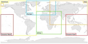
SocioEconomic Data and Applications Center provides data as zipfile of ESRI File geodatabases or shapefiles, and have decimal degree geographic coordinates system with datum WGS84 (world Geodetic System spheroid of 1984). Continent based regional data is available as shown below. Before downloading the data, you need to register and sign in to their system.
If you are working on Sea or marine related subject, this website may help you to get the direct data to link to the relevant website from which you can get the shapefile maps data.
It might be possible that the data which you might have downloaded from website provided here, can be of different format which was not required. For this, you can refer to following articles where you can convert different GIS data format to any of it.
Is the above provided links are not fulfilling your need. Than the best option you can opt for is to create your own shapefile with the help of QGIS and openstreetmap. You can easily download the data from their and then edit it make it more clear according to your requirement. If you are new to QGIS then let me provide you some tutorial link which helps you to digitize the OSM data and create shapefile.
For what purpose you need to download shapefiles? Which project you are working on? Which website you to get the map data? Do share your valuable thoughts by commenting below. I hope that the above list have definitely helped you in finding the right website to get free shapefile download, while their might be possibilities that I have not listed some of the website which should be present in the list. Please help us by providing those links by commenting below.
Convert Shapefile to kml by QGIS. Shapefile is ESRI based Vector file, While KML or Keyhole Markup Language is file which models and stores geographic features for display in Google Earth or Google maps. Many times you may require to convert the required shapefile to KML file, so that you can deploy the same over Google Earth for some reason. QGIS (Quantum GIS) is an open source GIS (Geographic Information System) tool, which let you upload the Shapefile and convert the same to KML file. Similarly ogr2ogr is also an open source tool, which let you to convert between GIS data formats. Look over shp to kml convert using ogr2ogr tool which can be marked as an alternative to this article. You can also see to convert Kml to Shapefile and also Shapefile to GeoJSON in QGIS.
1.) Open up the installed QGIS.
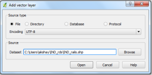
2.) In the menu bar, select Layer and press Add Vector Layer. Now select the source type in the pop up window opened as File and browse the source Shapefile(Note:Your shapefile .shp, .dbf and .shx file should be in same folder). Press open.
Convert Shapefile to kml by QGIS
Select the coordinate reference type system if coordinate reference window appears and press ok.
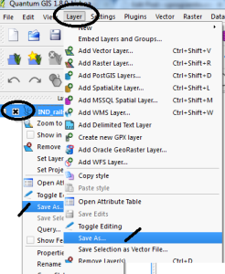
3.) Right click on the name of Shapefile layer Appearing in the Left upper side and select save as:
or
You can select layer from the menu, and click on save as. (Image below provide demonstrate both the options with the indicator displayed)
Convert Shapefile to kml by QGIS
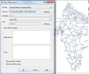
4.) In the Save vector layer as window, Select the format from the drop down box as Keyhole Markup Language(KML) and browse the folder in which you want to save the KML file . Name it and Press OK.
Convert Shapefile to kml by QGIS
Your KML file will be Exported in the directed folder. You can Verify the generated KML file for its validity by uploading the generated KML file to QGIS or uploading KML file in Google map. You may soon find the tool and the coding for the same on this site.
You may check in converting Geojson to Topojson and Shapefile to TopoJSON file. Hope this may help you in converting Shapefile to KML file easily. If you still find problem in converting the file, do let me know by commenting below.
We use cookies to ensure that we give you the best experience on our website. If you continue to use this site we will assume that you are happy with it.Ok