The applications of GIS tools are expanding in the field of business, research, defense, etc. Thus the features and tools of every GIS software are updating abruptly for helping users in these industries to get the right information by performing complex analyses over GIS data. But working with most of the GIS software in the market requires adequate training and dense knowledge in geospatial concepts.
That is where IGISMap is useful. IGISMap is GIS based web platform providing multiple GIS applications that are most important in the field of geospatial analytics. The peculiarity of IGISMAP in the GIS Industry is its UI/UX that helps the user to perform effortless geospatial operations. In this article, we will discuss Add Existing File tool of IGISMap.
In IGISMap, GIS data is uploaded, created, edited and worked on a map. A map is a spatial interface that supports GIS data and give access to various tools to perform geospatial operations. As a user of IGISMap, you can create any number of maps and add GIS data of any formats.
Add Existing File is a tool that keeps the list of all data that are available on every map in your IGISMap account. Users can open this tool directly from the map or from the dashboard to view the list of data that are published in the maps. You can select any data from the list, preview it and add that data to the map. Thus you dont have to take effort on uploading the data again if it is available in any map.
Let’s look into the application of Add Existing File tool in IGISMap.
Get directed to Add Existing file tool using the following link
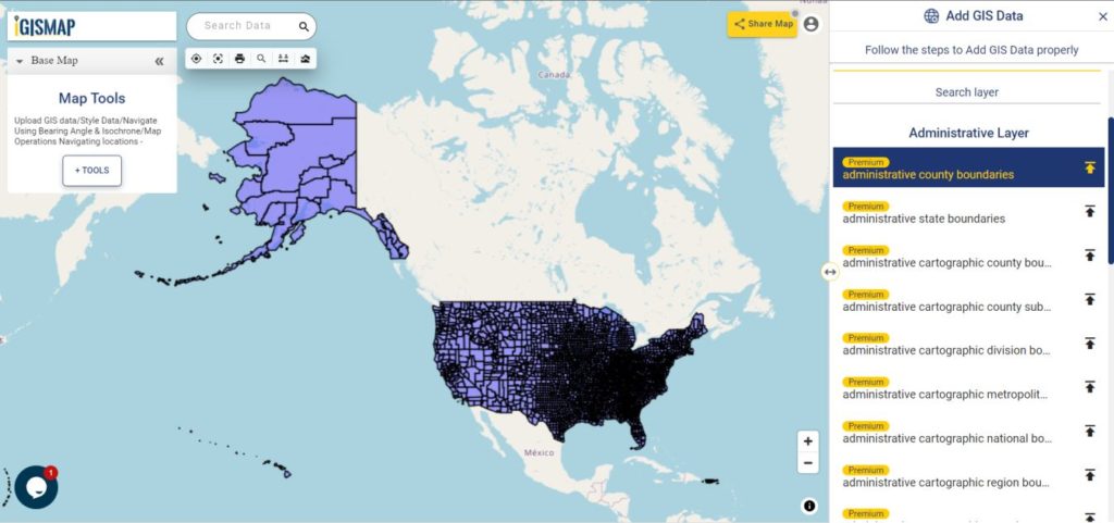
Let’s see how a data published in a map get listed in Add Existing Tool. So let’s first publish a data in a map. For this lets use Add GIS Data and publish USA county boundaries polygono data
Add data from IGISMap GIS data collection
Select united states of america from the list of countries and select the data administrative county boundaries and click Add Layer icon.
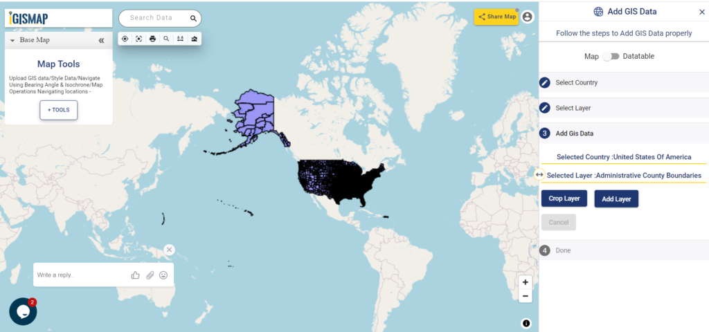
In the next step, since we dont need to crop the data, directly click Add Layer button as shown below.
Add GIS Data – Add Layer
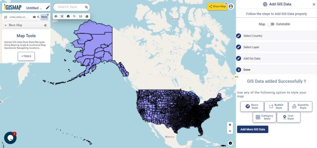
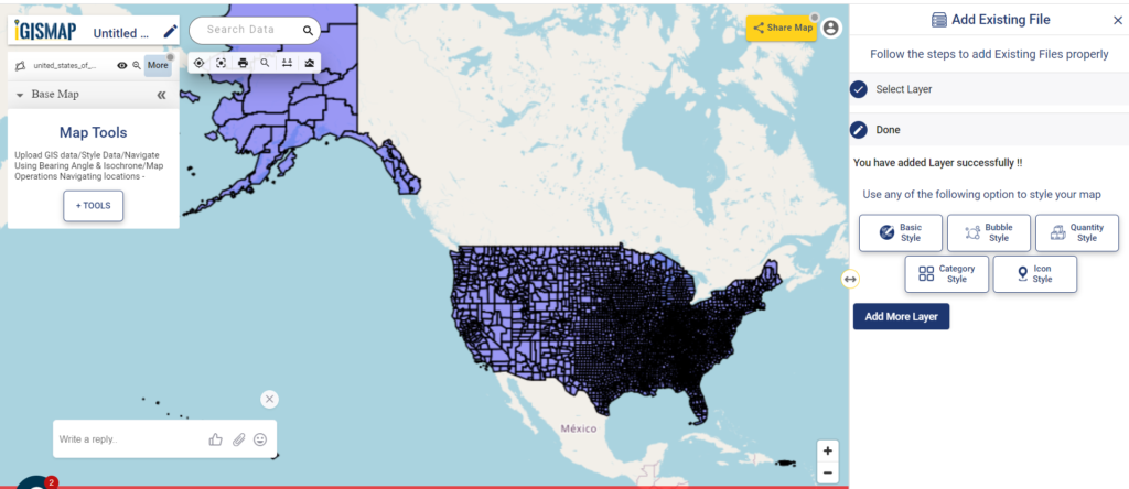
Now, GIS data of USA county boundaries are successfully added in the map.
Data Published
Publish data from Add Existing File
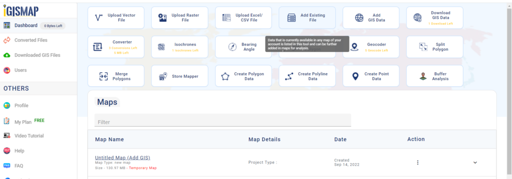
Now, we can add the USA County Level data layer using the Add Existing File. If you want add the data in a new map, open Add Existing File tool from the dashboard.
IGISMap Dasboard
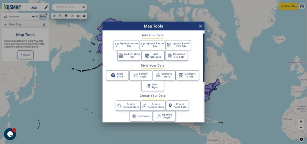
If you want to add the data from an existing map, click the Tools button below the layer list. This will open the list of all tools of IGISMap, as shown below.
In the section Add Your Data, click Add Existing File to open the tool.
Map Tools
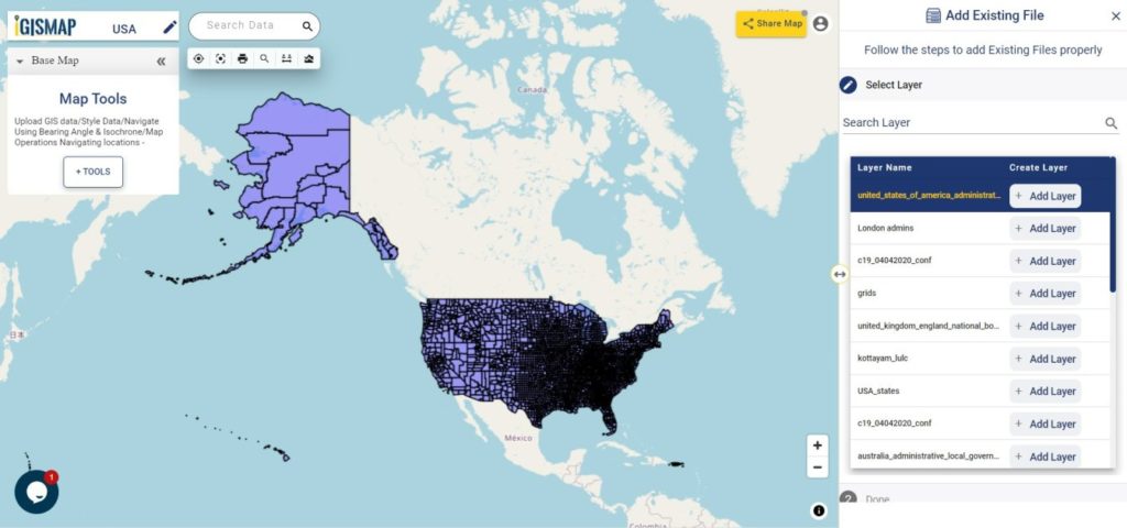
Now Add Existing File tool is opened with the list of all images currently published in the maps of your IGISMap account. The data we added from Add GIS Data, which is administrative county boundaries data of USA is listed top of the list. Or you can search the data using Search Layer option.
You can click and preview the data like the following.
Add Existing File tool
Click Add Layer button to publish this layer in your new map.
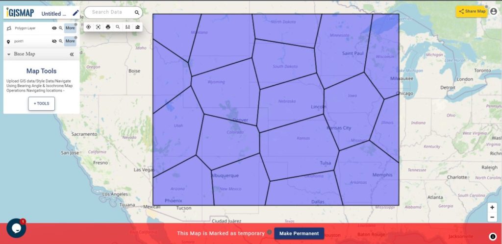
Voronoi polygon is an area representing the influence from a particular point location. A Voronoi polygon is actually a systematic way to divide spaces into a number of regions using a set of input points. For each point there will be a corresponding area that consists of the locations closer to that point than any other. These areas are called Voronoi cells.
MAPOG provides a Point to Polygontool to create Voronoi polygons out of point from input point data. IGISMap is a web platform providing multiple GIS applications that are most important in the field of geospatial analytics. In IGISMap, you can upload your GIS data and perform geospatial analysis.
In IGISMap,Point To Polygon tool will convert input point data into polygon data by creating a polygon shape for each point in the input point data, like the following.
Voronoi Polygon
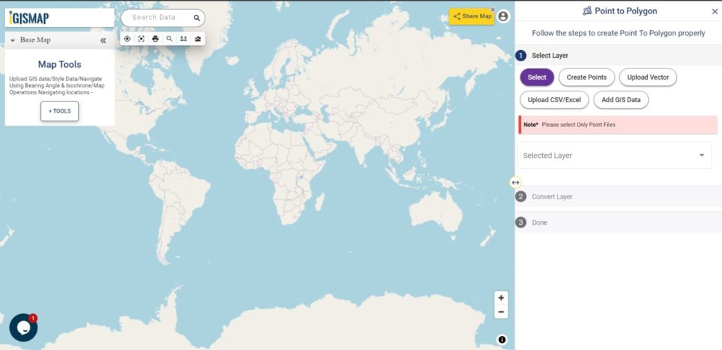
Let’s look into the steps to use Point to Polygon tool of IGISMap.
After opening Point to Polygon tool, first step is to add the data using any of the following options:
Select
Create Points
Upload Vector
Upload CSV/Excel
Add GIS Data
Point to Polygon
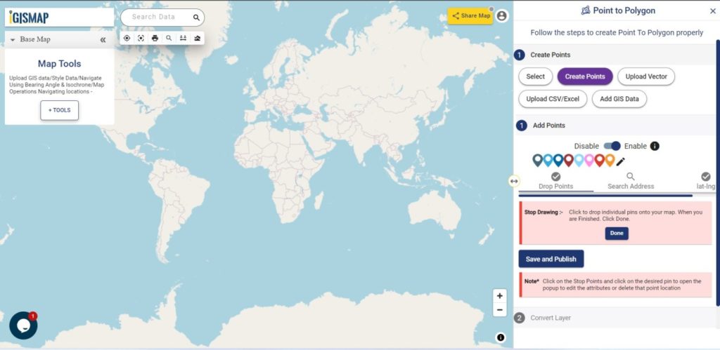
Here we are going to choose the option to Create Points and then convert the point to polygons through voronoi conversion. Thus lets first create and publish point GIS data.
Creating point data
Select Create Points tab which open Add Points section to plot points on the map at the desired locations.
Create Points
Points can be plotted through any of the following options that can be used anytime in this section. They are:
Add Points
Search Address
Lat Lon Values
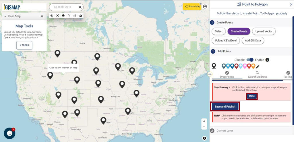
After finish the plotting, click Save and Publish button to publish the point GIS data.
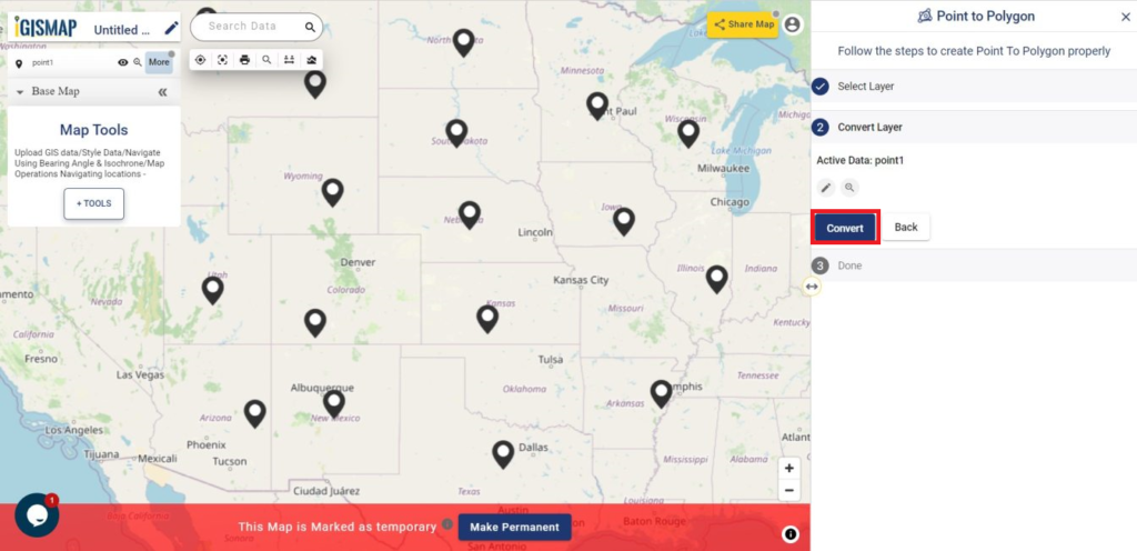
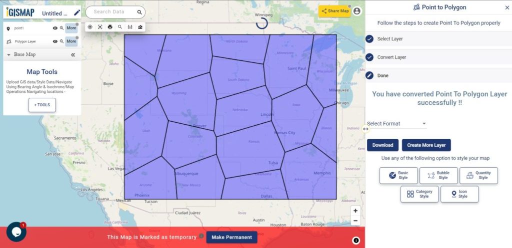
After saving the point data, Convert Layer section is appears to carry out the point to polygon process.
Now click Convert button to run the point to polygon process.
Convert the Point Layer
As you can see, voronoi polygon layer is created and published in the map.
Voronoi Polygon
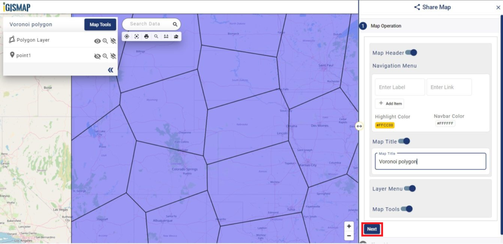
Sharing the voronoi polygon map
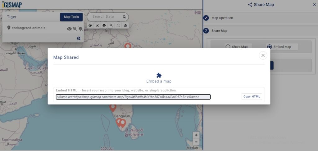
For sharing this map we have to click on Share Map button from the map. In the Share Map window, you can give the map name at the map title and click on Next. Then a share map section appears.
Share Map
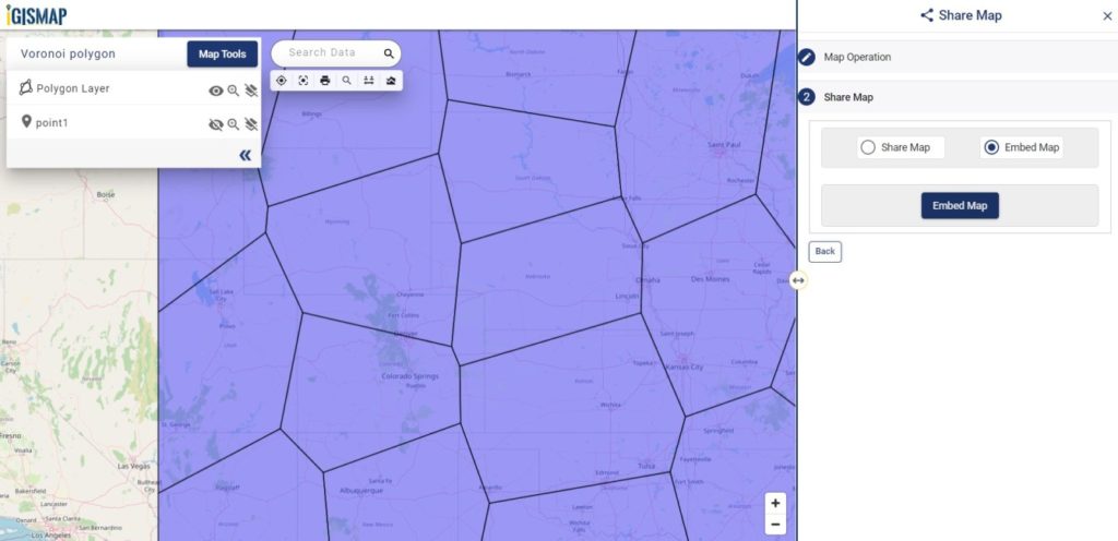
Choose the option between Share Map as a link or Embed Map to get the html iframe to attach in the webpage. Here you can also two security of the map by selecting Public or Private.
Embed Map
Check the article Share your Map to understand the Share Map feature of IGISMap.
Structure of telecommunication networks are complex and create large quantities of geographically dispersed data. Consider you are a data engineer working in the telecommunication sector who wants to plot telephone pole locations with its attribute data to keep the track for its operations and maintenance. The attribute data added with the plotted locations can help you to observe information associated with each telephone pole and maybe embed this map on the department website.
GIStechnology is advancing in various field including the telecommunications sector to build maps and perform GIS analysis. Limited GIS software are available that provides services in both creating maps and hosting them on websites. GIS mapping enables people working in telecommunication sectors to enhance network planning, deployment, maintenance, operations, and even sales and marketing.
MAPOG gives powerful tool sets to create interactive maps of locations and geospatial features associated with any applications based on social services, business analysis, scientific research etc. Using the tools in the IGISMap application, we can track, maintain and analyze the telephone poles. IGISMap is a web platform providing multiple GIS applications that are most important in the field of geospatial analytics. GIS tools of IGISMap application allows users to Add Data, Create Data, Map Data, Style Data, Process Data, Analyze Data and also help users to Share Data privately or publicly.
How to plot Telephone pole locations online with Attributes?
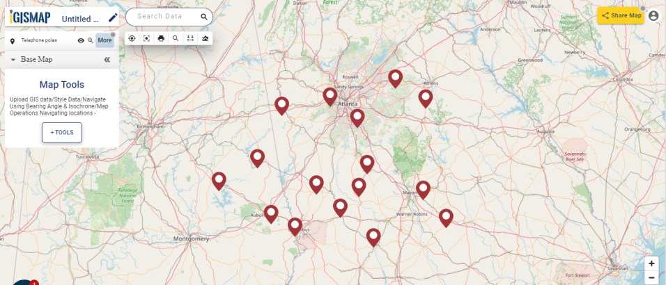
Create Point Datatool of IGISMap is a powerful GIS tool to plot point vector data to represent locations and point objects with latitude and longitude value. Using this online tool, we can plot the locations of telephone poles and can add the attribute data to each location of the data created.
Start Plotting Points for Telephone Pole Locations
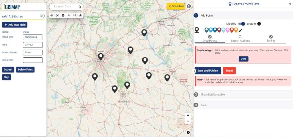
First step is Add Points, where we can start plotting the telephone pole locations as pins. IGISMap provides you with three features for plotting points: Drop Points, Search Address, and Lat Lon Values.
Drop points let us drop a pin at the desired location on the map. Zoom to the location of the telephone pole and click to add the pin.
Add Points – Drop Points
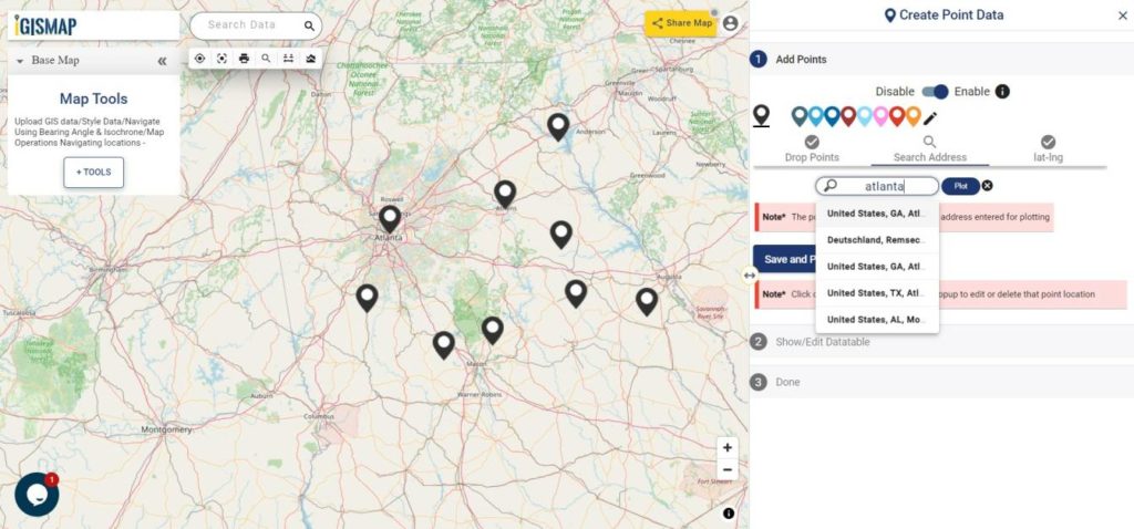
Search Address option opens a search address box, where you can enter an address and choose the right location address from the dropdown and click the Plot button to plot a point on that location.
Add Points – Search Address
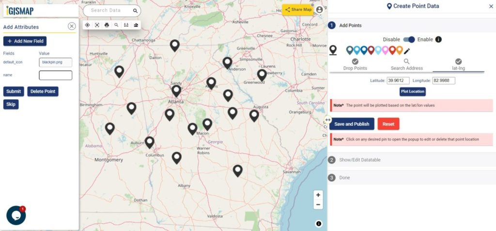
Lat Lon Values will open two boxes to enter latitude and longitude values of the location you want to plot, Plot Location button in this option will plot a pin at the location you have entered.
Add Points – Lat Lon
Also, a popup will open for entering attribute values in each attribute field for that telephone pole locations when a point is plotting. Click the Submit button to submit the save the attribute entries. You can choose to delete the point you plotted by clicking the Delete Point button. You can disable the default opening of this popup using the toggle button.
But we can open this popup anytime while plotting, by simply clicking on an existing pin.
Note: If the Drop Points option is active for dropping pins, it should be unselected for selecting the plotted pins to open the attribute popup.
After plotting every desired slum locations for our data, click the Save and Publish button to publish your data in the map.
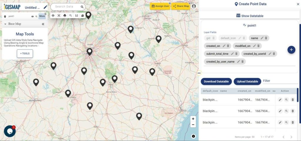
Review and edit the datatable
After publishing Telephone poles, Show/Edit Datatable section will be opened. Here you can edit the attribute values entered for each point location after clicking button in the datatable along each row in the datatable. You can also choose to delete a point by clicking button.
Show Datatable
Options to edit or delete the attribute fields are also available in this step along with the option to add new attribute fields to this data. If you thought of adding more points to the data of ATM Locations, select the Back button to go to the Add Points section, where you can add more points and make changes to the already published data.
Option to update the data table as bulk is available in this section. Where the whole data table can be downloaded in Excel format using Download Datatable button. And to make the changes outside IGISMap, then upload the edited/updated spreadsheet file using Upload Datatable button and integrate with the same point data of ATM locations.
After making all the changes in the datatable, let’s move to the styling section by clicking the Next button to finish plotting.
Style Your Telephone Pole Points
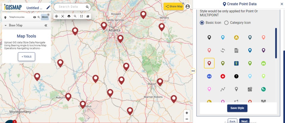
A map will become more meaningful if appropriate icons and colors are used to visualize the features of the map. In IGISMap styling options, Bubble Style and Icon Style are provided for point GIS data.
In Icon Styling, IGISMap provides two more options – Basic and Category styling. Basic Style will provide an appropriate pin icon for styling the telephone pole points and apply it on the telephone polesdata as follows.
Basic Icon style
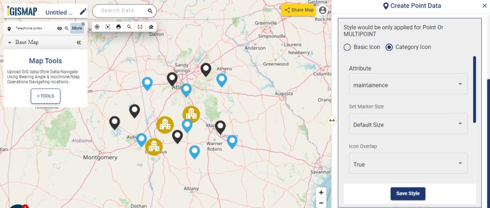
Another style is the Category Icon styling, where users can select the category on the basis of which styling is added to the point data. For example, if the user selects maintenance attribute as a categorical option, style is changed to symbol using those items.
Bubble style is used to visualize the data quantitatively based on the numerical fields in the datatable. We can assign the size and color of the bubble for each class of values.
Click on Save Style option to save the Bubble style option for the added points.
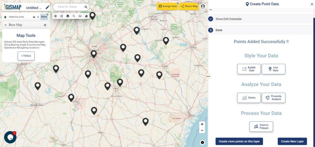
It’s done! Now if the user wants to add more points, click on Create more points on the layer option. If the user wants to create a new layer, select Create New Layer option.
Created point GIS data
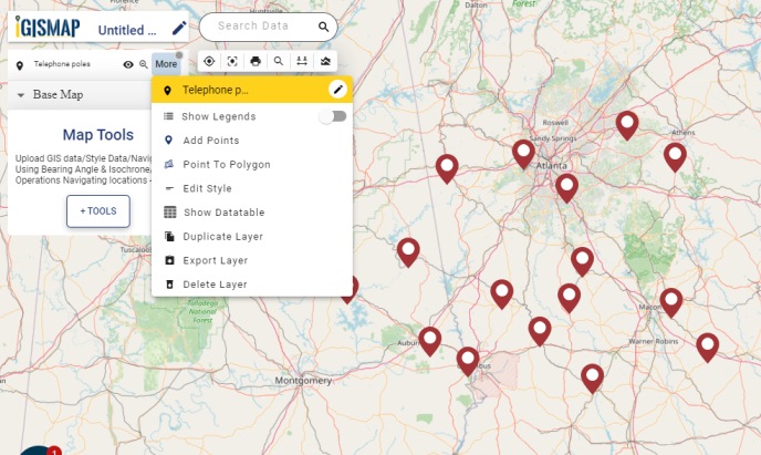
After the point GIS data of telephone pole locations is published in the name Telephone poles, More option beside the data provides list of other features. They can be used for adding more points, showing the legend in the map, editing the style and more.
More options
Check the article Share your Map to understand about Share Map feature of IGISMap.
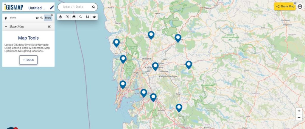
On one fine day, people from a well reputed Non-Governmental Organization (NGO) contacted us about how we can locate slum areas. This NGO works for social welfare activities such as food, clothes, water supply, drainage, etc. for the people who live in slums. They basically wanted a web map for slum locations where they can provide the above social services and keep track of various details to those locations through visualization and spatial analysis.
The use of GIS technology is advancing in the field of data science and information technology as demand for maps and geospatial analysis became important in both public and private sectors. There is limited GIS software that provides services in both creating maps and hosting them on websites. MAPOGgives powerful tool sets to create interactive maps of locations and geospatial features associated with applications based on social services, business analysis, scientific research etc. Using the tools of IGISMap, we can manage, analyze, and visualize slum areas where monitoring and management is required. IGISMap is a web platform providing multiple GIS applications that are most important in the field of geospatial analytics. GIS tools of IGISMap application allows users to Add Data, Create Data, Map Data, Style Data, Process Data, Analyze Data and also help users to Share Data privately or publicly.
IGISMap application has Create Point Data tool which can be used to plot locations and point objects as point vector data model. By using the Create Point Data tool let’s discuss how we can map the slum locations like the following.
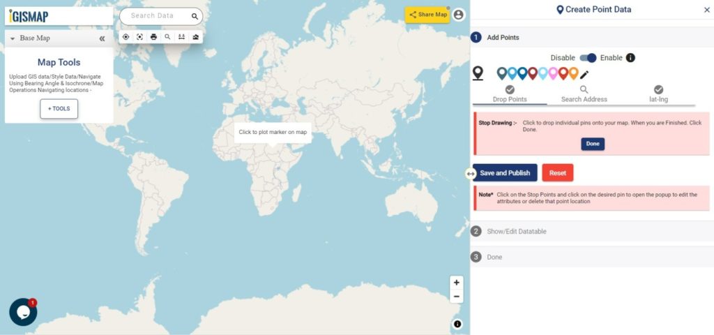
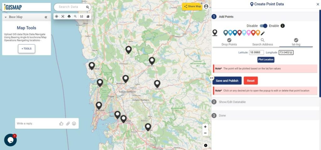
In Create Point Data tool, first step is to Add Points, where we can start plotting the slum locations as points, in the form of pins. IGISMap provides you with three features for plotting points: Drop Points, Search Address, and Lat Lon Values.
Create Point Data tool
Drop points let us drop a pin at the desired location on the map. Zoom to the location of the slum and click to add the pin.
Drop Points
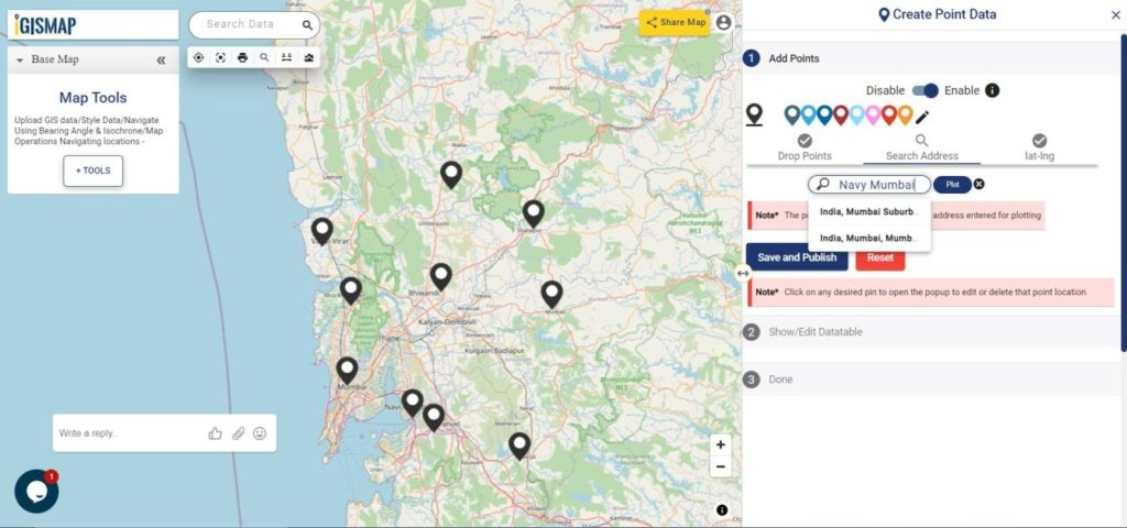
Search Address option opens a search address box, where you can enter an address and choose the right option from the dropdown list, then click the Plot button to plot a point on that location.
Seach Address and Plot Points
Lat Lon Values will open two boxes to enter latitude and longitude values of the location you want to plot, Plot Location button in this option will plot a pin at the location you have entered.
Enter Coordinates and Plot Points
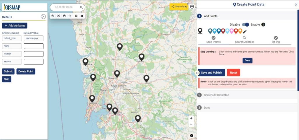
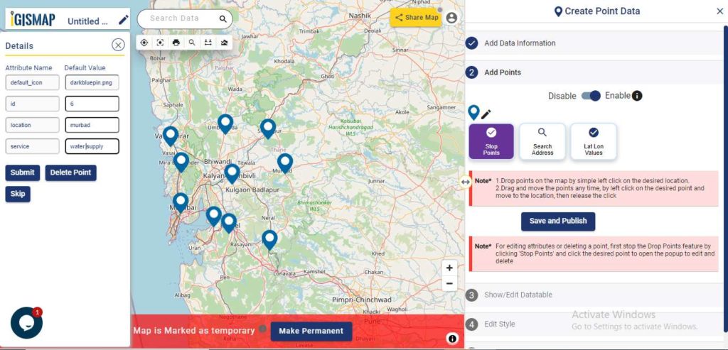
Add Attributes popup will appear every time you plot a point. Using this popup, you can add the attribute fields and values. Click the Submit button to Submit the save the attribute entries. You can choose to delete the point you plotted by clicking the Delete Point button. You can disable this popup anytime using the following toggle button.
But we can open this popup anytime while plotting, by simply clicking on an existing pin.
After plotting every desired location for our data, click the Save and Publish button to publish your data in the map.
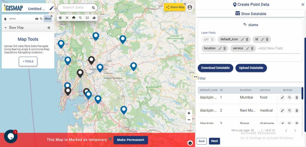
Review and edit the datatable
After the slum locations are published as point GIS layer, Show/Edit Datatable section will be open. Here you can edit the attribute values entered for each point location after clicking the button in the data table along each row in the data table. You can also choose to delete a point by clickingbutton.
Show/Edit Datatable
Options to edit or delete the attribute fields are also available in this step along with the option to add new attribute fields to this data. If you thought of adding more points to the data of ATM Locations, select the Back button to go to the Add Points section, where you can add more points and make changes to the already published data.
Option to update the data table as bulk is available in this section. Where the whole data table can be downloaded in Excel format using Download Datatable button. And to make the changes outside IGISMap, then upload the edited/updated spreadsheet file using Upload Datatable button and integrate with the same point data of ATM locations.
After making all the changes in the datatable, let’s move to the styling section by clicking the Next button to finish plotting.
Plotting of Slum Locations Completed
Styling the slum location points
A map will become more meaningful if appropriate icons and colors are used to visualize the spatial features of the map. In IGISMap styling options, Bubble Style and Icon Style are provided for point GIS data.
In Icon Styling, IGISMap provides two more options – Basic and Category styling. For now, let’s make it simple by providing an appropriate pin icon for styling the Slum location points.
After opening Icon Style tool from the Done section or from the Map Tools, select the data from the dropdown and click Next
Styling with Proper Icons
Basic Icon will be selected as default. Select appropriate icon from the list and click Save Style to apply icon for the points.
Select Icon
Another styling option using Icon Style tool is the Categorial Icon, where users can select the category on the basis of which styling is added to the point data.
Bubble style is used to visualize the data quantitatively based on the numerical fields in the datatable. We can assign the size and color of the bubble for each class of values.
Click on Save Style option to save the Styling options of added points.
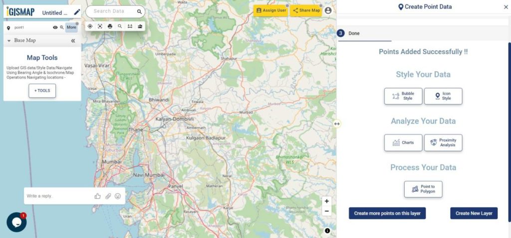
It’s done! Now if the user wants to add more points, click on Create more points on the layer option, which will then direct you back to the Add Points section.
Add Points
If the user wants to create a new layer, select Create New Layer option.
Embed your slum locations map in a website
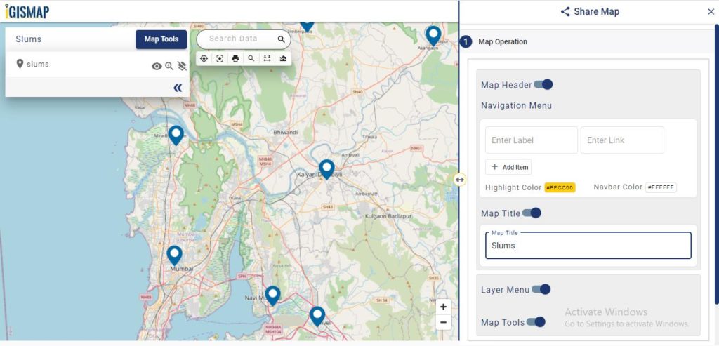
As the data is created completely and styles appropriately, let’s embed the map of Slums in a website. For this, click the button at the top right, where you will reach the UI to control the sharing of this map.
Share Map
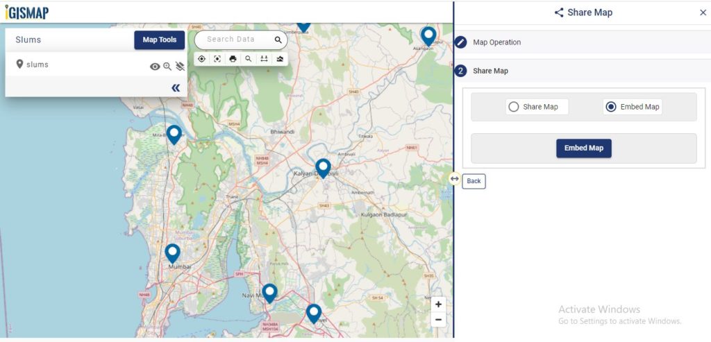
After the share map components are enabled and disabled as desired, click Next button to proceed to the step for copying the iframe link to embed in a website.
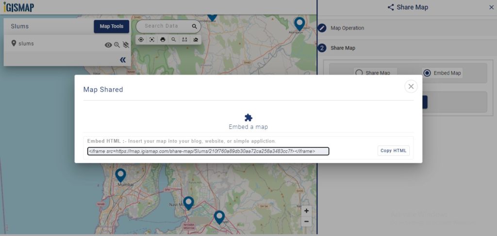
Embed MapIframe link
Copy this link from the popup and attach it to your website. Thus the map will be available as interactive as below.
Check the article Share your Map to understand more about Share Map feature of IGISMap.
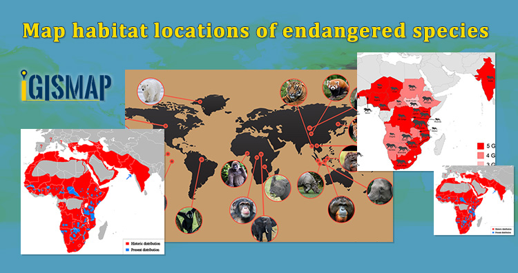
“ Wilderness without wildlife is just scenery” -Lois Crisler
The International Union for Conservation of Nature (IUCN) states that endangered species are the species of plant or animal that are seriously at the risk of extinction. In this time of data revolution, data analytics plays a huge role in the field of environmental science and atmospheric studies. Keeping the record of the habitat locations of endangered species and observing the variations in their environmental factors will help the authorities to study the causes that threaten the life of these species. These observations can be further useful to prevent global extinction by rehabilitating their populations and restoring habitats. In the article we create point vector data in GIS tool.
GIS technology is an effective tool for managing, analyzing, and visualizing wildlife data to target areas where monitoring and managing is required. GIS technology helps in tracking the migration patterns, mapping biodiversity, and habitat suitability models which provide analysis for animals to locate their habitat locations in suitable environmental conditions.
Consider that a wildlife conservationist wants to map the habitat locations of endangered animals in India and keep track of the factors such as total strength, temperature, precipitation, food, water, etc. There are a lot of GIS applications available, but only MAPOG meets the requirements creating a map and hosting the map. Create Point Datatool of IGISMap can be used to plot locations and point objects as a point vector data model.
Map habitat locations of endangered species
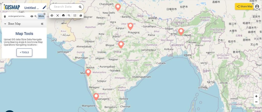
Users can rely on the Create Point Data tool of IGISMap application to plot the habitat locations of endangered animals as given below.
Final Map of Habitat Locations
GIS data created in IGISMap can be shared via links or embed in websites. More information based on these locations can be added as attributes in the datatable. Attribute information in the datatable can be queried using the Proximity Analysis tool of IGISMap. Let’s look into the steps on how the habitat location map can be created and further used for the protection of endangered animals.
To navigate to the IGISMap Create Point Data tool, click the below link
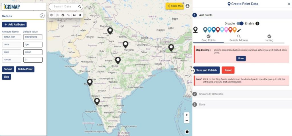
Adding the points of habitat locations of endangered animals
First step is to Add Points, where we can start plotting the habitat locations as points, in the form of pins. IGISMap provides you with three features for plotting points: Drop Points, Search Address, and Lat Lon Values.
Create Point Data tool
Let’s select the Drop Points option and zoom to the location with the desired location to plot a pin in that specific location on the map
Drop Points
Everytime when a point gets plotted, a popup will open to enter the attribute values in each attribute field of the habitat locations. Click the Submit button to Submit and save the attribute entries. You can choose to delete the point you plotted by clicking the Delete Point button. Else you can click Skip to close the popup. You can disable the default opening of this popup using the toggle button.
Search Address option opens a search address box, where you can enter an address and choose the right option from the dropdown list, then click the Plot button to plot a point on that location.
Lat Lon Values will open two boxes to enter latitude and longitude values of the location you want to plot, Plot Location button in this option will plot a pin at the location you have entered.
A plotted point can be moved to a different location by click and drag to the desired location
Note: If the Drop Points option is active for dropping pins, it should be unselected for selecting the plotted pins to open the attribute popup.
After making all the changes, click on the Save and Publish button to publish the GIS data of habitat locations.
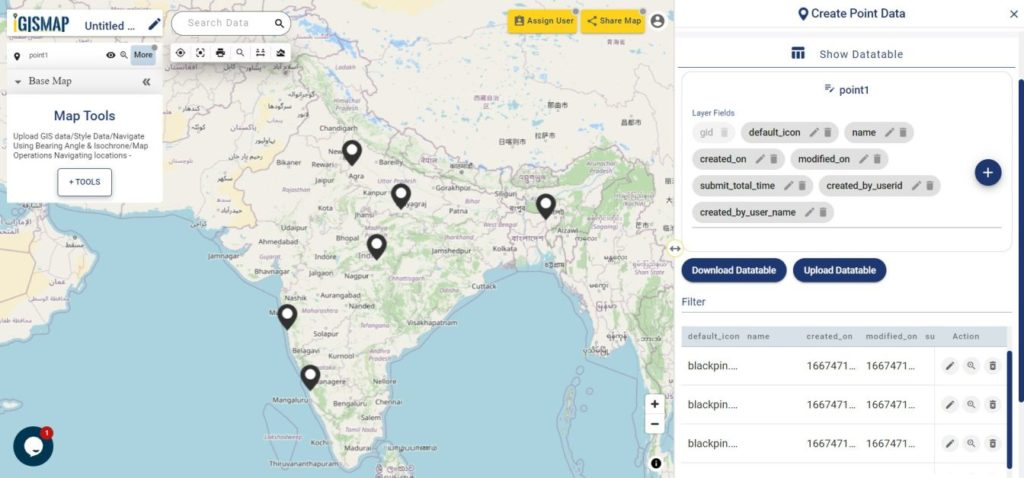
Review and Edit the Datatable of the Data
Save and Publish button will publish the point location of endangered animals as point GIS data layer. The default name of the published layer will be point1 that can be edited any time. Show/Edit Datatable section will also open, where attribute fields and attribute values of each location can be edited, updated or deleted.
Option to update the data table as bulk is available in this section. Here the whole datatable can be downloaded in Excel format using Download Datatable button. And to make the changes outside IGISMap, then upload the edited/updated spreadsheet file using Upload Datatable button. Further, integrate with the same point data of habitat locations.
Show/Edit Datatable
Here the Back button is present for going back to the Add Points section to add more points or click Next option to proceed further.
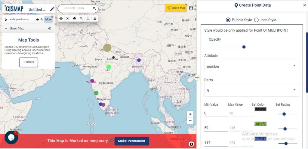
Styling The Habitat Location Points Of Endangered Species
A map will become more meaningful if appropriate icons and colors are used to visualize the features of the map. IGISMap provides – Bubble Style and Icon Style for point GIS data. Icon Styling has two more options – BasicIcon and Category Icon styling.
In basic styling, users can use different styling options for the pin.In Basic Icon styling, user can select any of the icons to represent the point locations.
Here we are going to style our data using Bubble Style. Bubble style is used to visualize the data quantitatively based on the numerical fields in the datatable. We can assign the size and color of the bubble for each class of values.
IGISMap provides direct access to Icon Style and Bubble Style tools from an existing map, where you can style point GIS data published in that map
It’s done! Now if the user wants to add more points, click on Create more points on the layer option. If the user wants to create a new layer, select Create New Layer option.
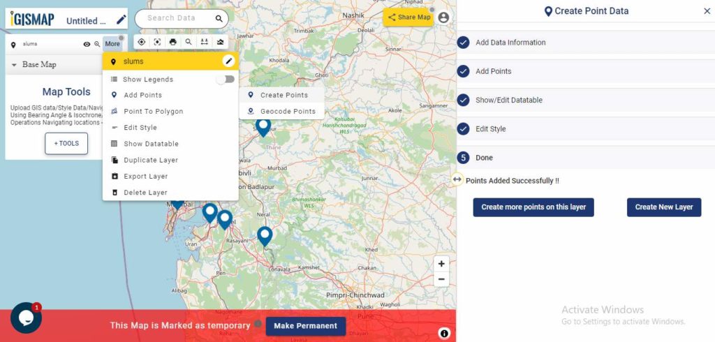
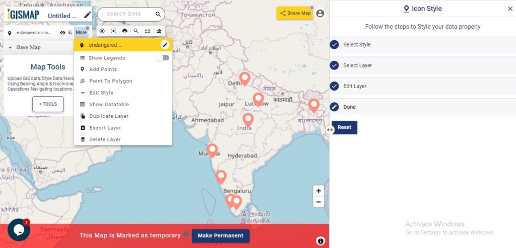
Add Points feature is available in the More section of the layer which will allow to add more points and attribute informations to the data you created.
More options
Embedding Map In Your Website
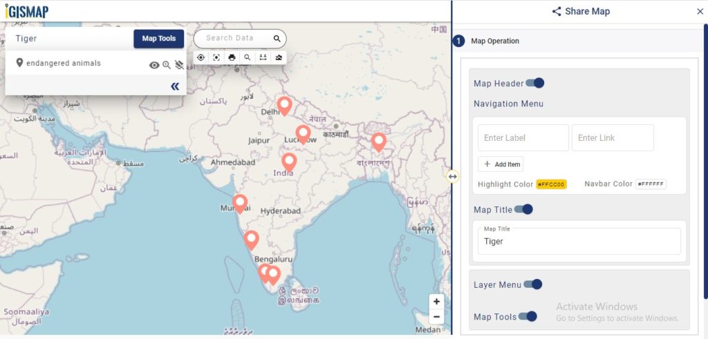
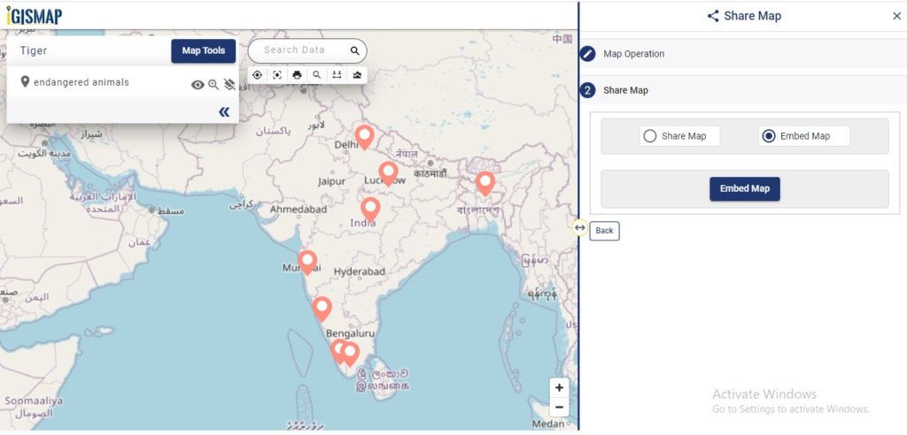
Now lets embed the map of habitat location in a website. For this, click the button at the top right, where you will reach the UI to control the sharing of this map.
Share Map
Enable and provide the necessary components of the Share Map and click Next button. Now select the Embed Map option and click Embed Map button.
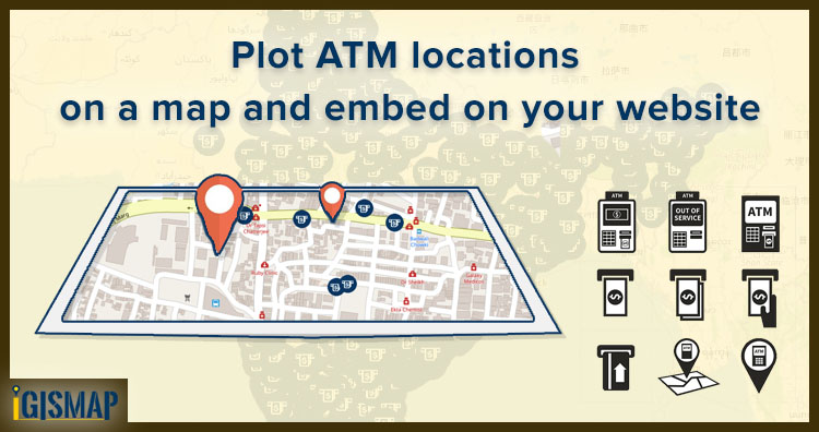
Consider that you are an engineer working for the technical support team in a bank. And you were asked to host a web map of the ATM locations under your branch. This same map should be later available to dynamically visualize the transactions associated with each ATM in a quantitative representation. In this article, you will learn how to plot atm/shop locations on map and embed it on your website.
There are limited GIS software and online tools where you can do this job. Most of them are limited to any single service, ie., either creating a map and hosting the map on a website, but IGISMap allows you to do both. MAPOG is a GIS based web platform providing multiple GIS applications that are most important in the field of geospatial analytics. The peculiarity of IGISMAP in the GIS Industry is its UI/UX which helps the user to perform effortless geospatial operations. GIS tools of IGISMAP allow you to Add Your Data, Create Your Data, Map Your Data, Style Your Data, Process Your Data, and Analyze Your Data, and additionally, it helps you to share your Data privately or publicly.
How to Plot ATM/shop locations on map
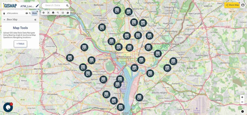
Create Point Data tool of IGISMap is a powerful GIS tool to plot point vector data to represent locations and point objects with single latitude and longitude values. Using Create Point Data tool, we can create an interactive map of ATM locations like the following.
Map of ATM Locations
Lets walk through each step of the Create Point Data tool to create a map like this and share with your team.
First, you need to log in to MAPOG . If you haven’t signed up for IGISMap, click the Sign Up button to create an account.
After Logging In, you will be directed to the dashboard of your IGISMap account.
From the dashboard, click on the Create Point Data tab to open the tool as shown below.
Create Point Data tool
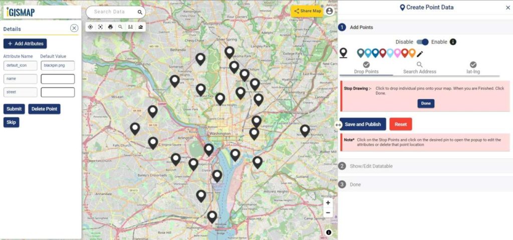
Start Plotting Points for the ATM Locations
First step is Add Points, where we can start plotting the ATM locations as points, in the form of pins. IGISMap provides you with three features for plotting points: Drop Points, Search Address, and Lat Lon Values.
Let’s select the Drop Points option and zoom to the location with the desired ATM Machine to plot a pin in that specific location on the map
Add Points – Drop Points
Search Address option opens a search address box, where you can enter an address and choose the right option from the dropdown list, then click the Plot button to plot a point on that location.
Lat Lon Values will open two boxes to enter latitude and longitude values of the location you want to plot, Plot Location button in this option will plot a pin at the location you have entered.
Also, a popup will open for entering attribute values in each attribute field for that atm location when a point is plotting. Click the Submit button to Submit the save the attribute entries. You can choose to delete the point you plotted by clicking the Delete Point button. You can disable the default opening of this popup using the toggle button.
But we can open this popup anytime while plotting, by simply clicking on an existing pin.
Note: If the Drop Points option is active for dropping pins, it should be unselected for selecting the plotted pins to open the attribute popup.
After plotting every desired ATM location for our data, click the Save and Publish button to publish your data in the map.
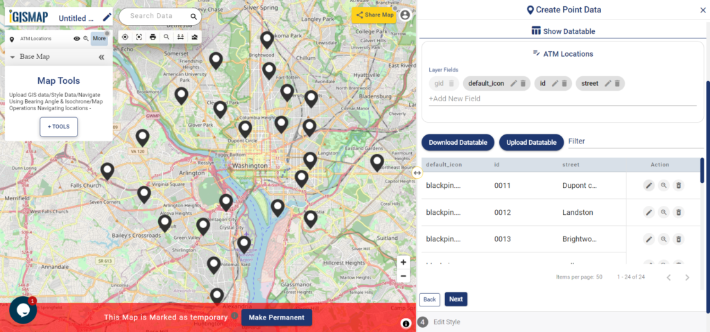
Review and Edit the Datatable
After the atm location is published, Show/Edit Datatable section will be open. Here you can edit the attribute values entered for each point location after clicking the button in the data table along each row in the data table. You can also choose to delete a point by clickingbutton.
Datatable
Options to edit or delete the attribute fields are also available in this step along with the option to add new attribute fields to this data. If you thought of adding more points to the data of ATM Locations, select the Back button to go to the Add Points section, where you can add more points and make changes to the already published data.
Option to update the data table as bulk is available in this section. Where the whole data table can be downloaded in Excel format using Download Datatable button. And to make the changes outside IGISMap, then upload the edited/updated spreadsheet file using Upload Datatable button and integrate with the same point data of ATM locations.
After making all the changes in the datatable, let’s move to the styling section by clicking the Next button to finish plotting.
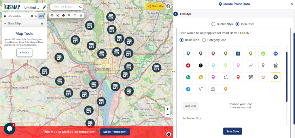
Style Your ATM Location Points
A map will become more meaningful if appropriate icons and colors are used to visualize the features of the map. In IGISMap styling options, Bubble Style and Icon Style are provided for point GIS data.
Here we are going to style our data using Icon Style. In Icon Styling, IGISMap provides two more options – Basic and Category styling. For now, let’s make it simple by providing an appropriate pin icon for styling the ATM location points. And apply it on the ATM Locations data as follows.
IGISMap provides direct access to Icon Style and Bubble Style tools from an existing map, where you can style point GIS data published in that map
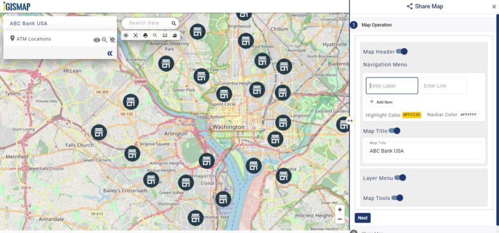
Embed Your ATM Locations Map in a Website
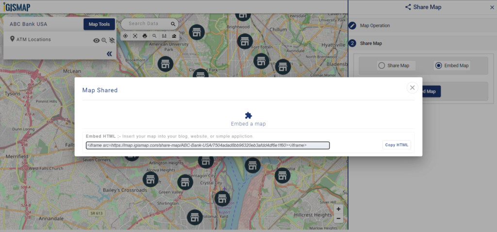
As the data is created completely and styled appropriately, let’s embed the map of ATM Locations in a website. For this, click the button at the top right, where you will reach the UI to control the sharing of this map.
Share Map
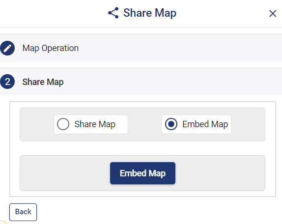
Once the components are enabled and disabled as desired. After that click the Next button to proceed to the step of copying the iframe link to embed in a website.
Share Map – Embed Map
Link to Embed Map
Copy the HTML code link and embed it on your website. Thus the map will be available as interactive as below.
Afterward merge the data table of the ATM Locations with the transaction data of each ATMs. Furthermore, for quantitative visualization, we can use Bubble Style. The style will apply automatically to your website. So with the following steps, you can plot atm/shop locations on a map and embed them on your website.
Article Share your Map will help you understand more about Share Map feature of IGISMap.
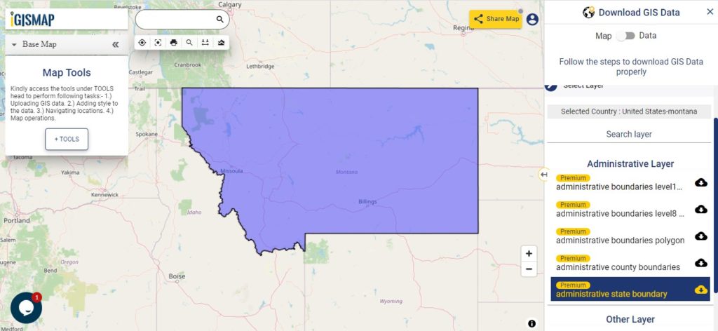
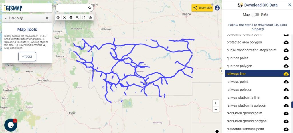
GIS Data and Maps of Montana State is used by planners and surveyors for visualizing and identifying the patterns that are difficult to examine when data is in table form. Here you can download the GIS data of the state boundary, county division, rail and highway maps in just a few clicks. You can use these data for analysis in MAPOG itself or download them in any suitable GIS format. You can download these data in KML, GeoJSON, CSV or Shapefile formats and You can upload your data on an MAPOG Tool for study & research.
In the above screen, Montana state gis maps are shown. The layer list is provided on the right side of the screen. For the data table toggle button from Map to Data. For download click on the button placed beside the layer name. A modal will appear to select the gis format in which you want your output file.
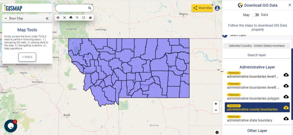
Polygon map with county division is visible on the above screen. You can easily download and upload in a tool for free and create a map from GIS data. Edit, format, add attribute column and share it with your colleagues.
Montana State data covers following GIS data of Counties
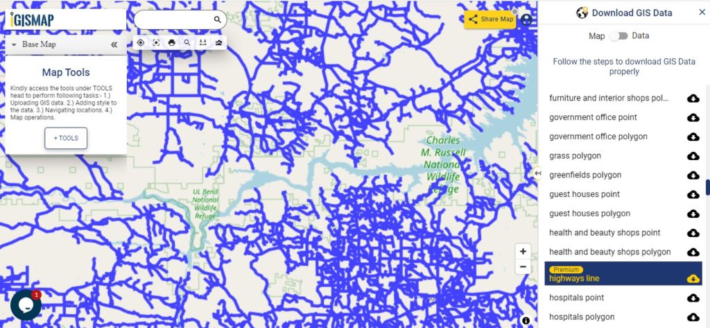
Zoom in view of highway line map is shown shown above. Similarly, you can easily download point based GIS data of airport point, ATM point, parking area, hospital location, etc..
Disclaimer : If you find any shapefile data of country provided is in correct do contact us or comment below, so that we will correct the same in our system.
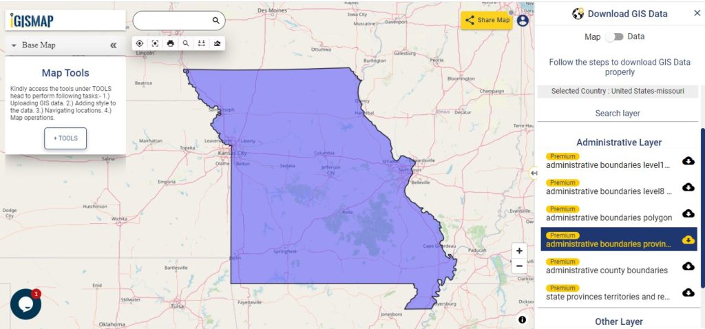
GIS Data and Maps of Missouri State is used by planners and surveyors for visualizing and identifying the patterns that are difficult to examine when data is in table form. Here you can download the GIS data of the state boundary, county division, rail and highway maps in just a few clicks. You can use these data for analysis in MAPOG itself or download them in any suitable GIS format. You can download these data in KML, GeoJSON, CSV or Shapefile formats.
Note:
All data available are in GCS datum EPSG:4326 WGS84 CRS (Coordinate Reference System).
You need to login for downloading the shapefile.
Download Shapefile Data of Missouri State
Missouri is the state in the Midwestern region of the United States. Jefferson city is the capital city of the state.
In the above screen, you can see the state boundary map of Missouri. Please make sure to check the data table by toggling Map to Data before download. Click on the button shown near the layer name. A modal will appear to select the desired GIS format. Similarly, you can also download other GIS layers too for example – administrative boundary levels 8 & 10, atm points, areas under construction, etc.
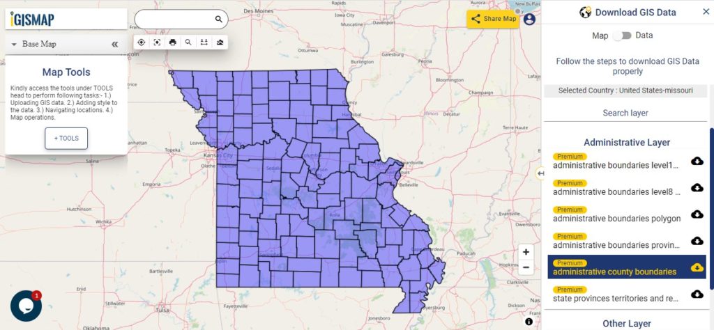
Polygon map with county division is visible on the above screen. You can easily download and upload in a tool for free and create a map from GIS data. Edit, format, add attribute column and share it with your colleagues.
Zoom in view of highway line map is shown shown above. Similarly, you can easily download point based GIS data of airport point, ATM point, parking area, hospital location, etc.
Disclaimer : If you find any shapefile data of country provided is in correct do contact us or comment below, so that we will correct the same in our system.
GIS Data and Maps of Mississippi State is used by planners and surveyors for visualizing and identifying the patterns that are difficult to examine when data is in table form. Here you can download the GIS data of the state boundary, county division, rail and highway maps in just a few clicks. You can use these data for analysis in MAPOG itself or download them in any suitable GIS format. You can download these data in KML, GeoJSON, CSV or Shapefile formats.
Note:
All data available are in GCS datum EPSG:4326 WGS84 CRS (Coordinate Reference System).
You need to login for downloading the shapefile.
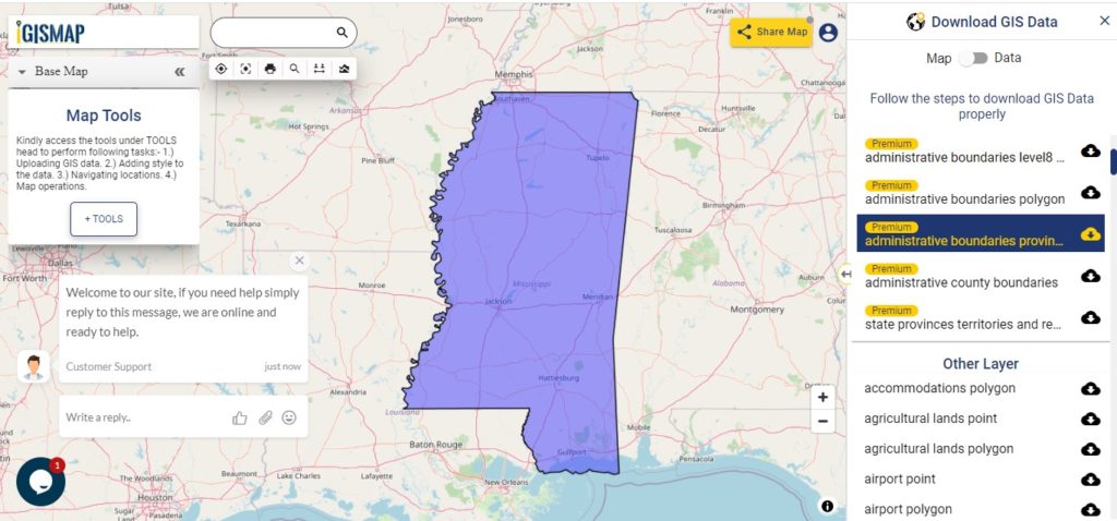
Download Shapefile Data of Mississippi state
Mississippi is the southern state of the United States with the Mississippi River to its west. Jackson is the capital city of Mississippi.
After, clicking on the link State boundary map will appear. Click on download button located near layers name on the Right side of the screen. Once you tap on button of selected layer, a modal will appear. Choose the GIS format from the drop down list. Make sure to check data table through switching button from Map to Data.
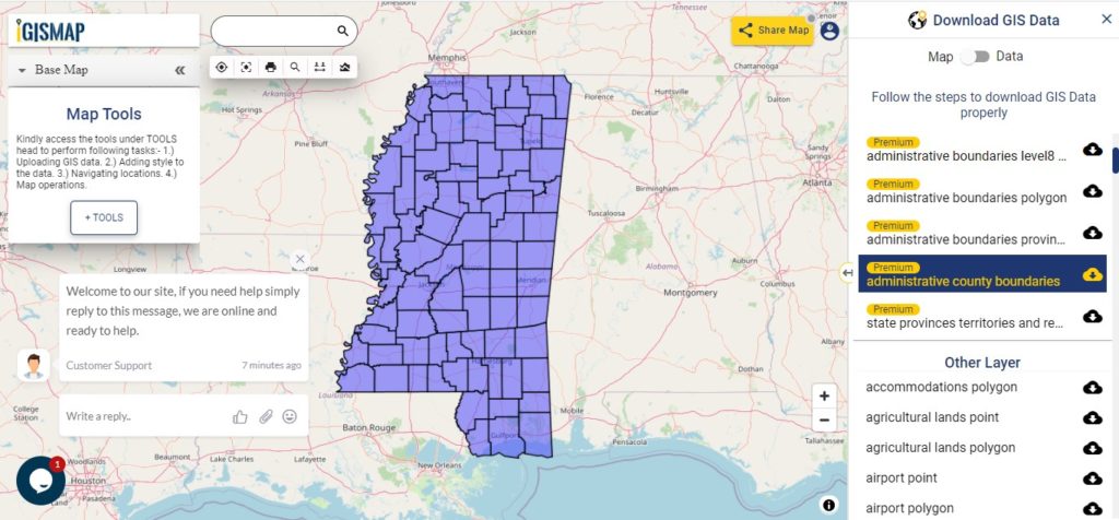
In above screen polygon shapefile of Mississippi state. In addition to administrative GIS maps other GIS layers are available for example – art & hobbies shops point, polygon, ATM point, areas under construction, etc.
Above all, Gis data covers the following Mississippi Counties –
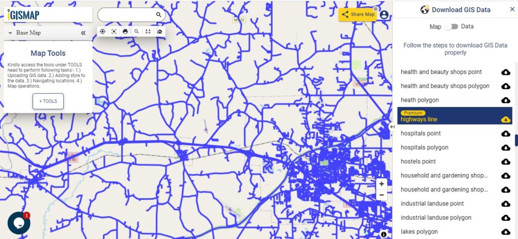
Zoom in view of highway line map is shown shown above. Similarly, you can easily download point based GIS data of airport point, ATM point, parking area, hospital location, etc.
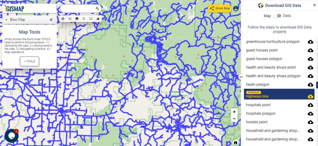
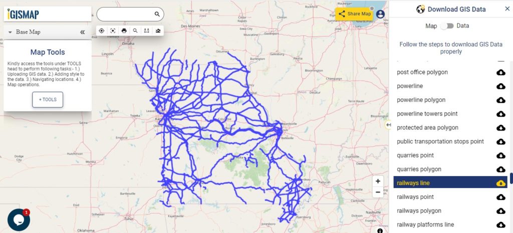
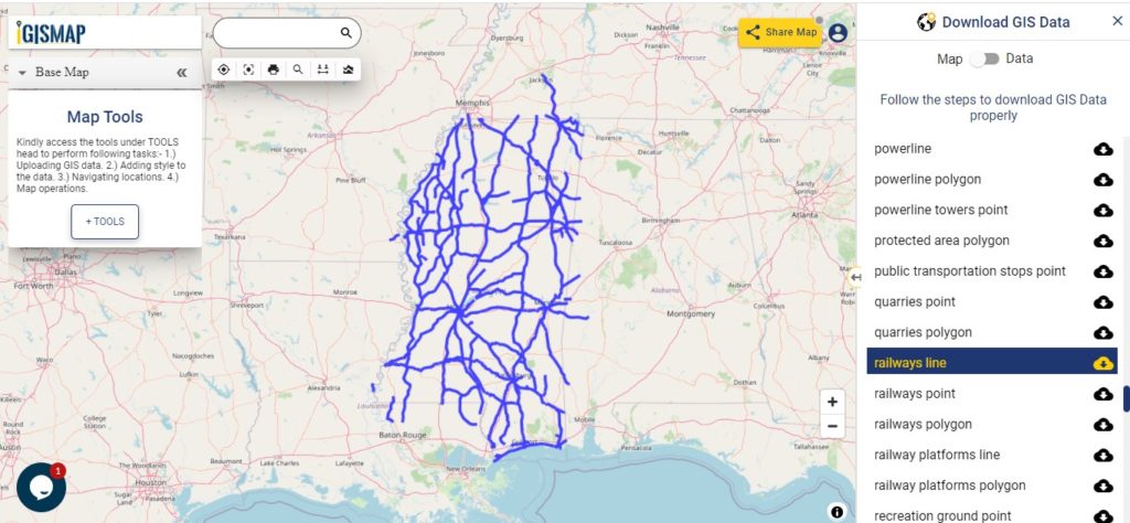
Railway line map is shown in above screen. Likewise you can download other GIS layers too. For example – Recreation grounds, residential, restaurants, business location, etc.
Disclaimer : If you find any shapefile data of country provided is in correct do contact us or comment below, so that we will correct the same in our system.
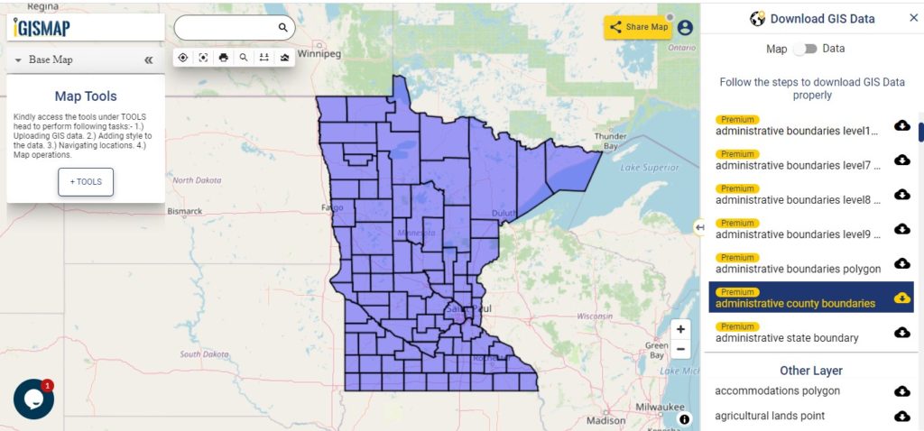
GIS Data and Maps of Minnesota State is used by planners and surveyors for visualizing and identifying the patterns that are difficult to examine when data is in table form. Here you can download the GIS data of the state boundary, county division, rail and highway maps in just a few clicks. You can use these data for analysis in MAPOG itself or download them in any suitable GIS format. You can download these data in KML, GeoJSON, CSV or Shapefile formats.
Note:
All data available are in GCS datum EPSG:4326 WGS84 CRS (Coordinate Reference System).
You need to login for downloading the shapefile.
Download Shapefile Data of Minnesota State
Minnesota State is the midwestern state of the United States of America. Saint Paul is the capital city of the state.
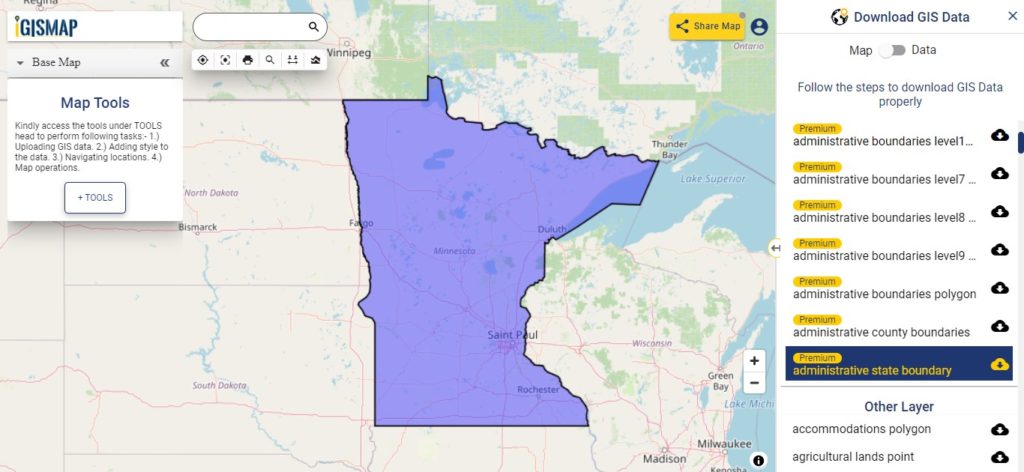
In the above screen boundary map of the state is visible. Other GIS layers are also available to download for example – administrative boundary level 7, 8,9 arts & hobby shops, etc. For viewing the data table toggle the button from Map to Data shown on the top of the map data on the screen. For download click on the button shown near the layer name. A modal will appear to select the GIS format from. You can put your business or store location on the map and embed it on your website.
County Division GIS Map of Minnesota
There are 87 counties in the United States of Minnesota.
In the above screen, the county division map is shown. If you want to do editing like, color change, heading, legend, or add attribute then try your hands on MAPOG Tool for free.
Above all GIS data covers following Counties of the state –
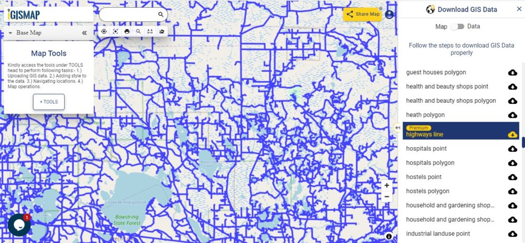
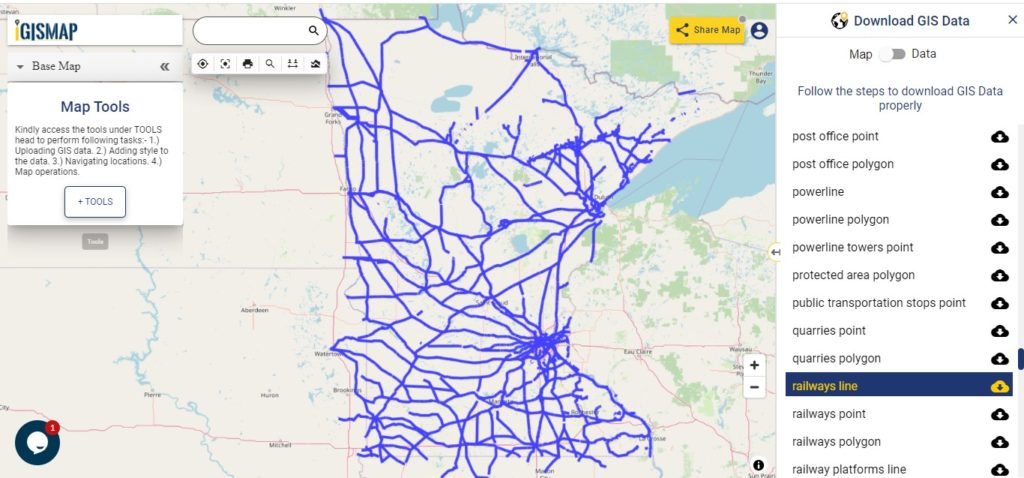
Zoom in view of highway line map is shown shown above. Similarly, you can easily download point based GIS data of airport point, ATM point, parking area, hospital location, etc.
Disclaimer : If you find any shapefile data of country provided is in correct do contact us or comment below, so that we will correct the same in our system.
Loading Comments...
We use cookies to ensure that we give you the best experience on our website. If you continue to use this site we will assume that you are happy with it.