Convert KML to DXF

Are you looking for converting your KML data file into DXF format for your GIS project or uploading in the CAD system? Have you extracted and downloaded KML file from Google Earth or Google map and want to render it with your geo library which support DXF format? You can carry out this process using any GIS or Design specific desktop software. There are also a number of online tools to perform this conversion. but If you don’t want to spend so much time just on conversions and want an easy way for conversions. Here is an amazing tool for converting your data files within a minute, i.e. MapOG Converter.

MapOG Converter

IGIS Map converter is an incredible tool for data file conversions. It will translate an AutoCAD file (in DXF format) to a shapefile or KML format. It can also convert from KML format to shapefile, or KML to DXF, or Shapefile to DXF.  It Convert GIS / CAD files online without using complex and Enterprise Software like ArcGIS, QGIS, AutoCAD etc. IGIS Map converter is much easier to use then any other conversion software or tool.

MAPOG to Convert KML to DXF

Go to MAPOG Converter Tool, after logging in with your registered email and password. If you are a new user, click the Sign Up button in the Login popup and register to IGISMAP by filling the details.

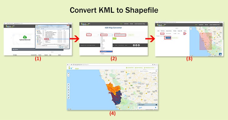
There are three main steps for using GIS Converter:

  • Upload the data
  • Choose the format to which it should be converted
  • Download the converted file.

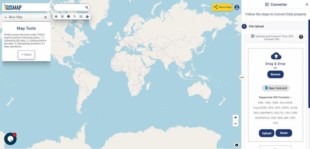
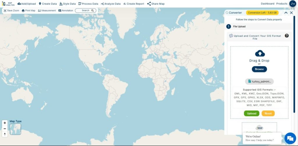
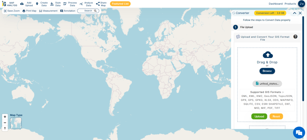
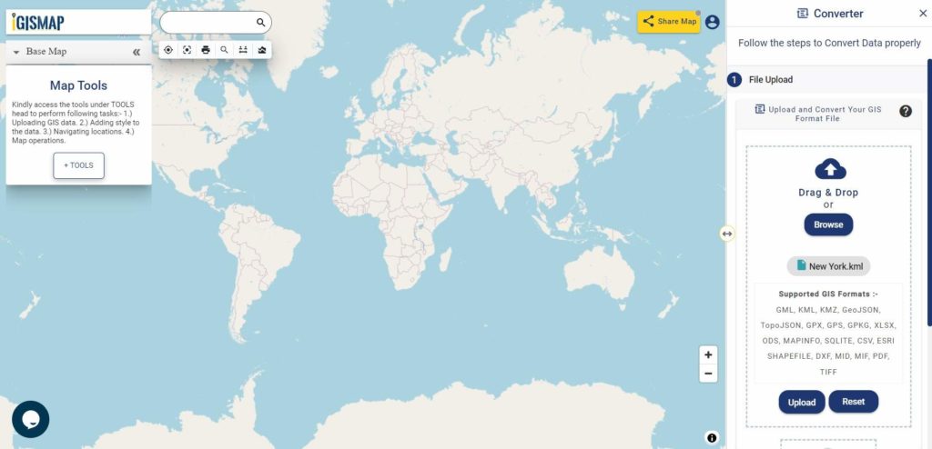
Step one is to upload your KML file which you want to convert. You can upload the file from your system or select from the Recent Files.

Converter Tool - Upload KML
Upload KML

Here we using the KML file of New York state boundary.

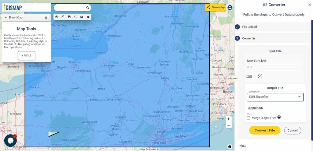
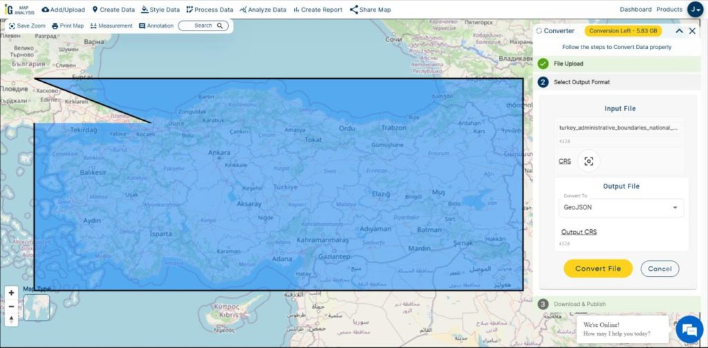
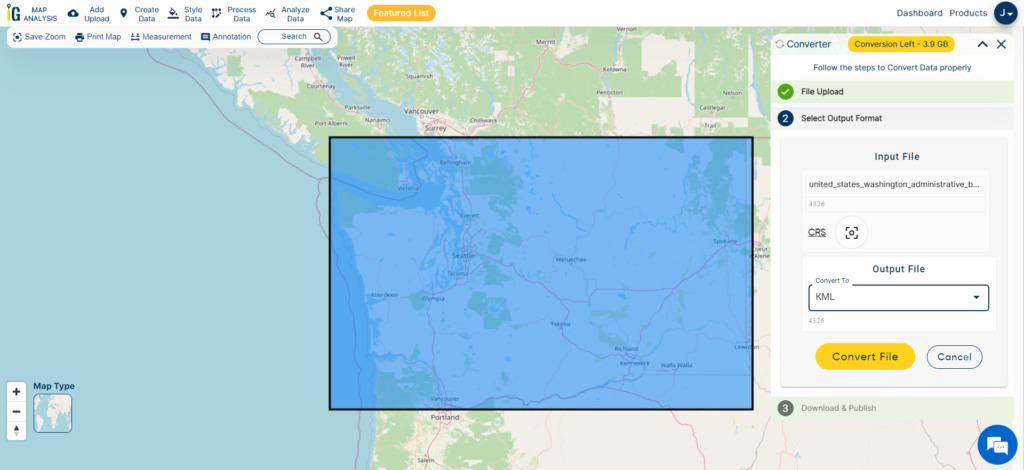
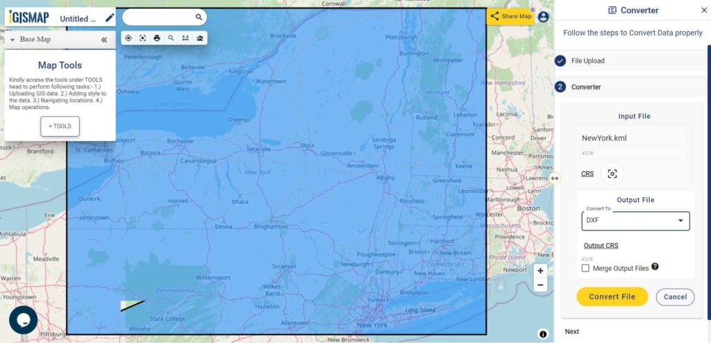
Step two is to select choose the output format of the converted file, in this case its DXF. You can also set the Coordinate Reference System of your preference. As a default CRS will set to WGS 84 (World) [EPSG:4326]. Click on the Convert File button.

Converter Tool - DXF as Output Format
Select DXF as Output Format

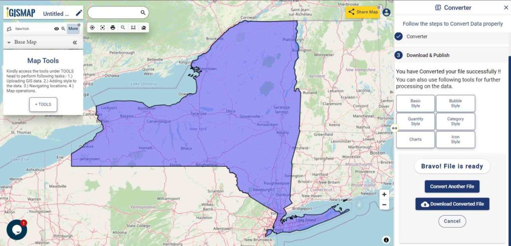
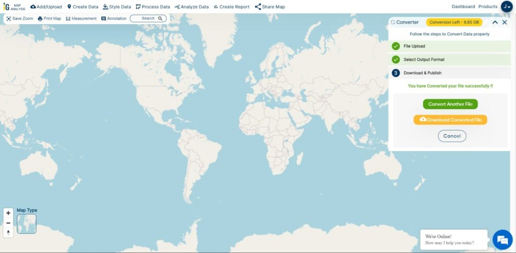
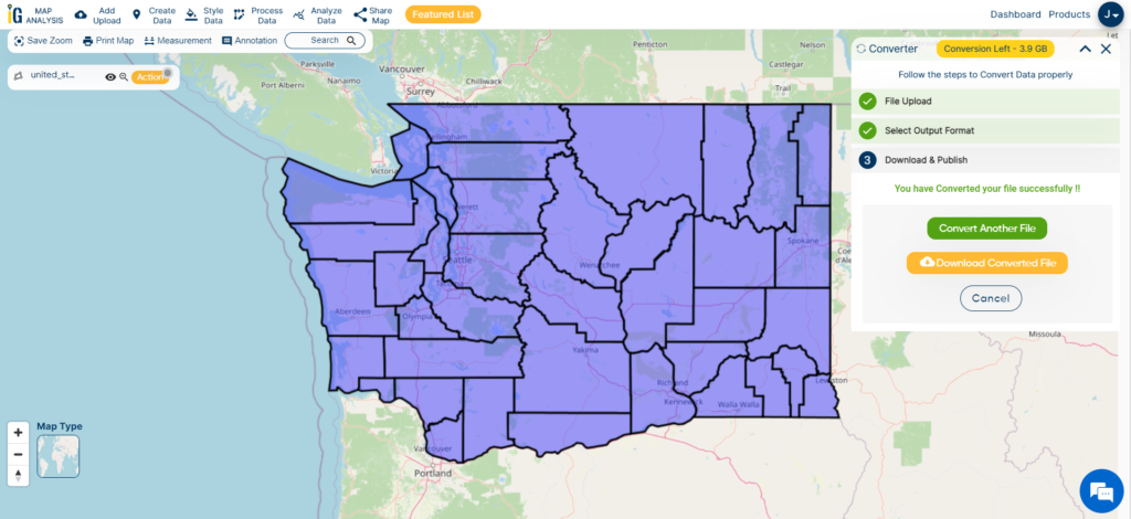
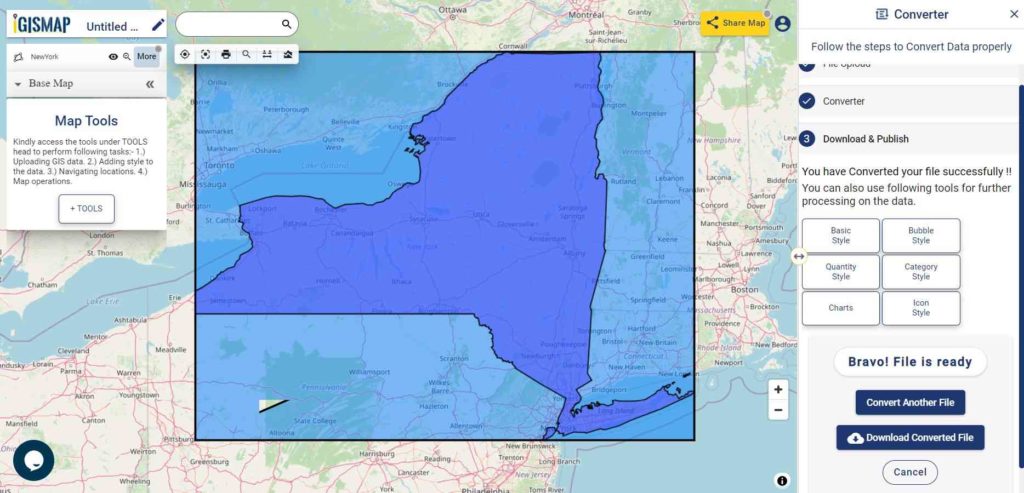
Your KML file will then get converted to DXF file after a few seconds and will be published in the map canvas. You can download the DXF file of New York state boundary by clicking the Download Converted File button.

Download and Publish DXF File

You can also choose to style the layer or continue with further conversion process by clicking the Convert Another File button.

Converted Files section from the dashboard contains the list of the details of all the conversion done in your account, providing both input and output data available for download their corresponding formats.

Conclusion

IGIS Map Converter Tool provides many benefits other then just conversion of data. This tool provides us to generate this published map in PDF or as image format.

InfoGIS MAPOG supports most of the commonly used GIS or AutoCAD files like Shapefile SHP, KML, KMZ, CSV, TopoJSON, GeoJSON, GML, DXF, GeoTIFF, NetCDF, GRIB, HDF5, OSM, PBF, and many more raster and vector files, along with that it support more than 4000 Coordinate Reference System.

IGIS Map Converter is a online tool for converting GIS data files from one format to another. which helps you in easy data conversion and beautiful and incredible map creation in no time. IGIS Map converter online tool is recommended for better and easy conversions.  If you want you can also use ogr2ogr offline conversion tool for convert KML to DXF format.

Need Sample data for research and study – Download Shapefile of Countries

If you face any problem during implementing this tutorial, drop a mail at support@igismap.com, also feel free to comment in given comment box.

KML to SHP Shapefile – Convert

Convert kml to shp shapefile. Have you extracted and downloaded kml file from Google Earth or Google map and want to render it with your geo library which support shapefile? Do you have KML data given from third party and want to give a proper representation of data over map by converting the same in shapefile? If so, here is an article to convert kml to shp using command line tool ogr2ogr or using php code. While if you use QGIS tool, you can look over kml to shp convert using QGIS or else continue using this article.

Here is the online Tool To Convert KML To SHP Shapefile

KML (Keyhole Markup Language) is very popular GIS format. It is available in text format containing tags such as Placemark, SimpleField, SimpleData and ExtendedData etc. It contains whole information in tag. But when you need to see the geometry you may require Shapefile. This conversion can be done using Ogr2ogr utility from GDAL (Geospatial Data Abstraction Library) and other GIS software such as QGIS, ArcGIS etc.

Convert kml to shp – Look Details For KML (Keyhole Markup Language) structure with Line feature-

<Schema name="India_roads" id="India_roads">
 <SimpleField name="MED_DESCRI" type="string"></SimpleField>
 <SimpleField name="RTT_DESCRI" type="string"></SimpleField>
 <SimpleField name="F_CODE_DES" type="string"></SimpleField>
 <SimpleField name="ISO" type="string"></SimpleField>
 <SimpleField name="ISOCOUNTRY" type="string"></SimpleField>
 <SimpleField name="Length_km" type="float"></SimpleField>
 <SimpleField name="Latitude" type="string"></SimpleField>
 </Schema>
 <Folder><name>India_roads</name>
 <Placemark>
 <Style><LineStyle><color>ff0000ff</color></LineStyle><PolyStyle><fill>0</fill></PolyStyle></Style>
 <ExtendedData><SchemaData schemaUrl="#India_raods">
 <SimpleData name="MED_DESCRI">Without Median</SimpleData>
 <SimpleData name="RTT_DESCRI">Secondary Route</SimpleData>
 <SimpleData name="F_CODE_DES">Road</SimpleData>
 <SimpleData name="ISO">IND</SimpleData>
 <SimpleData name="ISOCOUNTRY">INDIA</SimpleData>
 <SimpleData name="Length_km">0.3</SimpleData>
 </SchemaData></ExtendedData>
 <LineString><coordinates>77.8277403975188,35.5012774951028 77.8257523065223,35.4995003281062</coordinates></LineString>
 </Placemark>
 <Placemark>

In the above given example, attribute fields are given with their data type. In style tag geometry style shown with color. Extended Data encloses attribute field name with values. In the last coordinates are given for particular line string. In similar way other lines, point and polygon are given in KML.

You may also look over converting Shapefile to kml using QGIS or shp to kml using ogr2ogr tool.

KML to SHP Shapefile – Convert

    • Go to MapOG Tool  and login with email id or if you are new user then register with a valid email id.
    • After login next step is to  Tap on Switch To and select Converter.
    • Next screen will be opened. Upload your data from system or drag & drop.
    • After uploading your data select the output data. For KML to Shapefile select SHP.
    • If you want your output in different coordinate reference system then click on change CRS.
    • Your converted file is directly published on the map. Download your converted file by clicking download icon.

For step by step approach check the video given below:

Convert from Keyhole Markup Language KML to SHP Shapefile using ogr2ogr utility-

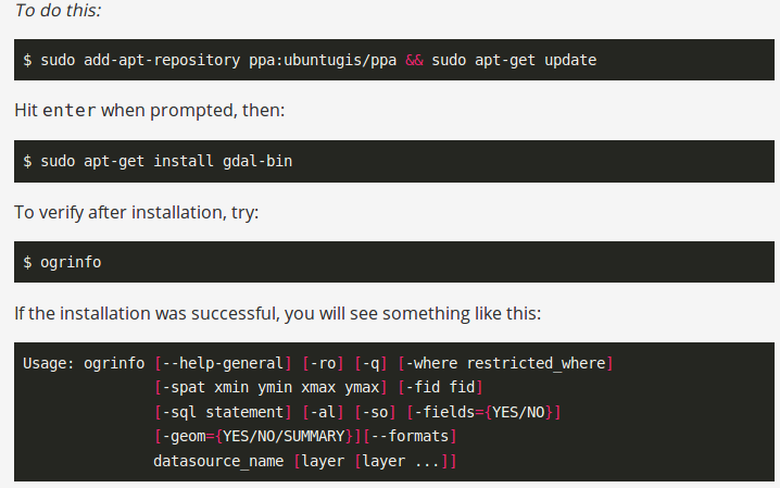
For using this utility you need to install it in your system. To install this utility you can follow given commands,

KML to SHP Shapefile - Convert
KML to SHP Shapefile – Convert

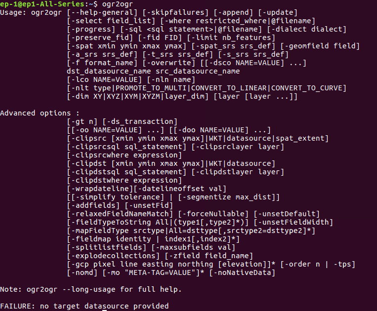
If you already have install this utility or you want to check availability of this utility you can type ogr2ogr in terminal.

KML to SHP Shapefile - Convert

For conversion the given command need to be executed on terminal-

--- ogr2ogr -f 'ESRI Shapefile' Output_sahpefile.shp Input_KML.kml

Here -f defines the output file format and ‘ESRI shapefile’ is driver available.

PHP code for converting KML to SHP shapefile-

If you want the conversion using programing or don’t want to use terminal then this can also be done using PHP. You can create a function that defined this command as string and can give this string in shell_exec() method to execute. Shell_exec() actually execute the command and returns output as string.

public function KML_to_shp($KMLfilepath,$output){
 $query="ogr2ogr -f 'ESRI Shapefile'  $output.gml  $KMLfilepath";
 shell_exec($query);
 }

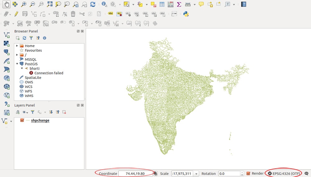
Generated output in QGIS software-

KML to SHP Shapefile - Convert
KML to SHP Shapefile – Convert

Change Coordinate System of shapefile generated from kml-

Changing coordinate system of output file can be done with this same ogr2ogr utility. It has various option for SRS (Spatial reference system), given below

-a_srs srs_def:

Assign an output SRS

-t_srs srs_def:

Reproject/transform to this SRS on output

-s_srs srs_def:

Override source SRS

These option can be used in command as-

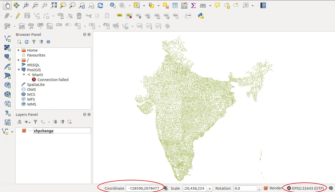
— ogr2ogr -f ‘ESRI Shapefile’ -t_srs EPSG:32643 (new EPSG) -s_srs EPSG:4326 (old EPSG) shpchange.shp output1.kml

Generated shapefile from kml after changing coordinate system in QGIS software-

Convert- KML to Shapefile - Keyhole Markup Language

Hence, we get our shapefile. Furthermore, try our tool MAPOG Tool if you want to conversion in single click.

You also can visit Shapefile to GeoJSON, Shapefile to TopoJSON, Shapfile to geopackage, KML to shapefile conversion using QGIS etc.

If you face any problem during implementing this tutorial, please let us know. Feel free to comment in given comment box.

Even more try your hands on our Conversion Tool

Convert Shapefile to kml by QGIS

Convert Shapefile to kml by QGIS. Shapefile is ESRI based Vector file, While KML or Keyhole Markup Language is file which models and stores geographic features for display in Google Earth or Google maps. Many times you may require to convert the required shapefile to KML file, so that you can deploy the same over Google Earth for some reason. QGIS (Quantum GIS) is an open source GIS (Geographic Information System) tool, which let you upload the Shapefile and convert the same to KML file. Similarly ogr2ogr is also an open source tool, which let you to convert between GIS data formats. Look over shp to kml convert using ogr2ogr tool which can be marked as an alternative to this article. You can also see to convert Kml to Shapefile and also Shapefile to GeoJSON in QGIS.

You can also try Online conversion instead of QGIS MAPOG Online converter tool

You can also go through other tutorial in QGIS.

Free SHP to KML conversion using GIS Converter Tool in one click.

Here are the steps to convert shapefile to kml:

Convert Shapefile to kml in QGIS

Convert Shapefile to kml by QGIS

Convert Shapefile to kml in QGIS:

1.) Open up the installed QGIS.
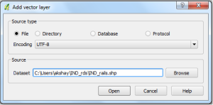
2.) In the menu bar, select Layer and press Add Vector Layer. Now select the source type in the pop up window opened as File and browse the source Shapefile(Note:Your shapefile .shp, .dbf and .shx file should be in same folder). Press open.

Convert Shapefile to kml by QGIS

Select the coordinate reference type system if coordinate reference window appears and press ok.

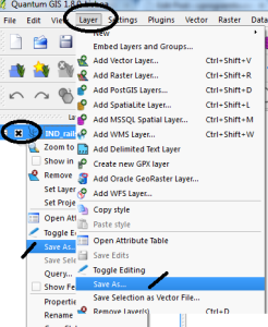
3.) Right click on the name of Shapefile layer Appearing in the Left upper side and select save as:
or
You can select layer from the menu, and click on save as. (Image below provide demonstrate both the options with the indicator displayed)

Convert Shapefile to kml by QGIS

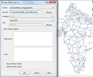
4.) In the Save vector layer as window, Select the format from the drop down box as Keyhole Markup Language(KML) and browse the folder in which you want to save the KML file . Name it and Press OK.

Convert Shapefile to kml by QGIS

Your KML file will be Exported in the directed folder. You can Verify the generated KML file for its validity by uploading the generated KML file to QGIS or uploading KML file in Google map. You may soon find the tool and the coding for the same on this site.
You may check in converting Geojson to Topojson and Shapefile to TopoJSON file. Hope this may help you in converting Shapefile to KML file easily. If you still find problem in converting the file, do let me know by commenting below.

Introduction of QGIS 3.2.1

Convert KML to Shapefile in QGIS

Convert KML to Shapefile in QGIS. KML or Keyhole markup language file which store and models geographic features for displaying in Google earth or Google maps, which is not common in use for Map makers and GIS programmers. ESRI made a standard Vector file i.e Shapefile which is most commonly adopted in the field of GIS (Geographic Information System), and this made me to convert KML to shapefile, created for learning purpose from Google map. QGIS (Qunatum GIS) is an open source GIS tool, which provide you a function to convert the KML file to Shapefile, and Vice versa i.e Shapefile to kml file.
You might be looking for converting KML to shapefile when you get the data from third party or from website which download free GIS map data but in different formats which can also be converted to.

If you still don’t prefer using QGIS or GDAL utility to convert the file from kml to shp, then you should also look for KML to Shapefile Conversion using Online Tool.

Convert KML to Shapefile in QGIS

You might be interested in seeing QGIS tutorials.

Instead of QGIS you can also try Online Converter tool here MAPOG Online converter tool

Convert KML to Shapefile in QGIS:

1.) Open up the installed QGIS.
2.) Select Layer in the menu bar and press Add Vector Layer or select the shortcut icon. Browse the KML file, in the Source DataSet type, in the pop up window opened.(While browsing, select either all files or Key Hole Markup language in file type). And press Open.

Convert KML to Shapefile in QGIS

Select the coordinate reference type system if coordinate reference window pop ups and press ok.

3.) In the Layer file appearing in the left upper side, right click on it, and select save as:

or

you can either select layer from the menu and click on save as.

Convert KML to Shapefile in QGIS`
Convert KML to Shapefile in QGIS

4.) In the Save vector layer as window, Select the format from the drop down box as ESRI Shapefile(OGR) and browse the folder in which you want to save the shapefile. Name it and Press OK.

Convert KML to Shapefile in QGIS

Try our tool for conversion: MAPOG Online converter tool

Your Shapefile i.e .shp, .shx and .dbf file will be created in the directed folder. Upload your KML file in your map browser tool, or try our tool, to verify whether the tool preserves all attributes and elements or not. You may also see how to merge two shapefile in QGIS. Or if you are looking to convert that shapefile to kml to Topojson then you can look for GeoJSON to Topojson and Shapefile to GeoJSON and shapefile to TopoJSON. Do comment below if you are getting any problem in converting the file.