Download United States – Alabama Shapefiles – Administrative Boundaries, Highway and Railway lines, Airport and Aerodrome Points

GIS Data and Maps of Alabama State is used by planners and surveyors for visualizing and identifying the patterns that are difficult to examine when data is in table form. Here you can download the GIS data of the state boundary, county division, rail and highway maps in just a few clicks. You can use these data for analysis in IGISMAP itself or download them in any suitable GIS format. You can download these data in KML, GeoJSON, CSV or Shapefile formats.

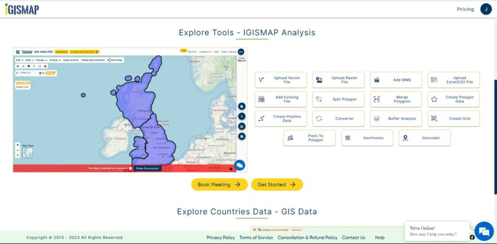
With IGISMAP’s versatile toolkit, you can effortlessly upload vector and raster filesadd WMS (Web Map Service) layers, upload Excel or CSV data, incorporate existing files, perform polygon splitting and merging, generate new polygon and polyline data, use the converter for various formats, conduct buffer analysiscreate gridstransform points into polygons, calculate isochrones, and utilize the geocoder for precise location information.

We offer an extensive array of data formats, including KML, SHP, CSV, GeoJSON, Tab, SQL, Tiff, GML, KMZ, GPKZ, SQLITE, Dxf, MIF, TOPOJSON, XLSX, GPX, ODS, MID, and GPS, ensuring compatibility and accessibility for various applications and analyses.

Note :

  • All data available are in GCS datum EPSG:4326 WGS84 CRS (Coordinate Reference System).
  • You need to login for downloading the shapefile.

Download shapefile of Alabama County

Alabama is a southeastern state of United States. The state is known for its iron and steel natural resources, sweet tea and Football. Alabama capital is Montgomery. Alabama is divided into 67 counties, including Autauga, Baldwin, Jefferson, and others.
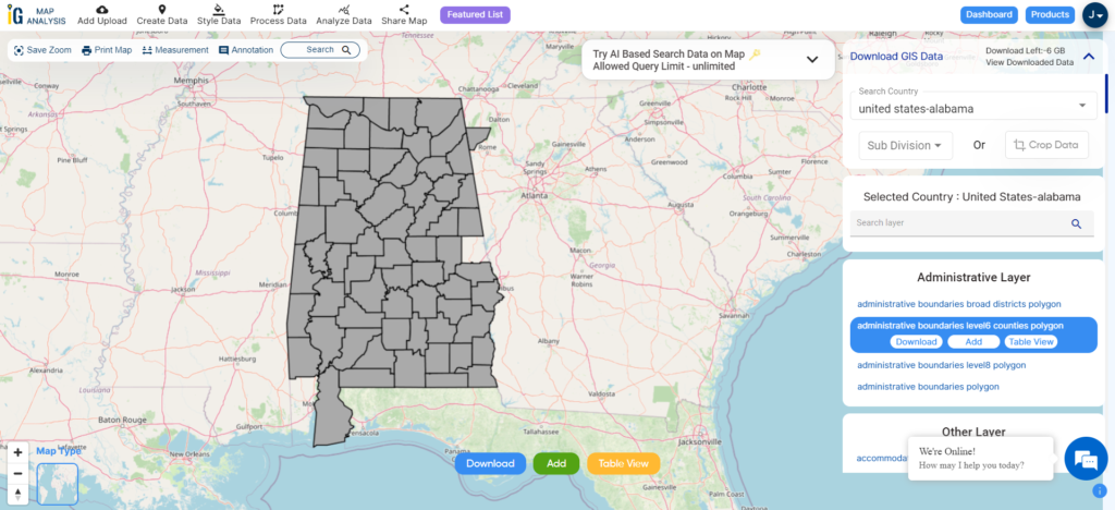
Alabama  County Boundary
Alabama County Boundary

Download Alabama Counties Boundary Shapefile

You can edit or format the map as per need or requirement. For analysis and editing use IGIS Map Anaylsis Tool. In addition to editing, you can share the map with your client or colleague.

You can view data information by clicking on the location on map. Before download Please check the data by toggle to data from map view.

Download Cities, Towns and Villages Shapefile of Alabama
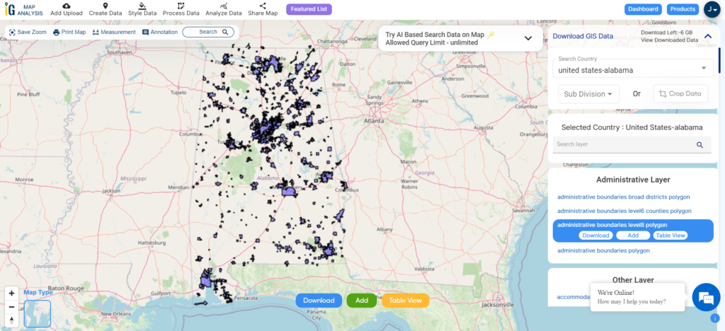
Alabama Cities, Towns and Villages Boundary

Download Alabama Cities, Towns and Villages Boundary Shapefile

Download Airport Point of Alabama State
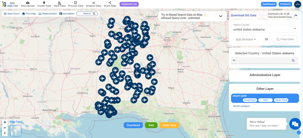
Alabama Airport Points

Download Alabama Airport Points Shapefile

For GIS data in another GIS format that is not listed in the drop-down list, use IGIS Map Converter Tool.

Other GIS Data:

Above all links are provided for GIS data of Alabama if you are looking for any specific data please write us on support@igismap.com

Download GIS Data of other states of USA:

  1. Alabama
  2. Alaska
  3. Arizona
  4. Arkansas
  5. California
  6. Colorado
  7. Connecticut
  8. Florida
  9. Georgia
  10. Hawaii
  11. Idaho
  12. Illinois
  13. Indiana
  14. Iowa
  15. Kansas
  16. Massachusetts
  17. Maryland
  18. Michigan
  19. Minnesota
  20. Mississipi
  21. Missouri
  22. Montana
  23. Nevada
  24. Nebraska
  25. Ohio
  26. Oklahoma
  27. Pennsylvania
  28. Utah
  29. Vermont
  30. Washington
  31. Wisconsin
  32. Wyoming
  33. Tennessee
  34. Texas
  35. Kentucky
  36. Louisiana
  37. Maine
  38. North Carolina
  39. Oregon
  40. Virginia
  41. West Virginia

Download Shapefile for the following:

  1. World Countries Shapefile
  2. Australia
  3. Argentina
  4. Austria
  5. Belgium
  6. Brazil
  7. Canada
  8. Denmark
  9. Fiji
  10. Finland
  11. Germany
  12. Greece
  13. India
  14. Indonesia
  15. Ireland
  16. Italy
  17. Japan
  18. Kenya
  19. Lebanon
  20. Madagascar
  21. Malaysia
  22. Mexico
  23. Mongolia
  24. Netherlands
  25. New Zealand
  26. Nigeria
  27. Papua New Guinea
  28. Philippines
  29. Poland
  30. Russia
  31. Singapore
  32. South Africa
  33. South Korea
  34. Spain
  35. Switzerland
  36. Tunisia
  37. United Kingdom Shapefile
  38. United States of America
  39. Vietnam
  40. Croatia
  41. Chile
  42. Norway
  43. Maldives
  44. Bhutan
  45. Colombia
  46. Libya
  47. Comoros
  48. Hungary
  49. Laos
  50. Estonia
  51. Iraq
  52. Portugal
  53. Azerbaijan
  54. Macedonia
  55. Romania
  56. Peru
  57. Marshall Islands
  58. Slovenia
  59. Nauru
  60. Guatemala
  61. El Salvador
  62. Afghanistan
  63. Cyprus
  64. Syria
  65. Slovakia
  66. Luxembourg
  67. Jordan
  68. Armenia
  69. Haiti And Dominican Republic

Disclaimer : If you find any shapefile data of country provided is incorrect do contact us or comment below, so that we will correct the same in our system as well we will try to correct the same in openstreetmap.
United States – Connecticut GIS Data – Shapefile, Kml, Csv, Geojson

GIS Data and Maps of Connecticut State is used by planners and surveyors for visualizing and identifying the patterns that are difficult to examine when data is in table form. Here you can download the GIS data of the state boundary, county division, rail and highway maps in just a few clicks. You can use these data for analysis in IGISMAP itself or download them in any suitable GIS format. You can download these data in KML, GeoJSON, CSV or Shapefile formats.

With IGISMAP’s versatile toolkit, you can effortlessly upload vector and raster filesadd WMS (Web Map Service) layers, upload Excel or CSV data, incorporate existing files, perform polygon splitting and merging, generate new polygon and polyline data, use the converter for various formats, conduct buffer analysiscreate gridstransform points into polygons, calculate isochrones, and utilize the geocoder for precise location information.

We offer an extensive array of data formats, including KML, SHP, CSV, GeoJSON, Tab, SQL, Tiff, GML, KMZ, GPKZ, SQLITE, Dxf, MIF, TOPOJSON, XLSX, GPX, ODS, MID, and GPS, ensuring compatibility and accessibility for various applications and analyses.

Note :

  • All data available are in GCS datum EPSG:4326 WGS84 CRS (Coordinate Reference System).
  • You need to login for downloading the shapefile.

Download Shapefile of United States – Connecticut.

Connecticut is located in New England reason of the northeastern United States of America. Hartford is the capital and Bridgeport is the largest city of United States. The state named for Connecticut river which bisects the state in two parts. It covers Litchfield county, Fairfield County, New Haven County, Middlesex County, New London County, Hartford County, Tolland County.

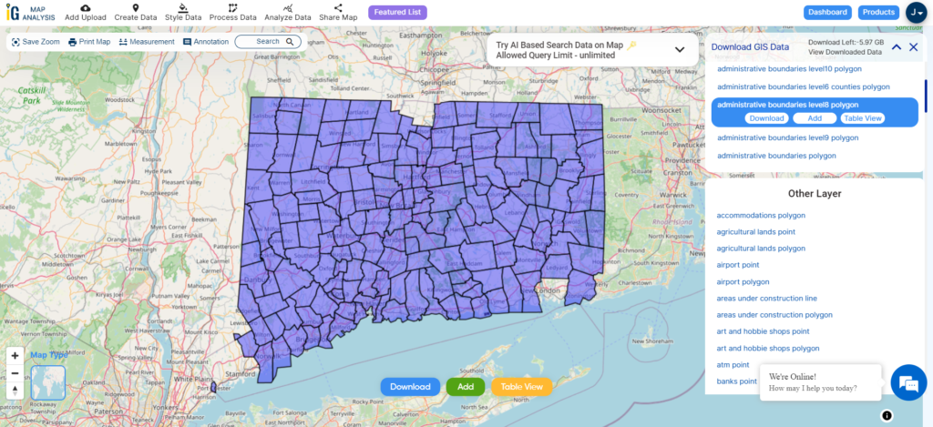
Connecticut Counties Boundary

Download Connecticut County Boundaries Shapefile

You can check data before download by switching Map to data. Shown in above screen. For download click on download button placed near the name of layer. You can download GIS data of United States – Connecticut in Shp (Shapefile), Kml, CSV, GeoJSON, Mapinfo file and PostgreSQL.

You can view data table just by clicking on map location.

If you want to GIS data in any other format then please have a look on GIS Converter Tool of IGIS Map.

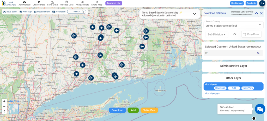
Connecticut States Airport Point GIS Data.

Connecticut Airport Points

Download Connecticut Airport Points Shapefile

After download if you want to analyze and create map try IGIS Map Analysis & Share Tool . You can share your work with clients (others) using Create and Share Custom Maps – Add on Website, Social Sites Share.

For more GIS data Click the on GIS Data.

Check the GIS Data Collection for Other USA States:

  1. Alabama
  2. Alaska
  3. Arizona
  4. Arkansas
  5. California
  6. Colorado
  7. Connecticut
  8. Florida
  9. Georgia
  10. Hawaii
  11. Idaho
  12. Illinois
  13. Indiana
  14. Iowa
  15. Kansas
  16. Massachusetts
  17. Maryland
  18. Michigan
  19. Minnesota
  20. Mississipi
  21. Missouri
  22. Montana
  23. Nevada
  24. Nebraska
  25. Ohio
  26. Oklahoma
  27. Pennsylvania
  28. Utah
  29. Vermont
  30. Washington
  31. Wisconsin
  32. Wyoming
  33. Tennessee
  34. Texas
  35. Kentucky
  36. Louisiana
  37. Maine
  38. North Carolina
  39. Oregon
  40. Virginia
  41. West Virginia

Download Shapefile for the following:

  1. World Countries Shapefile
  2. Australia
  3. Argentina
  4. Austria
  5. Belgium
  6. Brazil
  7. Canada
  8. Denmark
  9. Fiji
  10. Finland
  11. Germany
  12. Greece
  13. India
  14. Indonesia
  15. Ireland
  16. Italy
  17. Japan
  18. Kenya
  19. Lebanon
  20. Madagascar
  21. Malaysia
  22. Mexico
  23. Mongolia
  24. Netherlands
  25. New Zealand
  26. Nigeria
  27. Papua New Guinea
  28. Philippines
  29. Poland
  30. Russia
  31. Singapore
  32. South Africa
  33. South Korea
  34. Spain
  35. Switzerland
  36. Tunisia
  37. United Kingdom Shapefile
  38. United States of America
  39. Vietnam
  40. Croatia
  41. Chile
  42. Norway
  43. Maldives
  44. Bhutan
  45. Colombia
  46. Libya
  47. Comoros
  48. Hungary
  49. Laos
  50. Estonia
  51. Iraq
  52. Portugal
  53. Azerbaijan
  54. Macedonia
  55. Romania
  56. Peru
  57. Marshall Islands
  58. Slovenia
  59. Nauru
  60. Guatemala
  61. El Salvador
  62. Afghanistan
  63. Cyprus
  64. Syria
  65. Slovakia
  66. Luxembourg
  67. Jordan
  68. Armenia
  69. Haiti And Dominican Republic

Disclaimer : If you find any shapefile data of country provided is incorrect do contact us or comment below, so that we will correct the same in our system as well we will try to correct the same in openstreetmap.
Download Austria Shapefiles – Administrative Boundaries, Highway and Railway lines, Ferry, Airport and Aerodrome Points

Hello GIS enthusiasts, IGISMAP has now published the latest GIS vector data of Austria administrative levels. Links for downloading the shapefiles of the important administrative divisions of Austria are provided in the following. You can also download these data in KML, GeoJSON or CSV formats.

Note:

  • All data available are in GCS datum EPSG:4326 WGS84 CRS (Coordinate Reference System).
  • You need to login for downloading the shapefile.

Download Free Shapefile Data of Austria

Austria officially the Republic of Austria, is a country in the southern part of Central Europe. It is a federation of nine states, one of which is the capital Vienna, the largest city and state by population. The country is bordered by Germany to the northwest, the Czech Republic to the north, Slovakia to the northeast, Hungary to the east, Slovenia and Italy to the south, and Switzerland and Liechtenstein to the west. It occupies a landlocked area of 83,879 km2 (32,386 sq mi) and has a population of 9 million people.

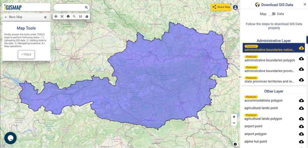
Austria GIS Data - National Boundary
Austria National Boundary

Download Austria National Outline Boundary Shapefile

If you are looking for any other GIS formats then use GIS File Converter.

Download Austria States Shapefile Data

Austria is a federal republic made up of nine states

Burgenland – Burgenland
Kärnten – Carinthia
Niederösterreich – Lower Austria
Oberösterreich – Upper Austria
Salzburg – Salzburg
Steiermark – Styria
Tirol – Tyrol
Vorarlberg – Vorarlberg
Wien – Vienna

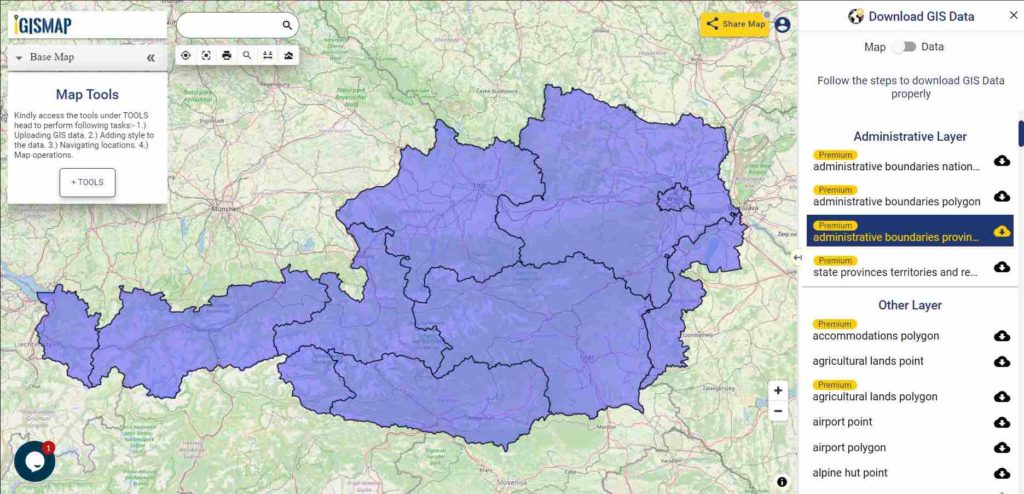
Austria GIS Data - State Boundaries
Austria State Boundaries

Download Austria State Boundaries Shapefile

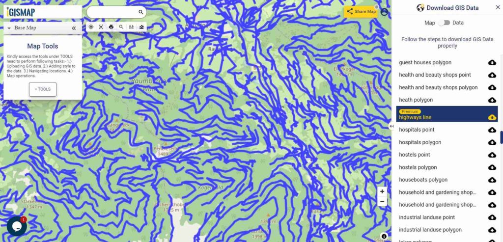
Highway Line GIS Data of Austria

Austria GIS Data - Highway Lines
Austria Highway Lines

Download Austria Highway Lines Shapefile

In the above map, zoom in view of highway line map is shown. Similarly, you can easily download point based GIS data of airport locations, ATM locations, parking locations, hospital location, etc.

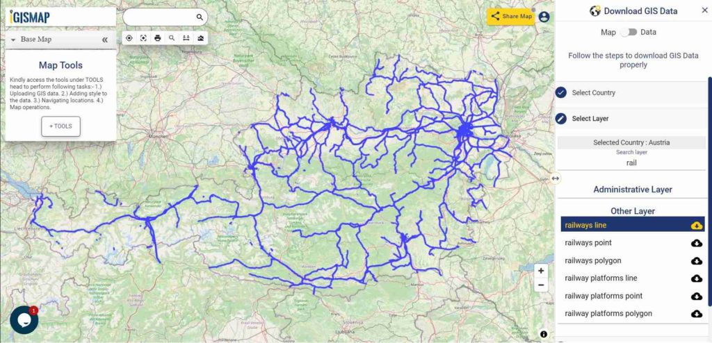
Railways Line GIS Data of Austria

Austria GIS Data - Railway Lines
Austria Railway Lines

Download Austria Railway Lines Shapefile

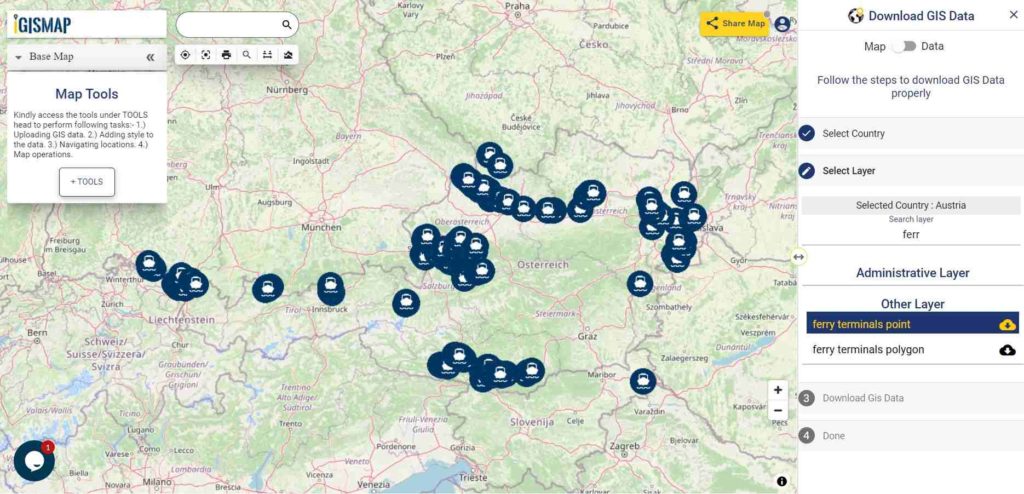
Download Ferry Point Shapefile of Austria

Austria GIS Data - Ferry Points
Austria Ferry Points

Download Austria Ferry Points Shapefile

You can view and download the ferry points of Austria from above link.

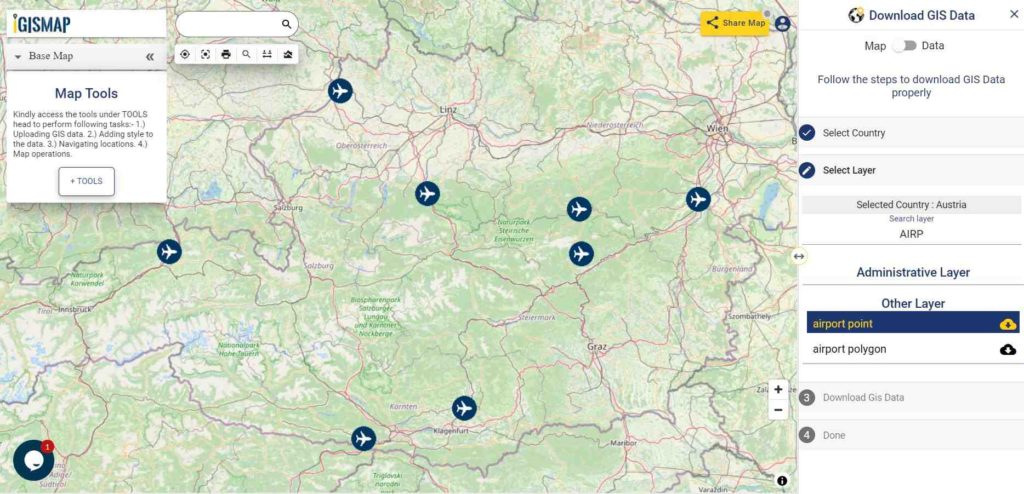
Download Austria Airport/Aerodrome Point Shapefile

Airport location points of the following airports are available:

  • Flugfeld Mariazell
  • Flugplatz Lanzen-Turnau
  • Zivilflugplatz Micheldorf
  • Flugplatz Schärding-Suben
  • Wiener Neustadt West Airport
  • Flugplatz Nötsch
  • Flugplatz Kufstein-Langkampfen
  • Flugplatz Sankt Donat Mairist
Austria GIS Data - Airport Points
Austria Airport Points

Download Austria Airport Points Shapefile

For more GIS data visit – MAPOG GIS Data

For more specific data contact us at support@igismap.com

Download Free Shapefile for the following:

  1. World Countries Shapefile
  2. Australia
  3. Argentina
  4. Austria
  5. Belgium
  6. Brazil
  7. Canada
  8. Denmark
  9. Fiji
  10. Finland
  11. Germany
  12. Greece
  13. India
  14. Indonesia
  15. Ireland
  16. Italy
  17. Japan
  18. Kenya
  19. Lebanon
  20. Madagascar
  21. Malaysia
  22. Mexico
  23. Mongolia
  24. Netherlands
  25. New Zealand
  26. Nigeria
  27. Papua New Guinea
  28. Philippines
  29. Poland
  30. Russia
  31. Singapore
  32. South Africa
  33. South Korea
  34. Spain
  35. Switzerland
  36. Tunisia
  37. United Kingdom Shapefile
  38. United States of America
  39. Vietnam
  40. Croatia
  41. Chile
  42. Norway

Disclaimer : If you find any shapefile data of country provided is in correct do contact us or comment below, so that we will correct the same in our system as well we will try to correct the same in OSM.

Download Russia Shapefiles – Administrative Boundaries, Highway and Railway lines, Ferry, Airport and Aerodrome Points

Hello GIS enthusiasts, IGISMAP has now published the latest GIS vector data of Russia administrative levels. Links for downloading the shapefiles of the important administrative divisions of Russia are provided in the following. You can also download these data in KML, GeoJSON or CSV formats.

Note:

  • All data available are in GCS datum EPSG:4326 WGS84 CRS (Coordinate Reference System).
  • You need to login for downloading the shapefile.

Download Free Shapefile Data of Russia

Russia or the Russian Federation (RF), is a transcontinental country spanning Eastern Europe and Northern Asia. It is the largest country in the world by area, covering over 17,125,191 square kilometers (6,612,073 sq mi), and encompassing one-eighth of Earth’s inhabitable landmass. Russia extends across eleven time zones and borders sixteen sovereign nations, the most of any country in the world.[d] It is the ninth-most populous country and the most populous country in Europe, with a population of 145.5 million. The country’s capital and largest city is Moscow, the largest city entirely within Europe. Saint Petersburg is Russia’s cultural center and second-largest city. Other major urban areas include Novosibirsk, Yekaterinburg, Nizhny Novgorod and Kazan.

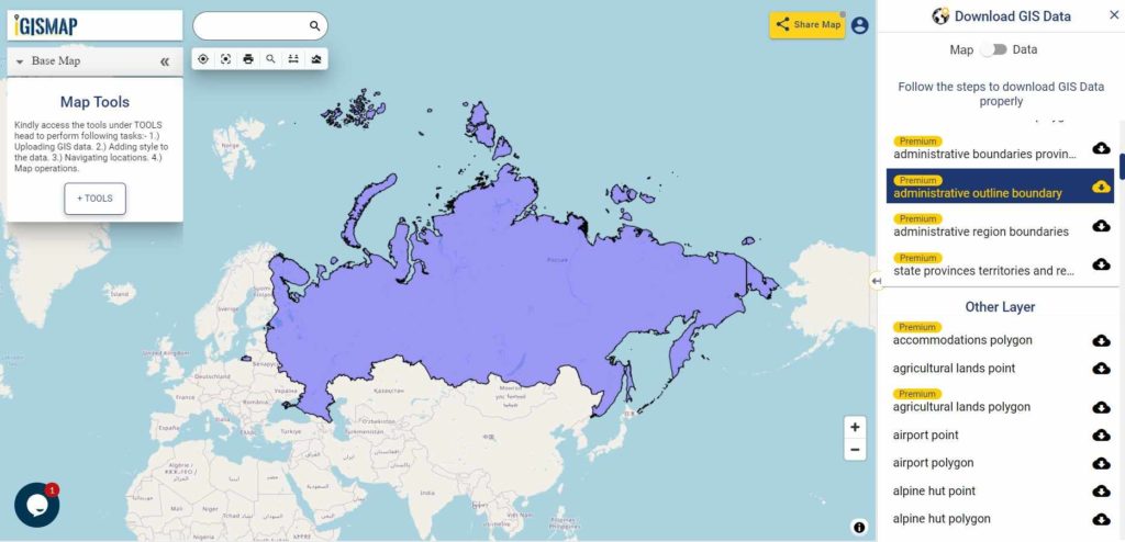
Russia GIS Data - National Boundary
Russia National Boundary

Download Russia National Outline Boundary Shapefile

If you are looking for any other GIS formats then use GIS File Converter.

Download Russia Regions Shapefile Data

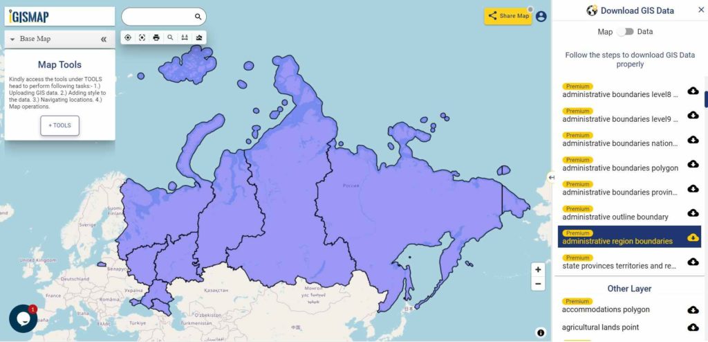
Russia is geographically divided into two parts: European Russia and Asian Russia. We will categorize Central, European North, North-West, European South (Northern Caucasus), the Volga region and the Ural region as part of European Russia. Asian Russia consists of Western Siberia, Eastern Siberia and the Far East.

Russia GIS Data - Region Boundaries
Russia National Boundary

Download Russia Regions Boundaries Shapefile

Highway Line GIS Data of Russia

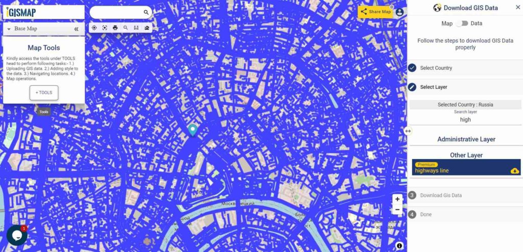
Russia GIS Data - Highway Lines
Russia Highway Lines

Download Russia Highway Lines Shapefile

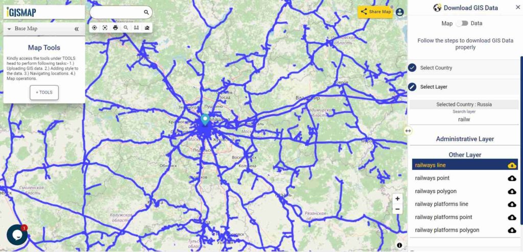
In the above map, zoom in view of highway lines of Moscow is shown. Similarly, you can easily download point based GIS data of airport locations, ATM locations, parking locations, hospital location, etc.

Railways Line GIS Data of Russia

Russia GIS Data - Railway Lines
Russia Railway Lines

Download Russia Railway Lines Shapefile

In the above map, zoom in view of railway lines in Moscow is shown.

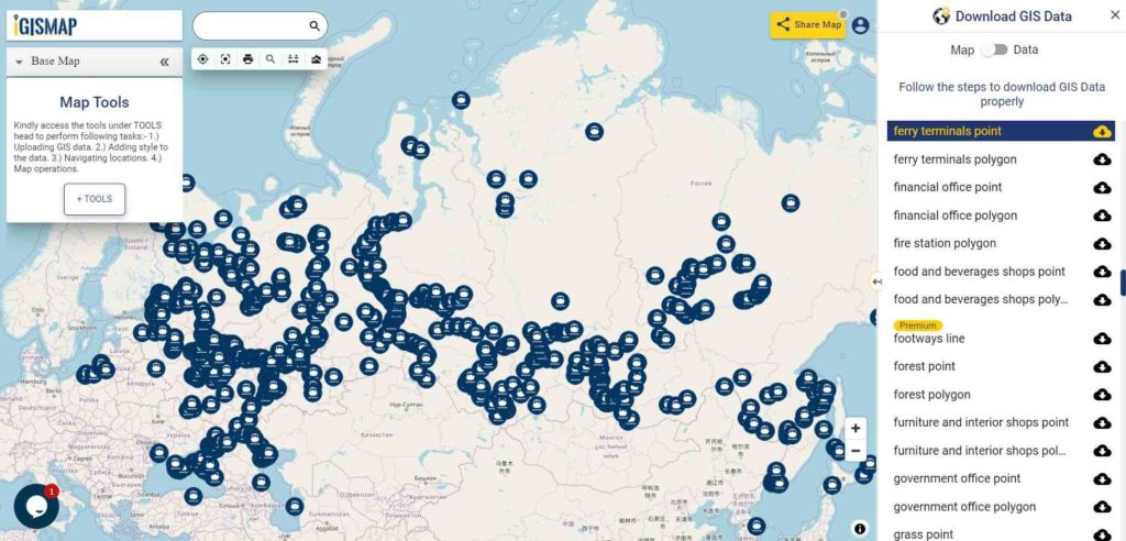
Download Ferry Point Shapefile of Russia

Russia GIS Data - Ferry Points
Austria Ferry Points

Download Russia Ferry Points Shapefile

You can view and download the ferry points of Austria from above link.

Other Data:

For more GIS data visit – MAPOG GIS Data

If you any problem in downloading shapefile please comment below or mail us at support@igismap.com

Download Free Shapefile for the following:

  1. World Countries Shapefile
  2. Australia
  3. Argentina
  4. Austria
  5. Belgium
  6. Brazil
  7. Canada
  8. Denmark
  9. Fiji
  10. Finland
  11. Germany
  12. Greece
  13. India
  14. Indonesia
  15. Ireland
  16. Italy
  17. Japan
  18. Kenya
  19. Lebanon
  20. Madagascar
  21. Malaysia
  22. Mexico
  23. Mongolia
  24. Netherlands
  25. New Zealand
  26. Nigeria
  27. Papua New Guinea
  28. Philippines
  29. Poland
  30. Russia
  31. Singapore
  32. South Africa
  33. South Korea
  34. Spain
  35. Switzerland
  36. Tunisia
  37. United Kingdom Shapefile
  38. United States of America
  39. Vietnam
  40. Croatia
  41. Chile
  42. Norway

Disclaimer : If you find any shapefile data of country provided is in correct do contact us or comment below, so that we will correct the same in our system as well we will try to correct the same in OSM.

Download Fiji Shapefile free – City, polygon, boundary

Hello GIS enthusiasts, IGISMAP has now published the latest GIS vector data of Austria administrative levels. Links for downloading the shapefiles of the important administrative divisions of Austria are provided in the following. You can also download these data in KML, GeoJSON or CSV formats.

Download Fiji Shapefile

Download link for both shapefile is provided. Before download fill your email id if you are not registered users. For registered user you can export Fiji datasets directly.

Boundary Shapefile of Fiji

All data available are in EPSG:4326 WGS84 CRS (Coordinate Reference System). Using following link you will be redirected to the boundary map of Fiji.

Download Boundary Fiji Map Shapefile

Polygon Shapefile of Fiji

Download Province State Polygon Shapefile of Fiji

Fiji polygon shapefile covers Central, Eastern, Northern, Rotuma and western.

Clarification – GIS datasets of Fiji provided here is license under Open Data Commons Open Database License (ODbL) .

Download shapefile of other countries –

In the following list if your requirement is not fulfilled then please comment below so that we can add it.

  1. World Countries Shapefile
  2. Australia
  3. Argentina
  4. Austria
  5. Belgium
  6. Brazil
  7. Canada
  8. Denmark
  9. Fiji
  10. Finland
  11. Germany
  12. Greece
  13. India
  14. Indonesia
  15. Ireland
  16. Italy
  17. Japan
  18. Kenya
  19. Lebanon
  20. Madagascar
  21. Malaysia
  22. Mexico
  23. Mongolia
  24. Netherlands
  25. New Zealand
  26. Nigeria
  27. Papua New Guinea
  28. Philippines
  29. Poland
  30. Russia
  31. Singapore
  32. South Africa
  33. South Korea
  34. Spain
  35. Switzerland
  36. Tunisia
  37. United Kingdom Shapefile
  38. United States of America
  39. Vietnam
  40. Croatia
  41. Chile
  42. Norway

Disclaimer : If you find any shapefile data of country provided is in correct do contact us or comment below, so that we will correct the same in our system as well we will try to correct the same in openstreetmap

Download Netherland Shapefiles – Administrative Boundaries, Highway and Railway lines, Ferry, Airport and Aerodrome Points

Hello GIS enthusiasts, IGISMAP has now published the latest GIS vector data of Netherland administrative levels. Links for downloading the shapefiles of the important administrative divisions of Netherland are provided in the following. You can also download these data in KML, GeoJSON or CSV formats.

Note:

  • All data available are in GCS datum EPSG:4326 WGS84 CRS (Coordinate Reference System).
  • You need to login for downloading the shapefile.

Download Free Shapefile Data of Netherland

Netherland, informally Holland, is a transcontinental country located in north-western Europe with overseas territories in the Caribbean. It is the largest of four constituent countries of the Kingdom of the Netherlands (the others being Aruba, Curaçao and Sint Maarten). In Europe, the Netherlands consists of twelve provinces, and borders Germany to the east, Belgium to the south, with a North Sea coast-line to the north and west. It also shares maritime borders with both countries and with the United Kingdom in the North Sea. The Caribbean overseas territories—Bonaire, Sint Eustatius and Saba—became special municipalities of the country of the Netherlands in 2010.

Netherland Country Boundary Shapefile

All data available are in EPSG:4326 WGS84 CRS (Coordinate Reference System) . Following link is for Netherland country boundary shapefile.

Download Link

Download Country boundary Outline of Netherland

Netherland province shapefile download

This polygon shapefile of Netherland covers Aruba, Curacao, Drenthe, Friesland, Gelderland, Linburg, North Brabant, North Holland, Overijssel, South Holland, Utrecht, Zeeland, Sint Maarten. Download link is provided below.

Download Link

Download Netherland Province Shapefile

Please note – Netherland data provided here is license under Open Data Commons Open Database License (ODbL). Please review the same before using it. If you want data under different license you can also look over to the post : Download Free Shapefile Maps – Country Boundary Polygon, Rail-Road, Water polyline etc

Download Shapefile for the following:

  1. World Countries Shapefile
  2. Australia
  3. Argentina
  4. Austria
  5. Belgium
  6. Brazil
  7. Canada
  8. Denmark
  9. Fiji
  10. Finland
  11. Germany
  12. Greece
  13. India
  14. Indonesia
  15. Ireland
  16. Italy
  17. Japan
  18. Kenya
  19. Lebanon
  20. Madagascar
  21. Malaysia
  22. Mexico
  23. Mongolia
  24. Netherlands
  25. New Zealand
  26. Nigeria
  27. Papua New Guinea
  28. Philippines
  29. Poland
  30. Russia
  31. Singapore
  32. South Africa
  33. South Korea
  34. Spain
  35. Switzerland
  36. Tunisia
  37. United Kingdom Shapefile
  38. United States of America
  39. Vietnam
  40. Croatia
  41. Chile
  42. Norway

Disclaimer : If you find any shapefile data of country provided is in correct do contact us or comment below, so that we will correct the same in our system as well we will try to correct the same in openstreetmap .

Embed map Store/Shop location on website – Google Map Alternative

Making your Store/Shop location available on map makes your visitors or customers easy to find your premises. And if your business have different branches at different location then Embed map Store/Shop location on website – Google Map Alternative is advantageous to your business. It suits best for local business like – barber shops, groceries stores, cafes or restaurants etc. IGIS MAP Tool is also good for those who are looking for  alternative of google map. Here we also provide customized solution as per your needs.  Create your own map and share with your client or customers with logo and navigation bar.
Embed map Store/Shop location on website – Google Map Alternative

Now Embed map on website showing your store location are no more tough. Even if you belong to non technical background still its be like a piece of cake. Just pin your store location and Generate iframe and embed on your website.

Create your map – Locate Store/Shop

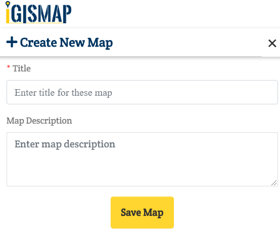
For creating map go to IGIS MAP Tool and login with email id and password. Click on Add Map Button located in the right side of screen. Fill the name and description of the map. In the end click on Save Map.
Embed map Store/Shop location on website - Google Map Alternative

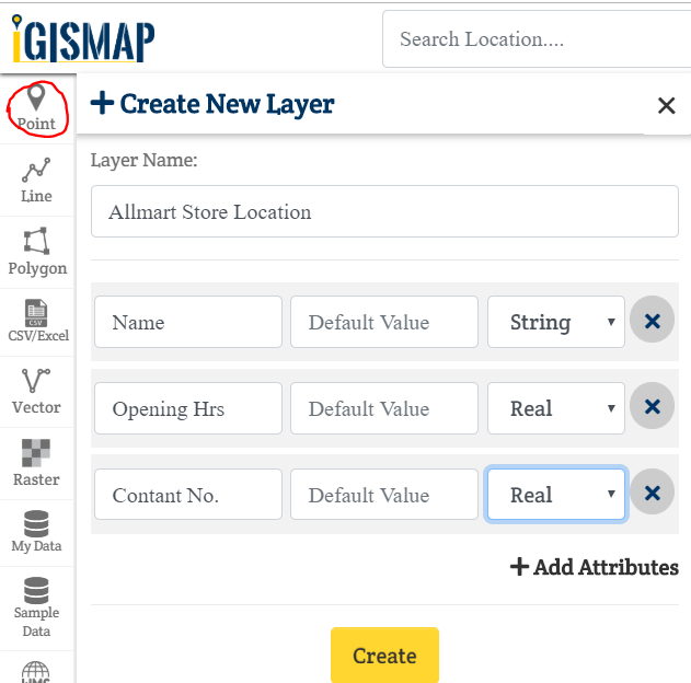
For location map you need to create point layer. So for this click on Point shown in below image. Fill the layer name and add the attributes as per your desired (this is the information shown when you click on the location point or pinned point).  We add three for name, opening hours and contact details. You can add multiple attributes.
Embed map Store/Shop location on website - Google Map Alternative

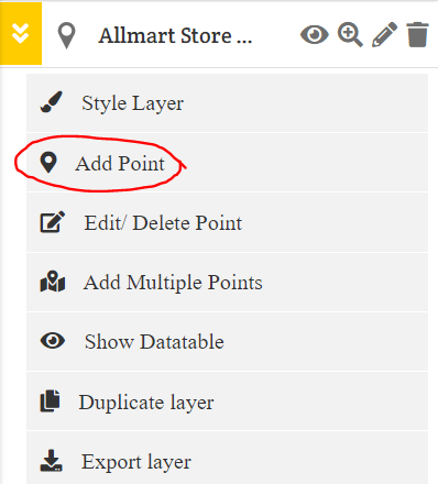
After creating layer let start adding point at your location of store branches. Place you point on the map as per location by dragging.

Embed map Store/Shop location on website - Google Map Alternative

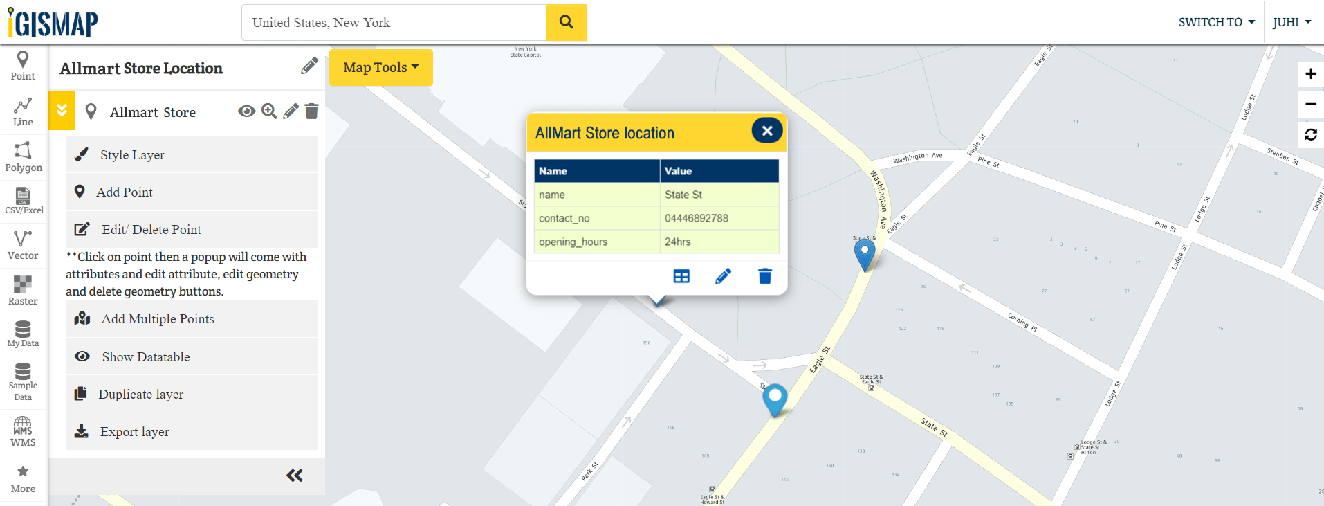
In the screen given below you can see the points with information (provided using attributes)

Embed map Store/Shop location on website - Google Map Alternative

I added multiple points by dragging and dropping on store location. You can add multiple points at a time if you have lat long of the store location.

Embed map Store/Shop location on website - Google Map Alternative

You can also can do styling of the layer.

Embed Map or Share Map

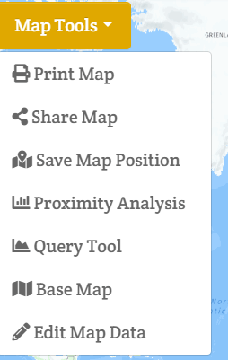
For Embed or Share map click in Map Tools and select share map in the dropdown list.

Embed map Store/Shop location on website - Google Map Alternative

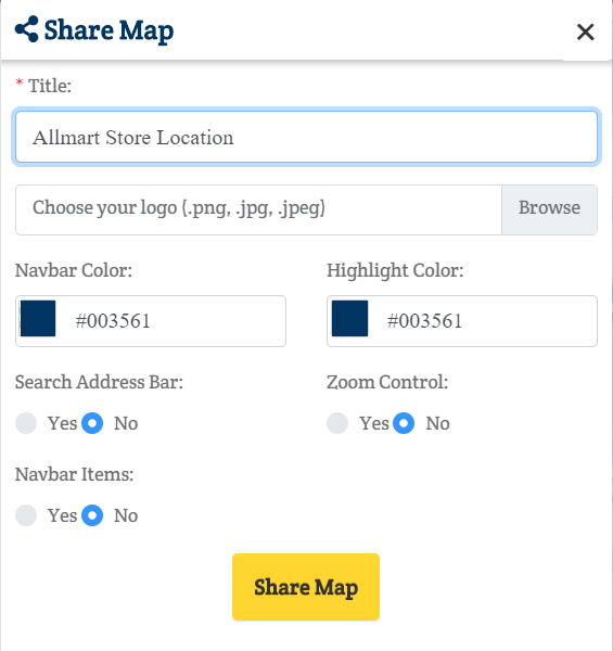
After clicking Share Map, below box will come. Write the Title, choose logo if desired for share map. Select navbar color and highlight color. Tick yes if want address bar for search and zoom control. Add Navbar items if required. And click on Share Map button.

Embed map Store/Shop location on website - Google Map Alternative

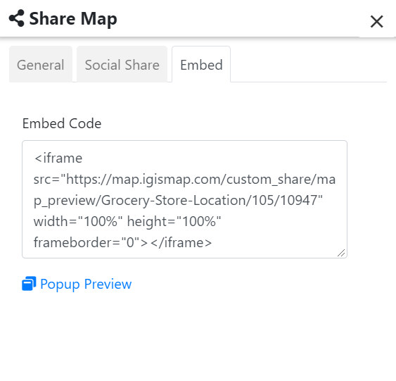
Now you can share map just by copy and paste link with clients or customer or social share directly. Embed on website with code generated shown inthe below image.

Embed map Store/Shop location on website - Google Map Alternative

So this is all about the share or embed your store location on website. If you face any issue in implementing then write us or comment below for further assistance.


Convert GML to KML

GML is used in a geographic information system(GIS) for expressing  geographic features as well as an open interchange format for geographic transactions on the Internet. KML is a file format used to display geographic data in an Earth browser such as Google Earth. KML is an international standard maintained by the Open Geospatial Consortium, Inc. (OGC).

You can convert GML to KML as well as other GIS Data Conversion using IGIS Map tool.

IGISMAP to Convert GML to KML

For GML to KML conversion go to IGIS Map Tool, after logging in with your registered email and password. If you are a new user, click the Sign Up button in the Login popup and register to IGISMAP by filling the details.

There are three main steps for using GIS Converter:

  • Upload the data
  • Choose the format to which it should be converted
  • Download the converted file.

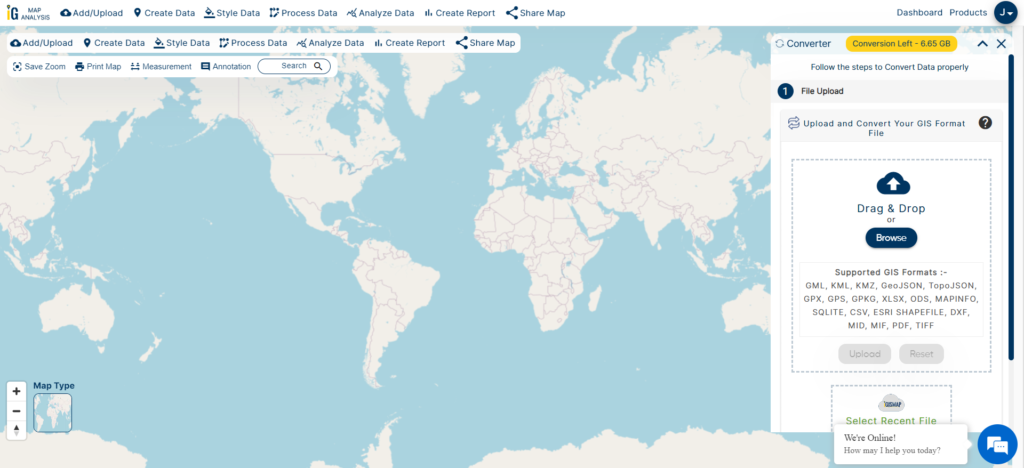
Step one is to upload your GML file which you want to convert. You can upload your file from system or select from the Recent Files.

Upload GML
Upload GML

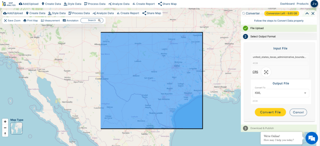
Step two is to select choose the output format of the converted file, in this case its KML. You can also set the Coordinate Reference System of your preference. As a default CRS will set to WGS 84 (World) [EPSG:4326]. Click on the Convert File.

Select KML as Output Format

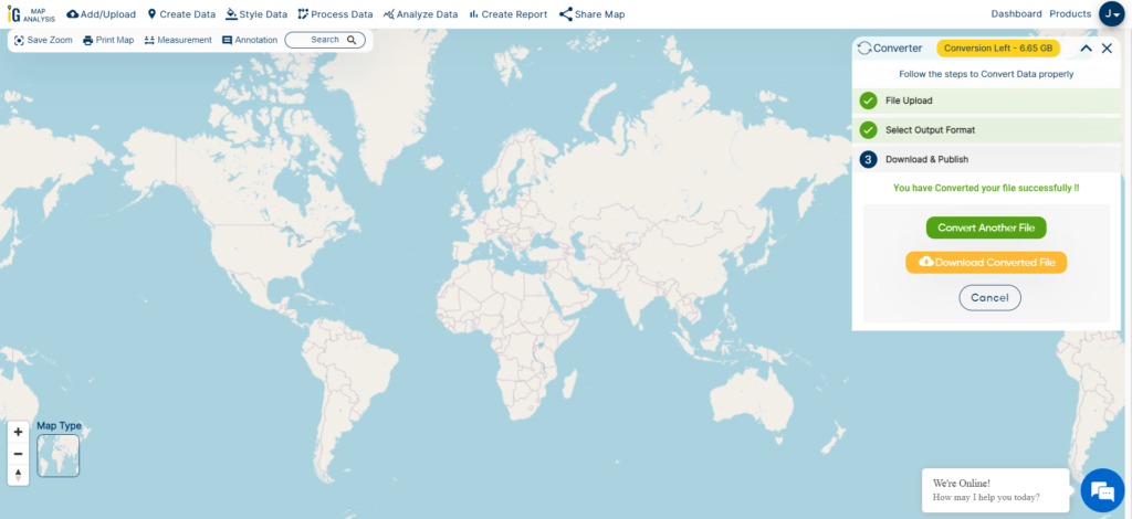
After uploading your GML file, it will undergo conversion to a KML file within a few seconds. Once the conversion is complete, you’ll be able to download the KML file.

Download and Publish KML File

You can also choose to style the layer or continue with further conversion process by clicking the Convert Another File button.

Converted Files section from the dashboard contains the list of the details of all the conversion done in your account, providing both input and output data available for download their corresponding formats.

Other GIS data Conversions

If you are facing any problem in conversion or login then please let us know by mailing at support@igismap.com or drop comment.

Convert GML to Shapefile

The Geography Markup Language (GML) is the XML grammar defined by the Open Geospatial Consortium (OGC) to express geographical features. Shapefile is a vector GIS format developed by ESRI. Using IGIS Map Tool you can easily convert – GML to Shapefile. You can also do other GIS Data Conversion using this tool.

IGISMAP to Convert GML to Shapefile

For GML to Shapefile conversion, go to IGIS Map Tool, after logging in with your registered email and password. If you are a new user, click the Sign Up button in the Login popup and register to IGISMAP by filling the details.

IGISMAP
IGISMAP

There are four main steps for using GIS Converter:

  • Click on Tool Converter
  • Upload the data
  • Choose the format to which it should be converted
  • Download the converted file

Step one is to upload your GML file which you want to convert. You can upload your file from system or select from the Recent Files.

Upload GML
Upload GML

Step two is to select the output format from the dropdown for the converted file, in this case its Shapefile. You can also set the Coordinate Reference System of your preference. As a default CRS will set to WGS 84 (World) [EPSG:4326]. Click on the Convert File.

Select Shapefile as Output Format

Your GML file will then gets converted to Shapefile file after a few seconds and will be available for downloading.

Download ESRI Shape File

You can also choose to style the layer or continue with further conversion process by clicking the Convert Another File button.

Converted Files section from the dashboard contains the list of the details of all the conversion done in your account, providing both input and output data available for download their corresponding formats.

Download free shapefile of various countries.

Create your own shapefile and share with your clients or embed on your website. 

Online Conversion of GeoJSON to Shapefile

You can convert Geojson to Shapefile offline using GDAL or QGIS. This would require you to download and install those software. One should have adequate knowledge in using these GIS applications to do simple processes. IGISMAP is an online platform to carry out geospatial operations by any non GIS expert. Converter tool of IGISMAP is also easy to perform applied file conversions between GIS formats.

GeoJSON is an open standard geospatial data interchange format that represents simple geographic features and their non spatial attributes. Based on JavaScript Object Notation (JSON), GeoJSON is a format for encoding a variety of geographic data structures. Shapefile is a vector GIS format developed by ESRI.

Using IGIS Map Tool you can easily convert – GML to Shapefile. You can also do other GIS Data Conversion using this tool.

IGISMAP to Convert GeoJSON to Shapefile

For GeoJSON to Shapefile conversion, go to IGIS Map Tool, after logging in with your registered email and password. If you are a new user, click the Sign Up button in the Login popup and register to IGISMAP by filling the details.

There are three main steps for using GIS Converter:

  • Upload the data
  • Choose the format to which it should be converted
  • Download the converted file

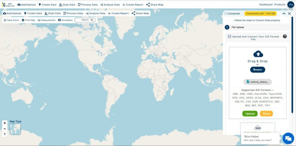
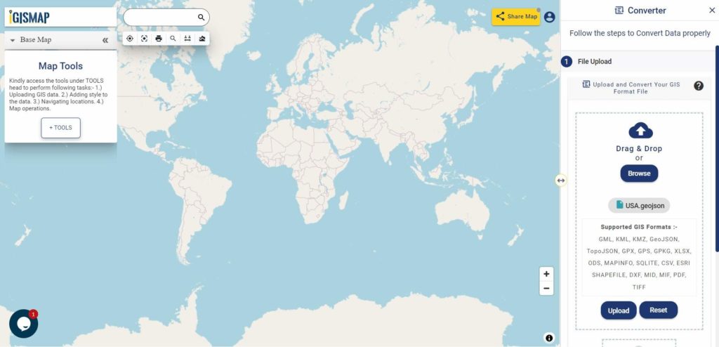
Step one is to upload your GeoJSON file which you want to convert. You can upload your file from system or select from the Recent Files.

Upload GeoJSON

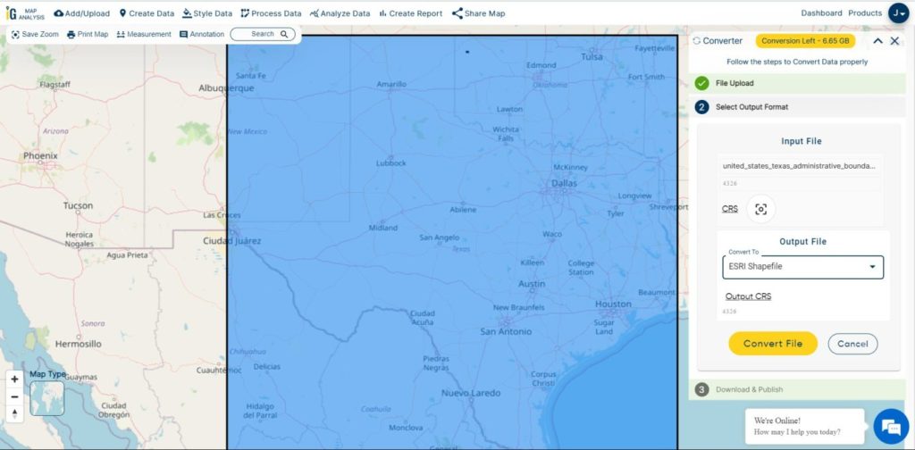
Here we have uploaded the GeoJSON file of USA.

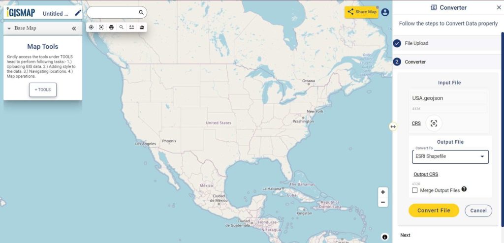
Step two is to select the output format from the dropdown for the converted file, in this case its Shapefile. You can also set the Coordinate Reference System of your preference. As a default CRS will set to WGS 84 (World) [EPSG:4326]. Click on the Convert File.

Select Output Format

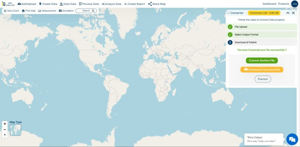
Your GeoJSON file will then gets converted to Shapefile after a few seconds and will be available for downloading..

Download and Publish Output File

You can also choose to style the layer or continue with further conversion process by clicking the Convert Another File button.

Converted Files section from the dashboard contains the list of the details of all the conversion done in your account, providing both input and output data available for download their corresponding formats.

Download free shapefile of various countries.

Create your own shapefile and share with your clients or embed on your website.