GIS Uses and Application – 16 Different Industries Covered

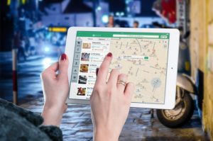
GIS (Geographic information system) is a tool to get Geo spatial information related to any sector. GIS is helping people out here every now and then. People are using GIS to get through the route problems, for finding the locations, and also for making important decision. Curious to know how GIS helps in making the Important decisions? Well!! You are looking for a new place to move in ? okay in that case GIS can help you out by showing the location nearby places and what not. GIS is being used in many Sectors and fields. 16 GIS Uses for different purpose is described below:

Areas of GIS uses :

Okay so you are from agriculture  or a government official or a business man ?? No matter who you are GIS will help you, be it –

  • Telecom sector
  • medical sector
  • Agriculture sector
  • Banking Sector
  • Insurance Sector
  • Logistics
  • Travels & tourism
  • Disaster Management
  • Traffic
  • BCP (Business continuation plan)
  • Crime Mapping
  • Education
  • Economic Development
  • Infrastructure Development
  • Advertisement.

GIS Uses and Application – 16 Different Industries Covered

Now that we have already sorted the sectors where we can use GIS ,lets check how GIS can be useful for these sectors.

1.Telecom Sector:  GIS uses

Telecom sector is one of the vast sector which requires to get the details of all the regions to provide services to the people in each corner of the country. Telecom sector faces many problems which can be easily solved with the help of GIS.

The problems which are faced by Telecom sectors are :

  • Capacity Planning:  The main problem for the telecom sector is the planning of capacity. Capacity here refers to the capacity of network providing , which are the areas where we need to establish more network services. So for establishing network services in those areas they need some resources

So all these things can be easily found out with the help of GIS maps.

  • Market Segmentation: Market segmentation states that its a concept to understand the customers and the use of the product by these customers, and specially to understand the market that needs to be target.
  • Real – time knowledge of Network Structure : Telecom service providers can easily access to the points from where they provide the network service and how strong or weak the signal is in which area. GIS helps  them to analyze the Network structure and status as well.
  • optimum Use of Resources:  GIS system helps the companies to utilize their resources efficiently and effectively, as GIS gives the information about where what is required ,which helps these companies to invest where it is required. This leads to the efficient use of resources.
  • Demand Forecasting : Once the company knows about the target market or target customers , it makes so easy for them to forecast the demand.
Telecom – GIS uses and application

2.Hospital Industry: GIS uses and application

Hospital industry is the need of today’s era, this is the only industry which is helping us to come out of any severe disease or it helps us whenever we need, they do not see time to serve us. We reach to them in midnight and they will be ready to serve you. So GIS is helping Hospital industry to serve us better in the following ways :

  • Identifying health Trends :  GIS helps this industry to identify and analyze the health trends , like which are the areas that can get affected with any particular disease,which are the areas where cancer patients are more and so on.
  • Tracking the disease spread: GIS helps this industry to look over the spread a disease can cause. How much harmful a disease spread would be.
Hospital – GIS uses and application
  • Improved Services : GIS helps this industry to grow by providing best services. The services of this industry can be improved on a regular basis with the help of GIS. As GIS would let them know about which are the disease prone area, where what kind of disease can occur.

3.Agriculture: GIS application

Agriculture is the main source of income in many families ,with Agriculture we get our two meals for a day, and it is very essential sector for any economy. We use agricultural products regularly,but have you ever seen a question crossing your mind that how does the agricultural products are produced ? So, there are few factors which can effect the Agriculture tremendously if not considered correct way . They are :

  • Know Land Type:  GIS helps you in looking for the type of land whether it is fertile or non fertile. Fertile land is used for agriculture purpose while non fertile is not usable or agriculture purpose.
  • Weather Prone Area:  GIS helps to locate the weather prone areas which can help the people to plan their agriculture process accordingly.
  • Drought :  GIS helps people to identify the area facing drought such that they can provide the crops to these areas.
  • Water supply:  water plays a major role in planning for agriculture as to we need water for irrigating the crops and that water should be poured to it in the right amount and it should be absorbed by the soil instead of leaking out of farms.

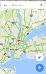
4.Traffic : GIS uses and application

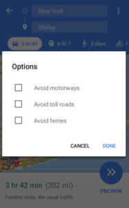
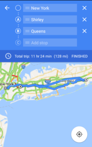
Traffic is such an irresistible thing which has power to irritate us ,to frustrate us and what not?? How great would that be to know the live traffic while leaving from home or office such that you can avoid that congestion?

Know live Congestion or future traffic on Google map

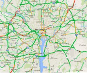
You may also check how Google Map can be used for knowing real time traffic and predicting in future.

GIS can help you out with this problem as it can provide you the traffic updates using Real – Time data . Moreover, you can also predict the future traffic situations with the help of GIS. What else do you want?. So avoid the traffic and reach anywhere on time.

5. Economic Development : GIS uses and application

Economic development can be done  using GIS. Basically, Economic development refers to the growth of economies of a country, which can be majorly effected by the business. So, Economic development is looking for the people to plan a business and invest money in it. But the question arises is how GIS can help in economic development?

The answer to this question is that GIS helps in identifying the locations and areas with all the attributes which can make a business grow with a fast or steady pace, GIS will find the best location for you, where you can plan a business and it will help you out with the business growth opportunities as well.

6.Insurance Sector: GIS uses

Insurance Sector is one of the prime sector which is indulged in the all sort of the sectors and individual as well. We all buy insurance policies for our own,for our vehicles,for our mobile phones or for any of our asset. We find insurance a very attractive thing which cover our losses. But have you ever thought that why the claim policies differs from one region to another.

Insurance – GIS uses and application

The reason for such differences occurs because of many factors out of which geographic conditions plays a major role. So, Insurance sector is highly driven by GIS .GIS helps this sector for following purpose :

  • Disaster Prone Regions: With the help of GIS ,Insurance providers assess the areas which are more disaster prone and what are the things which can be followed as to serve their clients.
  • Risk assessment: Risk assessment is a major part of the insurance policies. People who provides insurance firstly assess the risk.They assess how much risk is included in any region and they make policies according to their assessment of risk.
  • Claim management:  Claim management is followed by the  risk assessment and Risk management done with the help of GIS.
  • Decision making tool:  GIS works as a Decision making tool for the Insurance sector. They People use GIS for making decisions as to where to provide insurance and where to not. If providing it to any one then what should be the claim amount and so on.

7.Banking Sector: GIS application and Use

Banking sector helps in the proper flow of the money. Basically banking sector provides services for depositing money , providing loans, withdrawing money and what not. So  basically the thing is to maintain the cash outflow and inflow in  the bank and outer economy also.

Now days Banks are also into other activities and providing other services as well to generate the profits and making the customers look for more opportunities. So,all these activities becomes much easier with the help of the GIS.

GIS help Banks to maintain a good database of the customers. With the help of GIS,Banks can easily do the following process:

  • Customer Database : GIS helps banks  to maintain and visualize the  data of customers as they will know from where we have the more customer,how many customers are from which region and belongs to which age group
  • Market Analysis:  Banks do analysis of the market trends and allow the people from different area and regions to bank with them.
  • Focused Marketing: Focused marketing can be done very easily as banks can do the market analysis with the help of GIS. This Analysis can make Banks do marketing for the focused areas,regions,people.
  • Better Services: GIS make Banks to serve best to their customer as to they can know the area where customer needs to be focused.

8.Logistics: GIS uses

Logistics, in a layman language we can call it as transportation. We all use transportation for moving our luggage,our vehicles and for many things. So, lets check how GIS can be useful for the Logistic service providers:

Tracking – GIS uses and application
  • Navigation : GIS can help the Logistic service providers in navigating from one place to another,showing them routes and the shortest and the best route to reach their destination.
  • Cost Reduction: GIS helps in navigating and reducing cost also, GIS will make the route and will show the routes out of which you can choose any one whichever you find most suitable.
  • Tracking : Logistics service providers and the customers can also track their orders with the help of GIS.

9.Disaster Management: GIS application and Uses

In every country there is a separate department for Disaster Management. This department is specially organized for looking over the Disaster and how to manage those disaster if any occurs.

Disaster Management – GIS uses and application

This department take very good care of all the disaster related things with the help of GIS , in the following way:

  • Disaster Prone Area: The main and primary function of the Disaster management department is to identify the areas where disaster is more likely to occur. Disaster can be earthquake or flood or any miss happening .
  • Planning of Rescue and evacuation:  They identify the disaster prone areas with the help of GIS, that helps them to look for the rescue and evacuation. They plan how to rescue and evacuate the people from that disaster prone areas, what would be the procedure.
  • No construction Site :  This department makes sure that no construction site is established in these disaster prone areas.
  • Rehabiliation and post disaster Management:  Another main role performed by this department is the rehabiliation of the place and the people which has been effected because of the disaster. They make sure the situation comes back to normal as soon as possible.

10.Education Sector: GIS uses

Education is the basic necessity of the  people now days,Education allow us to grow,explore, and it helps us to make a difference in the society. GIS is also giving something to education sector also.

  • Degree : GIS  is now allowing students to earn a degree in GIS . We know the course as Geo Spatial. Many universities are providing Geo spatial courses to its students.
  • Difference in education system: Students are now looking for the different sectors to make their career in. Students are not looking for the same regular courses rather they are looking for something which would be different than the trending courses as well as should have good opportunities to grow and explore more. GIS is fulfilling this requirement with utmost efficiency which is definitely making a difference in our education system.

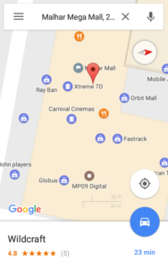
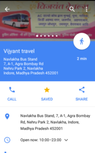
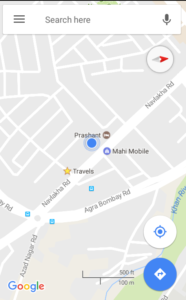
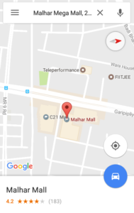
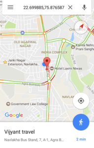
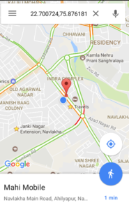
11.Travels and tourism : GIS uses and application

Travels and tourism is one of the growing business in today’s era. Travels and tourism sector is highly using GIS to show visualized places to their customers. We all approach to travels and tourism companies to provide us a package tour whenever we go to spend our vacations to a new place. Lets have a look on how Travels and Tourism business holders uses GIS :

Travel – GIS uses and application
  • Visualization of tourist spot:  GIS helps the customers and business as well to visualize all the tourist spot which helps business to attract customers by actually giving them visualized view of the spots, which they would be visiting.
  • Tourist location: GIS helps them to visualize location where they can visit.
  • Route planning : GIS helps in the route planning also.
  • Accommodation : GIS will help you to get the best accommodation facility.
  • Cultural Events and Special attraction :  For looking up to Cultural events and special attraction of any particular area GIS will be very Helpful.

12. BCP (Business continuation plan) : GIS application and uses

BCP or business continuation plan is one of the plan which businesses are implementing in their business. Business continuation plan is one of the way to keep our business working unaffected in adverse conditions. Adverse conditions could be any natural disaster or a human made like terrorist attack. This plan helps in continuation of business working . So to plan BCP business take help of GIS for :

  • Damage Assessment and Repair during Emergencies: GIS is helping to plan BCP by the assessment of the damage that can happen and how to cover up those damages in emergencies.
  • Evacuation:  Evacuation for any damage has to be a planned in prior . With the help of GIS we can make the route for evacuating people out of the affected area.
  • Office Relocation :  At the time of adversities , there might be chances that we need to relocate our office, until everything gets back to normal. With the help of GIS we can get the appropriate location for relocating the office.
  • SCM : SCM or supply chain management is one of the key factor for any business , specially for product providers. They need to supply their products further to its end users. GIS is required to Plan SCM in adversities.
  • Threat Assessment : GIS helps business to assess the threat level before establishing any business in any area, and also for the BCP they assess the level of threat.
  • Weather Mapping:  GIS helps in mapping the weather for any location. GIS  can help you the best to know weather conditions,for your office location.

13. Infrastructure Development : GIS application

GIS is continuously contributing in the development of the society. So now GIS is also contributing in the Development of Infrastructure. Lets see How GIS is helping in the development of the Infrastructure:

Real Estate – GIS uses and application
  • Transportation: GIS is helping in the development of transportation facilities as we all know that our success is highly depends on infrastructure development. So, in lieu to it every sector has to be developed.
  • Communication : Communication is the way of conveying our thoughts to other person. So GIS is providing ,the Communication service providers to visualize the network availability in the area.
  • Facilities and amenities : GIS helps to develop infrastructure of the country or society by providing the data of facilities and amenities available in which area , which are the areas lacking behind in terms of facilities and amenities, and also to get the data of the facilities and amenities which are provided.
  • Real Estate:

14. Crime Mapping : GIS uses and application

Today Crime is increasing day by day , people are being unsympathetic to others. Crime has taken a big toll irrespective of the place, be it a small village or a metro city . People are committing crime to satisfy their ego, to get their work done with  a fear and so on. It gets very much difficult to investigate about the crime, people involved , place where it has been done and what not. So we have a solution for all these problems as the Investigating team use GIS for solving any case. Lets see how this team can use GIS for their professional needs:

  • Helps in Law Enforcement : GIS can help in enforcing law to the regions according to the  crime committed in the area.
  • Display Spatial Patterns of events :  GIS helps in visualizing the type or pattern of crime committed in different areas.
  • Investigating Serial Offense :  GIS helps in investigating serial offense as we can reach to the culprit by tracking his location.

15. Advertising Industry : GIS application

In 21st century , marketing and advertising plays a major role in making a business famous and approachable to the people. But we need to understand the areas where we have to advertise or in other words we have to prioritize the users. We should know who are the people going to use your product. GIS can help in this task very easily. Advertising companies use GIS for following :

Advertising – GIS uses and application
  • Market Segmentation :  Market segmentation is  a process of identifying and dividing the market according to the usage of the product. We can divide the market by age,gender, regions as to identify the people for whom the product is useful and to know the usefulness of the product on map.
  • Target Market : Once the market segmentation is done, we need to target the market. GIS can help us to Visualize the customers from the segmented market.

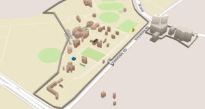
16. 3D Campus Mapping : GISUses and application

3D campus mapping is the another use of GIS. GIS helps in making the 3D map for campus. These maps are easier to use and way more convenient than other Maps. 3D maps are useful as they provide better understanding of the campus and the building. It makes so easy to find out the locations with the most efficiency. For all these we need GIS to make the 3D map for a campus.

3D campus Map- GIS uses and application

we have gone through all the sectors where GIS can be used or implemented.So use GIS to advertise your product , to attract customers for your tours and travel business and for what not. If any other sector is here , where we can use GIS, do let us know by commenting below in the comment box.

GIS – Best tool to search House Land

Today is the era where we want everything to be visualized. No matter what we are looking for , be it the route to our new office, nearby market places or maybe when you are looking to buy a home or want one on rent. These all are the problems usually faced by people. While these  problems are faced by many people but there is something which can solve all these problems. So the solution to all the problems is GIS- which helps you to search House Land

Best tool to search House Land – GIS

GIS is putting its foot in Housing solutions too!!! Isn’t it good that you can also get the Housing details with the help of GIS .  GIS stands for Geographic information system . GIS is one of the important tool for the people across the globe. GIS is highly used by the housing associations now days, as it helps them in the quick decision making for selecting any location for their house .

GIS – Best tool to search House Land

Have you ever thought of getting all the necessary details while sitting at home; regarding the location and nearby amenities,or to look over the shops to meet your daily need???

How great would that be to analyze and evaluate your considered choices while being at your comfort zone completely?? Yeah it would be so comforting to know about the place where you are planning to move.

So, Basically GIS is that main tool which helps you to take a tour to your future residence. GIS helps you in analyzing and evaluating your decisions in the following way:\

  • Know the Shops : You can now the what all shops are there , how far they are ?
  • Know the shops timings: you can also check the time at which these shops get opened.
  • Nearest Stations: Know the nearest stations and how to reach there,which trains to board.

Say for an instance ,Google Maps ; Google Maps is one of the most used GIS application. It shows us the Nearby place to our location. Google Maps is the best fit example to understand GIS concepts.

Now , that you are quite familiar with the GIS helps for housing solutions.

But the main thing is to know how can we find out the details . So, for knowing that we have to input the Spatial data, such as address,postcodes, locations and the people can produce the visual maps on the go.

Benefits of using GIS – Best tool to search House Land

This information helps us to make quick decision , getting all the money related information  for purchasing or renting, how likely your employment would be affected. If we do not use GIS for these Spatial things then we would not be able to fast and precisely see this pattern, as ultimately our main aim is to assess the monetary impact of using GIS on both the Business and customers.

Hence we can say that GIS is actually doing  good and offering service to its users in every best way possible. Plan your home with the GIS and share your experience with us by commenting below in the comment box.

35+ Google Maps Tricks – Explore New Google Map Cool features

Google Maps is widely used by the people around the world. People has a reason to use this widely as it provides the ample of features.

We are using these features efficiently because they are very easy to use. Moreover with the feature, Google maps is consists of  Tips and Tricks as well.

So, here  we have come up with the 35+ Google Maps Tips  and Tricks. 

Let us start with our Google Maps Tips and tricks.  We have divided them in few segments and categorized them.

List  – New Google Maps’ Tips And Tricks

A. Navigation – Different ways for Navigation

Navigation is the process of getting location to reach from one place to another, which can be used by anyone . so the first in the list is Master Navigation.

1.Master Navigation:  Master Navigation is the another  way of navigation. Master Navigation show the navigation according to your transit.

Moreover ,Master navigation also shows the distance and time taken by each transit.

So,whether you are travelling via  car or bike or any local transport or by walking it will show you the distance and time :

  •  it will take for car,
  • and for bike depending upon your transit.

2.Use Your Voice – Google Map feature: 

Have you ever thought of getting navigated by using your voice. Well, now you can think of it.

You can use your voice for navigation when your hands are busy in moving the steering wheel.

Now, whenever you want to use the voice  navigation just tap the microphone symbol located near the search bar. Then say your location .

Afterwards it will show you the navigation with audio, you can mute and unmute the audio .

you can ask the things like where do I turn next? How far is the destination.

3.Avoid Tolls – New Google Map feature: 

How great would that be if you can save few bucks because of Google Maps. Google Maps can help you save those bucks by giving you route options accordingly like avoid tolls ferries.

You can make your own route avoiding the tolls and ferries by selecting the route options.

You can select the route options once you set your destination by tapping direction icon.

Later on, once you are done with filling up the location and destination tap the three vertical dots. At the end you will find the route options.

Then Tap those three vertical dots and it will show you the route options to avoid tolls,highways,ferries.

4.Add Multiple Stop – Google Map: 

Just imagine you are travelling back to your home from your site and you have to go to your office. One of your friend’s home on your way, but they are poll apart .

Now,what will you do ??

Simply open your Google Maps and tap the directions icon,fill up your current and destination location.

Before starting your Navigation tap on the three vertical dots at top right of the screen and there you can see “add stop” option .

Add as much stop as you want and google maps will make a route for you.

5.Indoor Navigation :  Indoor navigation helps you in navigating inside the building or premises.

Google Maps will now give you the directions of the floor or to any shop or office to which you are looking for in the premises.

For using Indoor Maps all you  have to do is

  • open the Google maps in your phone.
  • Search for any location which you want to visit. For ex ; any mall
  • look up for the floor or the shop which you want to visit. For ex: Madame.
  • so just tap the location and zoom in at the Mall and it will show you the inside direction to the places.

B.Offline Area – Google Map New Feature:

 Suppose you are entering into roaming. If you use Google Maps there it will charge you extra for roaming.

Now you do not want to spend your extra data pack and money in roaming.  so you can also take the maps offline.

wondering how??

Lets check out below.

1. WIFI only : 

Wifi only is a feature that helps you limit your data usage , as it will work only if you are connected to wifi.

For using WIFI only feature of google Maps you need to enable it from settings.

Tap the top left Hamburger button. Scroll down to select settings, when you open the settings you will be able to  enable the  wifi only option by tapping on the switch beside it.

2.Plan Ahead : So, you are planning for some hill stations to visit in the upcoming vacations, and what if you do not find any networks at the heights ?

So, Simply plan your vacation and route without being panic and you can plan and save the locations and maps for future use.

3.Download the area: Well now you can download the area which you have saved offline. you can download the area only when you have enabled WIFI only feature of the Google Maps.

Once you download the area you can access to it anytime whenever you need it.

C. Convince – Google Map New features:  

New to a place and looking for routes and finding way to reach there, you can take the help of Google Maps.

1. Order a Cab : Google maps now let you order a cab through Google Maps application,You can book any cab whichever is available in your country.

Cabs options may vary from country to country.

To order a Cab from google maps ,Tap on the directions icon and fill up the current and destination locations ,and select the transit and it will show you the cab options available.

2.Search For Flight:  whenever you want to travel for a long route you can look up for the prices offered by the airlines companies .

You can plan your air trip with google maps very easily.

D.Types of Maps – Google Map tips and Tricks: 

we have so many things that are provided by Google Maps but there are various maps too which are provided by Google Maps which are as follows:

1. Terrain Maps : Terrain Maps are the maps which can be seen in a road view and satellite view.

Terrain Maps are the maps which shows the terrain or hilly area around you or the location for which you have  searched.

For Looking over the hilly areas in a map ,tap on the hamburger button and scroll it down and select the Terrain option there and it will show you the terrain area.

2.Road Map :  Road maps are the general maps which we visualize regularly.

Road maps are very easy to understand and mostly used for navigation, it is one of the reliable map of Google Maps.

3. Satellite Maps : Satellite maps are the maps which shows us the imagery of the area in the way that we can easily identify the  locations. It shows us the look of an area that how it looks from the sky or galaxy.

It provides us the satellite imagery of the area which can be easily identified.

Satellite Maps shows the upper view of the area with the real imagery.

E.Know Congestion – List of Google Map tips:

 Think that you are travelling back to home  from work which is very far from your work place and there are so many signals in between and you are in hurry,because you have to attend the birthday party of your family member and there is a lot of traffic.

You must have  thought if you were aware about the traffic in the route you would have opted for the  different route???

KNOW TRAFFIC: Now you can get the traffic updates near your area with the help of google maps ,to enjoy the traffic updates near your area just tap on the traffic options .

Tap on the Hamburger button and scroll it down and select the Traffic from there and now Google Maps will show you the traffic conditions Nearby you by Google maps Traffic updates.

F. Know Time machine – Google Map Cool features

Time Machine : Time machine is the tool of Google maps which helps you in looking over the past of any area,country location that how it used to be before few years it will show you the images of that area and how far it has been developed .

HISTORY LOCATION : Google maps not only shows the history of any area or country , it also shows the places you had been to in the past.

Find out your history location from Google Map

Yes Google maps will show you the locations you were at in your timeline, You can add a location with date for your past locations,you can edit the locations, and even you can delete the history location of yourself.

G. Route – Google Map feature:

 Routes are the ways which makes us reach our destination and Google Maps plays a very important role in it. There are few ways to make your routes. These ways are as follows:

1. Transit Information: You can make your route through Transit information, If you are travelling via car you can get the different routes for reaching your destination.

if you are travelling via local transport google maps will also give you the Local transit information.

Moreover it will tell you the route of local transport and  will help you to reach your destination without wasting your time.

2.Search Along the route: If you are travelling from one city to another and in between you feel hungry and you do not have any Idea of any restaurants in the route.

Then in that case do not get panic and simply open your Google maps and search for restaurants and it will show you the restaurant which will be nearby you and also in your route. Looking for gas station in between route, Google Map have this feature also.

So this way you can feed your tummy with something along with travelling.!!!!!!

H. Ways to Access  Google Maps – New Google Map features

Accessibility :  Its not that You can only use the map in its general form there are other accessibility of Google Maps as follows :

1.Switch to Compass Mode :  you can now access to the Google Maps not only with the Navigation key but also you can switch to compass mode.

Google Maps now show you the Navigation with compass as well .

While You switch to the Compass mode, It will show you the 2D and 3D view of the area.

Now switch to the Compass mode from the normal navigation and enjoy with Google Maps.

2.Lite Mode : 

You  can also use  lite mode  of google maps on the web platforms which will allow you to make the better use of Google Maps and later on you can also switch to the full Maps.

Switch to Google Map Lite Mode

3.Send Directions to phone :  If you are looking for some area in your office’s system and you are looking for the directions then obviously you can not take the system with you, so here you have an option to send the direction to your phone.

4.Google Now : Google Maps are accessible from Google Now also.

If you have Google now in your phone then you can directly search the location over there and google Now will directly direct you to Google Maps .

You can use all the functions of Google Maps with Google Now.

I.Your Location – Know Google Map cool tips: 

who would know about your location more than you , so Google maps is giving you an opportunity to be a local guide and explore the Favorite places of your location.

1.Local Guide: Now you can be a  Local Guide for Google maps and in return Google maps will appreciate your contribution by providing extra drive storage and many other stuffs in the form of rewards.

Being a Local Guide you can edit the places ,map and rate and review the places in the Google Maps.

2.Local Favorites : Google Maps will help you in looking out for the best favorites in the area nearby you , this will help you most when you are at a new place you can look for the restaurants , ATM nearby  you on the basis of rating and reviews given to them.

You can also give reviews to the places you had been to and also can rate them.

J.Customize – Google Map New features:  

Customization is the biggest factor for any business to grow, and so does apply to

Google Maps , Google maps  has set the standards high for customization. Let us look how Google Maps provide us the Customization.

1.My Maps:  With My Maps feature of Google Maps you can create your Customized map. Label and share them with people. moreover you can also see the  maps which you own and which you do not own.

You can also look over the maps which has been shared with you.

2.Explore :  Map explore is one of the feature of Google maps which we can use to explore the maps which has been created and shared by the people from different regions.

3.Upcoming Events : Google Maps will find you your upcoming events.

With the help of your Gmail Calendar and Google Calendar Google Maps will fetch the information and will let you know about the upcoming future events in the line.

4.Save : 

You can  save the Locations  which ever you like for further future reference. By searching for the locations and opening the card of that location,you will see the save option on that card. It will be saved when you tap on the save icon.

5.Label :

 Now search for the location,Afterwards open the card of that location. Tap on the three vertical dots in the top right. Select the Add Label button and you can Give it a name of your wish .

K.Find – Know Google Map tips and Tricks:

 Google maps also works as a google for its users as we can find the things which are Maps related. Such as

1.Postal Address: 

One can easily search the postal address of any location by searching for the postal codes . It will also show the area belonging to it,or you can search for postal code in search bar .

2.Distance:  One can easily find the Distance between the two points by simply stretching the two points. It will show you the distance between these two locations. Also the time it will take to travel to it via different transits.

You can easily measure Straight line distance between two points or location with Google Map.

3.Areas Google Maps Knows about:

Google maps also provides you with the areas about which google maps knows. It will also show you the ratings, reviews from the Local guides and from the people who have visited there.

4.Nation Specific Information: Google maps can help you find the nation specific information.

You can search for any country and then it will show you the nation specific information like the language. Also the domains would ends with the nation specific code.

L. More Tricks – New Google Map tips:

Few More For you : 

There are  more features of the Google Maps ,which are easy to use and are very useful for the users . These Features are :

1.Gestures :

Gestures are a very important thing in every aspect of life. While you are in an interview,the interviewer will look at your gestures that how you carry yourself, how presentable are you.

So does apply here and google Maps also has some gestures like :

  • Zoom In and Zoom Out by double tapping.
  • Map toolbar such as direction key,hamburger button.

  • Scrolling the Map
  • Compass icon for Navigation
  • My location button.

2.Keyboard’s Shortcuts :

 Google maps not only shows the shortcuts for the locations and routes. But it can also be controlled with Google Map key board shortcuts while you are using it in Web platforms.

You can use your Keyboard’s keys to navigate from one place to another. It can also scroll the map in all the directions and for performing the other functions of the Google maps.

So,you can use :

  • Page Up key or ‘W’ button – move camera upwards i.e towards sky.

  • Left arrow key or ‘A’ button –  Rotate left camera to 45 degrees
  • Page Down key or ‘S’  button – move camera downwards i.e towards ground.

  • Right arrow key or ‘D’ button – Rotate Right camera  to 45 degrees.
  • Double Left click : Zoom out the Google map.
  • (+) Plus and (-) key : Zoom in and out the map respectively.

  • Scroll wheel : Use mouse scroll to Zoom in and Zoom out in Google Map.
  • Double Right click : Moreover you can Zoom In the map.

3. Footnotes section of Google Map :

While there are few things for you in the footnote of Maps when you operate it in the web platforms. You can see the terms and conditions of Google Maps. Adding to it You can also send the feedback for the Maps.

You  can use these features in the Mobile application as well. For using these features in Mobile application , tap the hamburger and scroll it down. Right there you will find these options.

So, these all are the Google Maps’ Tips  and Tricks. If You know any other which I missed here then do let us know by commenting below.

Google Indoor Maps – Navigate Inside the building

We all are using the Google maps on a very high frequency that we find it very easy to reach any new place without a fear of getting distract route , we are all so comfortable using the Google Maps because of the way they offers the dynamic features. Google maps has ample of features that allows  its users to enjoy their travel without any fear. So,now that we have already been using this location search tool -Google maps, but now you can use it for Indoor  navigation as well. Yes, the Google Indoor Maps are introduced by Google Maps.

Google Indoor maps  is the tool to navigate inside the building or any mall or airport or any big infrastructure. Indoor maps helps you to find the location of your favorite Brand in the mall, or may be you are looking for some office in a building then also you can use Indoor maps feature of the  Google maps.

Well, the question arises now is how can we use the Google Indoor Maps Feature of  Google Maps , so let me show you the way to use it:

Google Indoor Maps

  • open the google maps in your phone or Web platforms.

  • Search for any location .for example : a Mall

  • Tap on the location searched and zoom in the location.

  • Once you zoom in the searched location it will show you the inside area  of the mall and the  shops which are there.
  • They also provide a static map, which can be created by Owner or Manager of Organization.

So, this is how Google Maps’ Indoor maps are helping Google Maps’ users finding any shop in the mall, or an office in a building or anything which is present in the building. Use Indoor Maps which helps you in exploring the new building ,new things in the mall and what not. Do let us know how much useful Indoor Maps are for you.

Road Map, Satellite Map, Terrain Map- Types Of Google Maps Layer

Google Maps is reaching the heights of  the Perfection in providing services to its users, Google Maps is one of the largest location service provider. They have again putted some features to make its use easy and flexible which will obviously make its users happy. We can use the Google maps in three different ways too. Types of Google Maps – Road Map, Satellite Map, Terrain Map. 

So, there are enormous use of all the three. Road Map has its own important features, Satellite View can also be very fruitful for Google Maps users, and the Terrain, it is also the greatly used  Map of Google Maps.

You may check all features covered under one article for Google Map.

Types of Google Maps – Road Map, Satellite Map, Terrain Map:

Basically, we have three types of Maps which are as follows :

  • Road Map

  • Satellite Map

  • Terrain Map.

Let us discuss all the features, good, bad and everything about these Google Maps Layers.

Road Map – Types of Google Maps

Road map Basically is the Map which we see which we visualize when we open the  Google Maps. It is the Normal and general Map which helps us to Navigate,to find location through roads, it is the basic version of the maps.

We can also use the Road maps to mark the places,for voice  navigations and all the other features can be used through it. It is one of the simplest way to find out the routes,locations, making our own route and what not.

Satellite Map – Types of Google Maps:

Satellite Maps gives the imagery view of any location or area . It shows  how a place would look like from satellite. These kind of maps are more certain and reliable ,they shows us the best possible ways to any location.

As it shows how the earth or part of earth will look like it makes easy for us to find out the area or location which we wish to know or which we want to visit, it gives the real image of the area , such that we can easily use this.
We can easily use all the features of google Maps in satellite view as well, like WIFI use only, add stop  in between the route and everything else can be done with the satellite map.

Terrain Map – Types of Google Maps:

Terrain Maps are useful for every Individual. Terrain Maps are the ones which makes us identify the terrain area or mountain area easily, they are shaded with the stone color or brown color to make them identify easily.

This useful terrain Map can be used by any individual user of Google Maps, and it also supports all the features of Google Maps like Label the locations.

45 degree imagery – Types of Google Map:

The  Google Maps provide 45 degree image resolution. This high resolution maps provide perspective view for each direction ,these images are available at higher Zoom level for the maps type supported.

So,these are the three Types of Maps which can be used by any individual for their convenience they allow you to access all the features of google maps . Now that you know about the type of maps , use them and do let us know your experience by commenting in the comment box.

Get County, postal address, administrative area On Google Maps

From adding stop in the route to limiting data usage by downloading offline area while connected to WIFI  , Google Maps has ample number of features for its users .Google Maps is widely introducing new Features for its users. Google Maps is providing these feature without restricting their use to Google maps application, rather you can also go for web platforms to use these Features. Add to it , Google Maps have now introduced one more feature to add to the list :  Get an area covered of County, postal address, administrative area On Google Maps.

Postal address of a Location can be found very easily through Google Maps’ My Maps or vice versa. With this feature of google Maps you can search postal address of any location or you can search any location when you know the postal address.

You may be interested in looking over 35+ Google Map cool tips and tricks.

Get County, postal address, administrative area On Google Maps

This feature is really very helpful for the people across the globe. Moreover this feature is accessible on web and application both.

Lets see how this feature of Google Maps works:

  • Open the Google maps on your phone application or on web platforms.

  • If you wish to know the postal address of your current location than tap on the  pin.

  • Once you tap on the pin you will see the card appearing for your location and it will provide you with the full postal address of the location.

  • If you wish to know the Location for any postal address you can search for location with the postal address.

  • Now,it will show you the location for which you were looking.

If you type the pincode or zipcode then their might be chances that Google Map would provide you whole administrative area of the respective pincode or zipcode as can be shown in figure below. The area indicated or covered by red border. While I didn’t find Google Map api to provide this feature to extract the area. Neither any notice is given, if this feature could be added to Google Map API in future.

Get County, postal address, administrative area On Google Maps

Disclaimer and note: That we are not sure whether Google Map shows the administrative area collected from Crowd sourced or if they are showing the area given by third party or Governments. So I am not sure to claim for the correctness of Google map in showing those Administrative Area.

Google Maps is the most used map tool by individuals as well as the organisations, governments also uses it for many purpose.

By Getting this Administrative area, we can take a snapshot and georeference the image and finally get a shapefile or KML file out of this image with the help of digitization.

Now that  you know about getting postal address, how this would help you to get administrative area and how to get a shapefile or KML file. So, make optimum use of this article and do let us know how useful this article is for you by commenting below in the comment box.

Add or Load GeoJSON file – Point, Polyline or Polygon map – Leaflet js

Are you looking to create a map interactive application to locate markers with points, or to highlight an area by polygon or to draw or show a river or roads line with polyline? With Leafletjs library and GeoJSON as GIS data, we can easily create a map which we are looking for and render the output in browser. Leaflet js is an opensource small library to create interactive map. GeoJSON is one of the GIS data structure which stores geographic data in JSON format. GeoJSON supports point, line, polygon, multipolyline, multipolygon and Geometry collection which can represent a geometry, feature or a collection of features. A detailed structure of GeoJSON would be written in separate article.

Add or Load GeoJSON file

This Article would let you know how to render and load geoJSON file with the help of leaflet js library. Also you would also get an idea by this article to implement a click event over a GeoJSON file and fetch information associated with the feature of GeoJOSN data loaded as map.

If you are not familiar with Leaflet, I would recommend you to read first the Getting Started tutorial with Leaflet js Library to create map application.

Lets setup a Base Map First i.e loading openstreetmap or osm in leaflet, in a html file:


<!DOCTYPE html>
<html>
<head>
<title>Getting Started - Leaflet js Map interactive library</title>
<meta charset="utf-8" />
<meta name="viewport" content="width=device-width, initial-scale=1.0">
<link rel="stylesheet" href="https://unpkg.com/leaflet@1.0.3/dist/leaflet.css" />
<script src="https://unpkg.com/leaflet@1.0.3/dist/leaflet.js"></script>
</head>
<body>
<div id="map" style="width: 1000px; height: 600px;"></div>
<script>
var newMap = L.map('map').setView([38.9188702,-77.0708398], 13);
L.tileLayer('http://{s}.tile.osm.org/{z}/{x}/{y}.png', {
attribution: '&copy; <a href=”http://osm.org/copyright”>OpenStreetMap</a> contributors'
}).addTo(newMap);
</script>
</body>
</html>

Above script would output and render an osm base map. Now lets start adding different features on map one by one with GeoJSON file.

Add or Load GeoJSON file – Load Polygon with leaflet on Map:

Add following script, and replace the ‘usa_adm.geojson’ to the file you are want to render.


// loading GeoJSON file - Here my html and usa_adm.geojson file resides in same folder
$.getJSON("usa_adm.geojson",function(data){
// L.geoJson function is used to parse geojson file and load on to map
L.geoJson(data).addTo(newMap);
});

After adding the polygon layer you may want to view or load the map area covered or extended by the polygon GeoJSON file. i.e On Map load you want to zoom and pan according to the extent or to fit layer bounds. For this, Leafletjs provided a function to calculate the bounding box of the geojson file or layer i.e layer.getBounds(). And also with leaflet map fitBounds function i.e map.fitBounds(“bounding coordinates”). Here is the line which you needs to add to script:


newMap.fitBounds(datalayer.getBounds());

Finally, we are left only adding a click event to get the features data. With the help of Leaflet L.geoJson optional object parameter with key “onEachFeature“, we can add and define click event on every feature of the layer.

Here we would be fetching the attribute data of the feature clicked on Polygon GeoJOSN file. So before writing any script, we need to list out the feature properties list. You can get those properties key name easily if you are familiar with JSON files and structure.

So lets define a function named as onEachFeature and replace the ‘key’ keyword with your actual feature properties key of GeoJSON file:


onEachFeature: function(feature, featureLayer) {
featureLayer.bindPopup(feature.properties.key);
}

So your final leaflet geojson code combines as i.e For adding polygon GeoJSON file on map, with click event and fit to extent functionality.


$.getJSON("usa_adm.geojson",function(data){
// add GeoJSON layer to the map once the file is loaded
var datalayer = L.geoJson(data ,{
onEachFeature: function(feature, featureLayer) {
featureLayer.bindPopup(feature.properties.NAME_1);
}
}).addTo(newMap);
newMap.fitBounds(datalayer.getBounds());
});

As I have loaded a US administrative polygon GeoJSON here, we can see following output as :

Add or Load GeoJSON file – polygon

Add or Load GeoJSON file – polyline on Leaflet Map:

Adding polyline Geojson with leaflet library is same as adding polygon file. So the above code would work for loading polyline GeoJSON file. Just you need to replace the file name with your polyline GeoJSON file and features properties key have to replaced by the actual key name, of which you want to retrive information.

Add or Load GeoJSON file – polyline

Add or Load GeoJSON file – point with Leaflet js on Map:

Adding Point GeoJSON file is same as loading Polygon GeoJSON file. Here is the output you can see for the famous world Cities.

Add or Load GeoJSON file – point

If you find any difficulty in adding or loading GeoJSON file on map with leaflet library, do comment below with your queries.

Google Maps Review Ratings of local Favorites – Know users view

Google maps, One can access map on desktop and on phone as well we have an application for Google maps that we can download from play store. Google map provides us with so many functions like navigation, locations, our history location is also been showed by  Google maps. So adding to the list we have one more new option updated by Google maps that  Google Maps Review Ratings and  “find your favorites” nearby.

So, if you are new to place you will definitely be obliged to thank Google maps for this option. Google is trying to render its services to people in the best way possible no matter if that means being a city guide.

Google Maps Review Ratings – Search Nearby Brief

Now Google maps suggest you the places you can visit, restaurants you can fill your hunger at , or maybe a good pub to enjoy the Saturday night at.

To use this option all you need is a Google map application in your android phone.

Check the following steps to find out your local favorites in the Google map application:-

  • Open your mobile app.
  • Tap on the search bar.

  • Once you tap on the search bar you will find some option

  • Tap on ‘MORE’ icon.
  • Now you will be able to get all the options.

  • Select any option whichever you want. For example:-restaurants.
  • Once you tap on restaurants icon it will give you a list of restaurants nearby you.
  • Tap on the individual restaurant card, doing so lets you check everything about that particular restraunt.

So, it is not only about filling your hunger up but it can be anything else which you need around your location.

Google Maps Review Ratings of LOCAL FAVORITES

while finding your nearby places you can select the places  on the basis of ratings and reviews as google maps will show you the ratings and reviews for every place it shows. Moreover  you can also add the places you had been to and you can review and rate any place you had been to.

Now you know that you can also update the places you had been to ,and also you can rate and review them, but how???

we will show you how to do that, check the steps below :-

Write Reviews and rate the places – LOCAL FAVORITES

suppose you want to rate and review the restaurant you recently been to,  so for that all you need to do is ;

  • Open your Google maps application in your phone.

  • Tap on the search bar.

  • write the name of the place you had been to.
  • click on it .
  • open the card that shows your search

  •  scroll down it to the end .
  • There you will see the option of rate and review.

  • Tap on these stars and it will ask you your review  and you are done with rate and review part.

Sometimes it happens that we do not remember the name of the place but damm you really liked that place and want other too to visit there at least for once. So it is also a very easy task to rate and review that place as Google saves your history locations . so rating and reviewing that way you can take the following steps:-

  • Open the Google maps app in your phone or desktop.

  • On the top left corner of your screen you will see the hamburger  button.
  • Tap that button and you will see the “your contribution” option.

  • Tap on “your contribution” option.
  • once you tap that option scroll it down and you will see “place you’ve visited” in the bold letters .

  • That is the place from where you can do the review  and rate thing for the place you had been to.

Look over Google Maps Tips and Tricks list and also Google Map Gas Station.

Check Ratings and reviews – Local Favorites

Have you ever thought of being to a new place and looking for a good restaurant, but nobody can decide  it without having been to it or maybe having someone who had been to it can help,also this will help to an extent. To check ratings and reviews of local favorites nearby your locations ; following are the steps for it :

  • open the Google Maps application in your phone.

  • Tap on the search options.

  • Choose your option out of all the choices given. for ex :restaurant.
  • Tap on the Restaurant

  • Open the card of any restaurant  out of all the options.

  • once  you open the card scroll it down
  • There you can see the ratings and reviews given  to that restaurant by the people who had been there.

On the basis of these ratings and reviews you can select the best option available. This way it makes so convenient to choose  a good place without wasting your resources. Use Google Maps Review Ratings feature offered by Google maps and I would love to hear how this article helped you!

Create Customized Maps with Google Maps – My Map Feature

My Map is one of the new feature offered by the Google Maps, Google maps are trying to satisfy their users by providing the best ease of using the Google Maps. Customization has reached to a level that now it is available in the google maps too. My maps is the tool which helps in making your own customized and personal maps.

Customization of the Maps has never been so easy than this. customization itself is a very much good attribute to hike upon on business and as we all know that we like the things which we can mould according to us, according to our comfort, according to our ease of use ,according to our benefit.

My Maps feature on web Platform – Google Map

Primary Features of My Maps

Let us check the way to use My Maps Feature on web, so as to create your own customized map:

  • To use my maps features of Google Maps open Google Maps in the Web platform google map  my map editor. Or you can do it by navigating to google map and follow this steps:

  • Tap on the hamburger button located left to the search bar.
  • when you tap on the hamburger button you will see ‘your places’ options.

  • Tap on ‘your places’ option.

  • once you tap on the ‘your places’ options you will see the card getting opened for your your places.
  • Tap on the ‘Maps’ option of the ‘your places’ card.
  • once you tap that card you will see the maps you have already created and in the bottom you will see the option to ‘create maps’ and ‘see all your maps’.
  • Tap on either of the option to create your customized map.

  • You will see this ‘create a new Map’ option, tap on it and now you can create your own map.

So, this is how you can make your customized map. Still not satisfied with the level of customization? okay not a big deal for google Maps, adding more features to Customization now you can also add image to your markers. As shown in the above image you can see at the right bottom of the card a camera sign, that means you can also add the image of your choice to that mark.

There are so many things which you can do with your customized Maps , such as :

  • Making Polygons: You can make polygons with the help of ‘draw line’ options by joining them. You can also change the color of the polygon once you save the polygon you can add color to it by tapping on the style icon. We use colors to give every polygon an Identity, You can give blue color to the polygon for water surfaces, green indicates park or garden.
  • Draw lines :  While with the plain lining you can also add the route for four wheeler, two wheeler and for the pedalist as well. You can use styling to color the poly lines also.
  • Label the spots :  you can also add the spots and label them.

  • Add the Marker : as shown in the above image I have marked a location by tapping on the pin.
  • You can also add directions to it:  you can add directions too while creating your customized map.
  • measure the distances: Google Maps customized map also help you in measuring the distances.

Share your Maps:  

You can also share your Maps by tapping on the ‘your Places’ and then tapping on the Maps to see all your Maps when you can see all  your Maps tap on any map and then it will be opened up as shown in the above picture.tap on the share button and then give a name to your Map and fill its description, and then add the name of the people you want to share it with and change the access according to you.

Secondary Features Of My Maps – Create Customized Map

Google Maps’ My Maps features also facilitates you to check map explorer option of Google map:

  • All Maps that you have created, own and the ones which you do not own.

  • Maps you own

  • Maps shared with You

  • Maps not owned by you

  • Maps you have been recently to.

Maps View :

You can also view the maps according to your preferences, you can arrange them in the list or grid order, you can also sort them according to you.

  • List View

  • Sorting

Moreover, you can also ‘Share customized maps’ on Google maps ,for other users to use and explore them and get to know about the various locations. Google Maps are very much known and reachable to anyone across the globe.

Look more Google Map tips and Tricks, So,now make your own map ,showcase your location, let people know more about the places , and enjoy the customization at Google Maps too.

Explore Maps Story – Google Maps My Map Explorer feature

Google Maps has been proving itself since very long, Google Map is one of a kind, location search engine.  Google Maps is the location search engine which is laced with the long list of the features . Google maps offers the best ever features to its users. Starting from the navigation they have now reached up to a very big level and advanced features. Now in addition they have allowed their users to make their maps and share them with the other users. My Maps – Maps Explorer are the very useful features offered by  Google Maps to its users.

This Feature can be used on the web platforms . Google Maps My Maps – Maps explorer features are very useful for the people who are travel freak or may be for the people who loves to know about the different locations of the different countries.

Explore Maps Story – Google Map Explorer

The Maps in the explore section of the My Maps features are the ones which are made by the people across the globe and  have shared it.

To explore the Maps across the world all you need to do is to follow the below steps:

  • Open the Google Maps on web  platform and login to it.

  • Tap on the Hamburger button located at the left of search tab.
  • After tapping on the Hamburger button scroll it down and you will see ‘your Places‘ option.

  • Tap on ‘your Places’ option .
  • once you open your places you will find four option ,tap on the last one that is ‘Maps’.

  • Tap on the Maps and you will get ‘see your Maps’ option, tap on it.

  • Once you open the explore option you can see the maps created and shared  over there. Or you can directly open following link if you are already login, you can check the map explorer.

https://www.google.com/maps/d/

Explore Google Map more features. This is just one feature of My Maps from Google Maps. Google Maps allows you to create your customized apps. So,there are more features to your ease offered by Google Maps.

Exit mobile version
%%footer%%