Hello GIS enthusiasts, IGISMAP has now published the latest GIS vector data of Australia administrative levels. Links for downloading the shapefiles of the important administrative divisions of Australia are provided in the following. You can also download these data in KML, GeoJSON or CSV formats.
Note:
- All data available are in GCS datum EPSG:4326 WGS84 CRS (Coordinate Reference System).
- You need to login for downloading the shapefile.
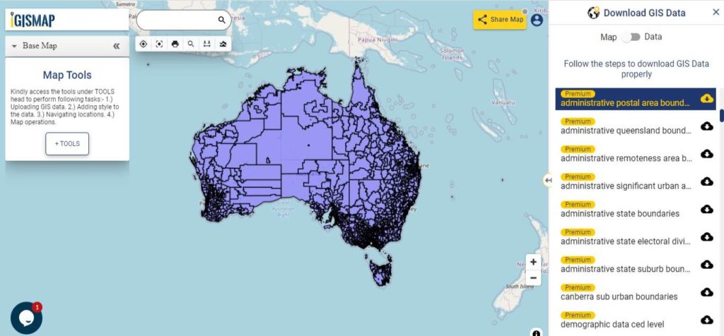
Download Free Shapefile Data of Australia
Australia is the sixth largest country of the world by total area. It is a continent surrounded by Indian and Pacific oceans. Australia as a continent also exist as country, where Australia Continent does have Australia, partially Indonesia and Papua New Guinea. Australia is one of the world’s most highly urbanized countries. Major cities of Australia are Sydney, Melbourne, Brisbane, Perth, Adelaide. Canberra is its capital city, which can be seen in the shapefile downloadable from below links.
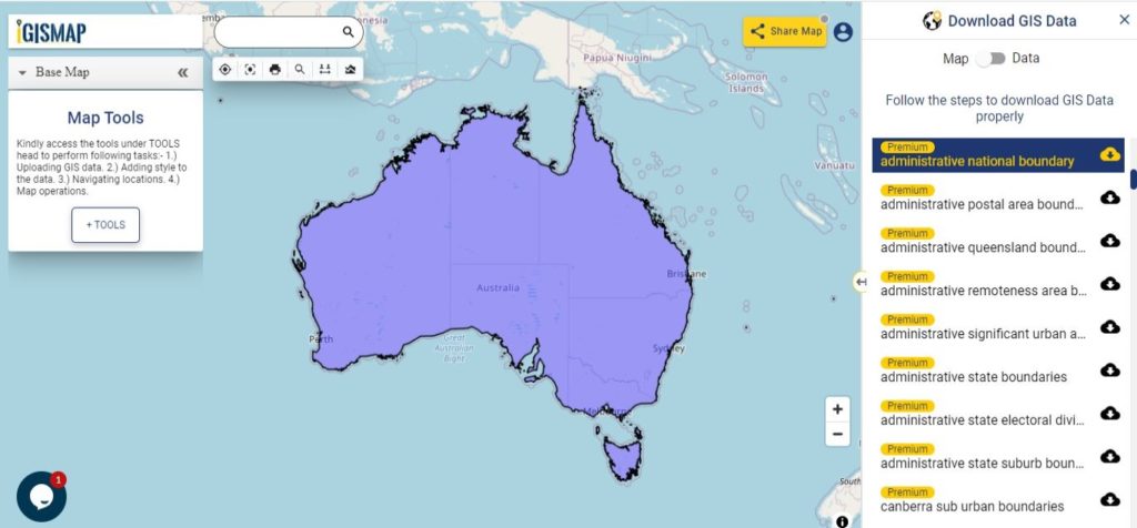
Download Australia National Outline Boundary Shapefile
Download Australia States Shapefile Data
The states and territories are federated administrative divisions in Australia, ruled by regional governments that constitute the second level of governance between the federal government and local governments. The Federation of Australia constitutionally consists of six federated states and ten federal territories, out of which three are internal territories contiguous to the Australian mainland; and the other seven are external territories and other offshore dependent territories.
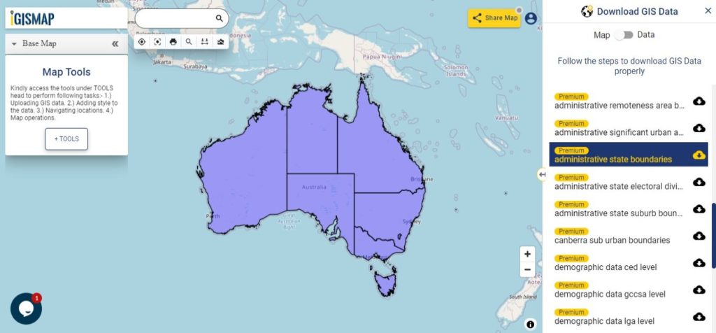
Download Australia State Boundaries Shapefile
Federal States
- New South Wales
- Queensland
- South Australia
- Tasmania
- Victoria
- Western Australia
Internal Territories
- Australian Capital Territory
- Jervis Bay Territory
- Northern Territory
External Territories
- Ashmore and Cartier Islands
- Christmas Island
- Cocos (Keeling) Islands
- Coral Sea Islands
- Heard Island and McDonald Islands
- Norfolk Island
- Australian Antarctic Territory
Download Australia Local Government Areas Shapefile Data
Local government is the third level of government in Australia, administered with limited autonomy under the states and territories, and in turn beneath the federal government. The Australian local government is generally run by a council, and its territory of public administration is referred to generically by the Australian Bureau of Statistics as the local government area or LGA, each of which encompasses multiple suburbs or localities often of different postcodes; however, stylized terms such as “city”, “borough” and “shire” also have a geographic or historical interpretation. As of August 2016, there were 547 local councils in Australia.
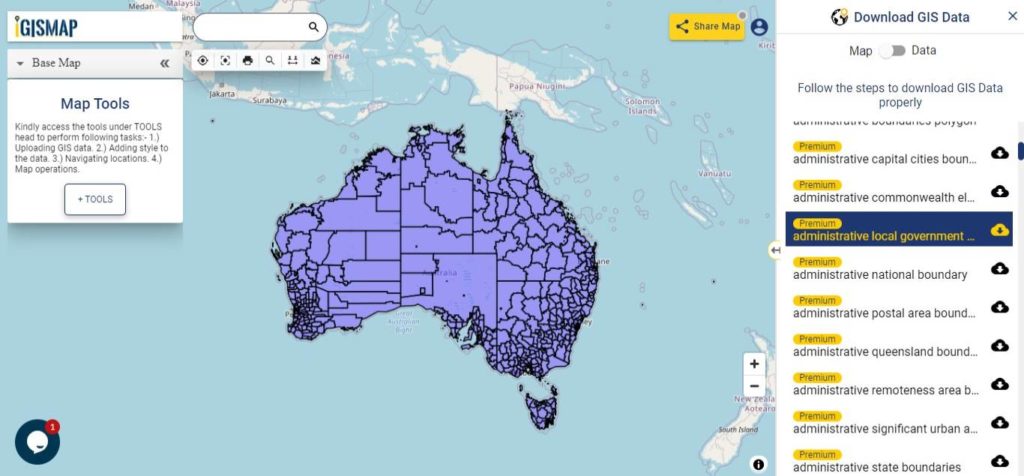
Download Australia LGA Boundaries Shapefile
This shapefile covers following shire or council listed below:
- Inner West Council
- Council of the City of Sydney
- Burwood Council
- Canterbury-Bankstown Council
- City of Banyule
- City of Darebin
- City of Boroondara
- City of Yarra
- City of Melbourne
- City of Port Phillip
- City of Stonnington
- City of Manningham
- City of Whitehorse
- City of Hobsons Bay
- City of Wyndham
- City of Greater Geelong
- City of Monash
- Northern Beaches Council
- City of Adelaide
- Borough of Queenscliffe
- Surf Coast Shire
- Golden Plains Shire
- Shire of Colac Otway
- Shire of Corangamite
- Shire of Pyrenees
- City of Ballarat
- Shire of Moorabool
- City of Melton
- City of Brimbank
- City of Hume
- Shire of Macedon Ranges
- City of Moreland
- City of Whittlesea
- Shire of Mitchell
- Shire of Hepburn
- City of Moonee Valley
- City of Maribyrnong
- Shire of Nillumbik
- City of Glen Eira
- Shire of Murrindindi
- City of Bayside
- City of Kingston
- City of Greater Dandenong
- City of Frankston
- City of Casey
- Shire of Mornington Peninsula
- City of Knox
- City of Maroondah
- Shire of Yarra Ranges
- Shire of Cardinia
- Shire of Baw Baw
- Shire of South Gippsland
- Bass Coast Shire
- Shire of Mount Alexander
- City of Greater Bendigo
- Shire of Loddon
- Rural City of Mildura
- Shire of West Wimmera
- Shire of Hindmarsh
- Shire of Yarriambiack
- Shire of Buloke
- Rural City of Swan Hill
- Shire of Strathbogie
- Shire of Campaspe
- Rural City of Ararat
- Shire of Moyne
- City of Warrnambool
- Shire of Northern Grampians
- Shire of Southern Grampians
- Shire of Mansfield
- Shire of Central Goldfields
- Shire of Wellington
- Rural City of Wangaratta
- Rural City of Benalla
- Latrobe City
- Shire of Glenelg
- Rural City of Horsham
- Shire of East Gippsland
- Alpine Shire
- Shire of Towong
- Shire of Gannawarra
- City of Greater Shepparton
- Shire of Moira
- Shire of Indigo
- City of Wodonga
- District Council of Grant
- City of Mount Gambier
- Albury City Council
- Greater Hume Shire Council
- Wattle Range Council
- Victoria-Daly Region
- City of Darwin
- Bundaberg Region
- Wentworth Shire Council
- Central Darling Shire Council
- Bourke Shire Council
- Broken Hill City Council
- Balranald Shire Council
- Brewarrina Shire Council
- Walgett Shire Council
- Cobar Shire Council
- Bogan Shire Council
- Moree Plains Shire Council
- Hay Shire Council
- Carrathool Shire Council
- Warren Shire Council
- Lachlan Shire Council
- Murray River Council
- Queanbeyan-Palerang Regional Council
- Edward River Council
- Clarence Valley Council
- Richmond Valley Council
- Griffith City Council
- Kyogle Council
- Tenterfield Shire Council
- Glen Innes Severn Council
- Armidale Regional Council
- Nambucca Shire Council
- Bellingen Shire Council
- Coffs Harbour City Council
- Lismore City Council
- Ballina Shire Council
- Tweed Shire Council
- Byron Shire Council
- Kempsey Shire Council
- Walcha Council
- Port Macquarie-Hastings Council
- Dungog Shire Council
- Port Stephens Council
- Upper Hunter Shire Council
- Maitland City Council
- Newcastle City Council
- Cessnock City Council
- Lake Macquarie City Council
- Singleton Council
- Inverell Shire Council
- Central Coast Council
- Randwick City Council
- Waverley Council
- Woollahra Municipal Council
- Georges River Council
- Sutherland Shire Council
- Strathfield Municipal Council
- Cumberland Council
- Fairfield City Council
- Liverpool City Council
- City of Parramatta Council
- City of Canada Bay Council
- Blacktown City Council
- Council of the City of Ryde
- The Council of the Shire of Hornsby
- The Hills Shire Council
- Hawkesbury City Council
- Ku-ring-gai Council
- Willoughby City Council
- Berrigan Shire Council
- Murrumbidgee Council
- Federation Council
- Snowy Monaro Regional Council
- Snowy Valleys Council
- Eurobodalla Shire Council
- Bega Valley Shire Council
- Wagga Wagga City Council
- Cootamundra-Gundagai Regional Council
- Yass Valley Council
- Mid-Coast Council
- Junee Shire Council
- Temora Shire Council
- Hilltops Council
- Bland Shire Council
- Weddin Shire Council
- Cowra Shire Council
- Upper Lachlan Shire Council
- Uralla Shire Council
- Gwydir Shire Council
- Gilgandra Shire Council
- Dubbo Regional Council
- Warrumbungle Shire Council
- Mid-Western Regional Council
- Cabonne Council
- Parkes Shire Council
- Narromine Shire Council
- The Council of the Municipality of Hunters Hill
- North Sydney Council
- Lane Cove Municipal Council
- Mosman Municipal Council
- Penrith City Council
- Wollondilly Shire Council
- Camden Council
- Campbelltown City Council
- Lithgow City Council
- Blue Mountains City Council
- Wollongong City Council
- Wingecarribee Shire Council
- Shellharbour City Council
- Oberon Council
- Goulburn Mulwaree Council
- The Council of the Municipality of Kiama
- Shoalhaven City Council
- Coolamon Shire Council
- Narrandera Shire Council
- Lockhart Shire Council
- Bathurst Regional Council
- Muswellbrook Shire Council
- Liverpool Plains Shire Council
- Tamworth Regional Council
- Narrabri Shire Council
- Gunnedah Shire Council
- Leeton Shire Council
- Forbes Shire Council
- Blayney Shire Council
- Orange City Council
- Kangaroo Island Council
- Yorke Peninsula Council
- Renmark Paringa Council
- District Council of Loxton Waikerie
- Southern Mallee District Council
- Tatiara District Council
- Naracoorte Lucindale Council
- District Council of Robe
- Kingston District Council
- Anangu Pitjantjatjara Yankunytjatjara Local Government Area
- Maralinga Tjarutja
- District Council of Coober Pedy
- Municipal Council of Roxby Downs
- Uia Riverland Local Government Area
- Berri Barmera Council
- Pastoral Unincorporated Area
- Port Augusta City Council
- Flinders Ranges Council
- District Council of Orroroo Carrieton
- District Council of Peterborough
- Mid Murray Council
- Unincorporated Area
- Bayside Council
- Coorong District Council
- District Council of Karoonda East Murray
- Rural City of Murray Bridge
- District Council of Ceduna
- District Council of Streaky Bay
- Wudinna District Council
- District Council of Elliston
- Coonamble Shire Council
- Alexandrina Council
- City of Victor Harbor
- District Council of Yankalilla
- City of Onkaparinga
- Mount Barker District Council
- City of Swan
- Bayswater
- City of Belmont
- Waverley Council
Download Australia Postal Areas Shapefile Data
There are over 2670 postal area boundaries in the following data
Download Australia Postal Area Boundaries Shapefile
Other Administrative Boundary Data:
- Download Australia State Sub Urban Areas Shapefile
- Download Australia Capital Cities Shapefile
- Download Australia Significant Urban Areas Shapefile
- Download Australia State Electoral Divisions Shapefile
- Download Australia Commonwealth Electoral Divisions Shapefile
- Download Australia Remoteness Areas Shapefile
- Download Australia Capital Territory Shapefile
- Download Australia Victoria State Regions Shapefile
- Download Australia Canberra Sub Urban Boundaries
Australia Demographic Data:
- Download Australia State Level Demographic Shapefile Data
- Download Australia LGA Level Demographic Shapefile Data
- Download Australia CED Level Demographic Shapefile Data
- Download Australia GCCS Demographic Shapefile Data
- Download Australia Remoteness Area Demographic Shapefile Data
- Download Australia SED Level Demographic Shapefile Data
Download Free Shapefile for the following:
- World Countries Shapefile
- Australia
- Argentina
- Austria
- Belgium
- Brazil
- Canada
- Denmark
- Fiji
- Finland
- Germany
- Greece
- India
- Indonesia
- Ireland
- Italy
- Japan
- Kenya
- Lebanon
- Madagascar
- Malaysia
- Mexico
- Mongolia
- Netherlands
- New Zealand
- Nigeria
- Papua New Guinea
- Philippines
- Poland
- Russia
- Singapore
- South Africa
- South Korea
- Spain
- Switzerland
- Tunisia
- United Kingdom Shapefile
- United States of America
- Vietnam
- Croatia
- Chile
- Norway
Disclaimer : If you find any shapefile data of country provided is in correct do contact us or comment below, so that we will correct the same in our system as well we will try to correct the same in openstreetmap.
Is there a shape file for The Sydney neighbourhoods?
The Australia Local Government Authority Border text does not highlight with a link
Shire of Cardinia and Shire of Yarra Ranges are missing from the Australia Local Government Authority Border(e.g Shire/Council) Shapefile Map.