The applications of GIS tools are expanding in the field of business, research, defense, etc. Thus the features and tools of every GIS software are updating abruptly for helping users in these industries to get the right information by performing complex analyses over GIS data. But working with most of the GIS software in the market requires adequate training and dense knowledge in geospatial concepts.
That is where IGISMap is useful. IGISMap is GIS based web platform providing multiple GIS applications that are most important in the field of geospatial analytics. The peculiarity of IGISMAP in the GIS Industry is its UI/UX that helps the user to perform effortless geospatial operations. In this article, we will discuss Add Existing File tool of IGISMap.
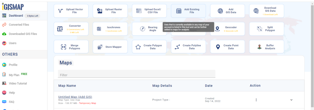
In IGISMap, GIS data is uploaded, created, edited and worked on a map. A map is a spatial interface that supports GIS data and give access to various tools to perform geospatial operations. As a user of IGISMap, you can create any number of maps and add GIS data of any formats.
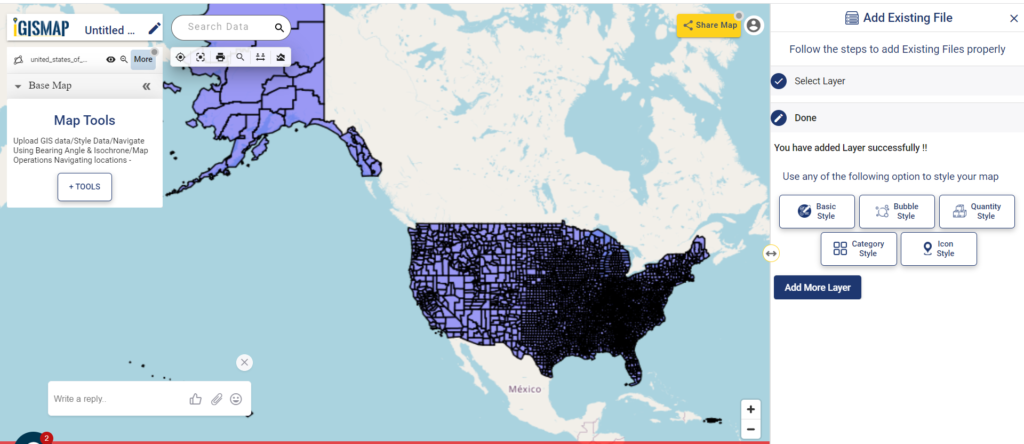
Add Existing File is a tool that keeps the list of all data that are available on every map in your IGISMap account. Users can open this tool directly from the map or from the dashboard to view the list of data that are published in the maps. You can select any data from the list, preview it and add that data to the map. Thus you dont have to take effort on uploading the data again if it is available in any map.
Let’s look into the application of Add Existing File tool in IGISMap.
Get directed to Add Existing file tool using the following link
https://story.mapog.com/app/tools/existing-file
Publish GIS data in the map
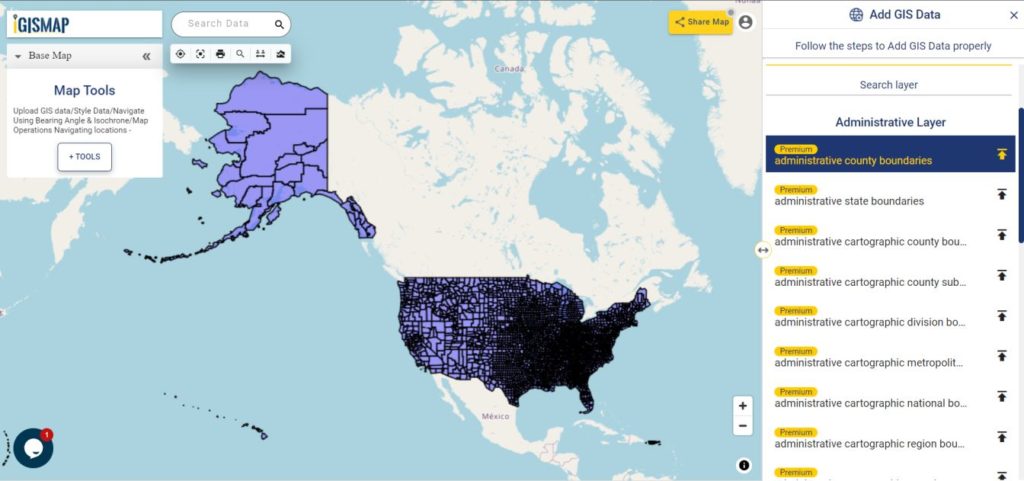
Let’s see how a data published in a map get listed in Add Existing Tool. So let’s first publish a data in a map. For this lets use Add GIS Data and publish USA county boundaries polygono data
Add data from IGISMap GIS data collection
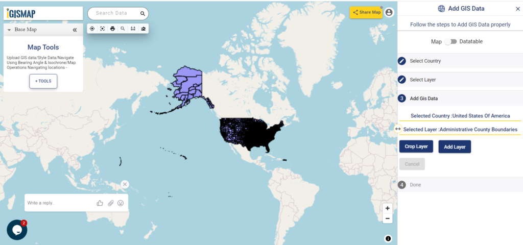
Select united states of america from the list of countries and select the data administrative county boundaries and click Add Layer icon.
Download USA County Boundaries Shapefile
In the next step, since we dont need to crop the data, directly click Add Layer button as shown below.
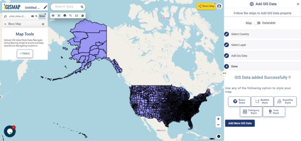
Now, GIS data of USA county boundaries are successfully added in the map.
Publish data from Add Existing File
Now, we can add the USA County Level data layer using the Add Existing File. If you want add the data in a new map, open Add Existing File tool from the dashboard.
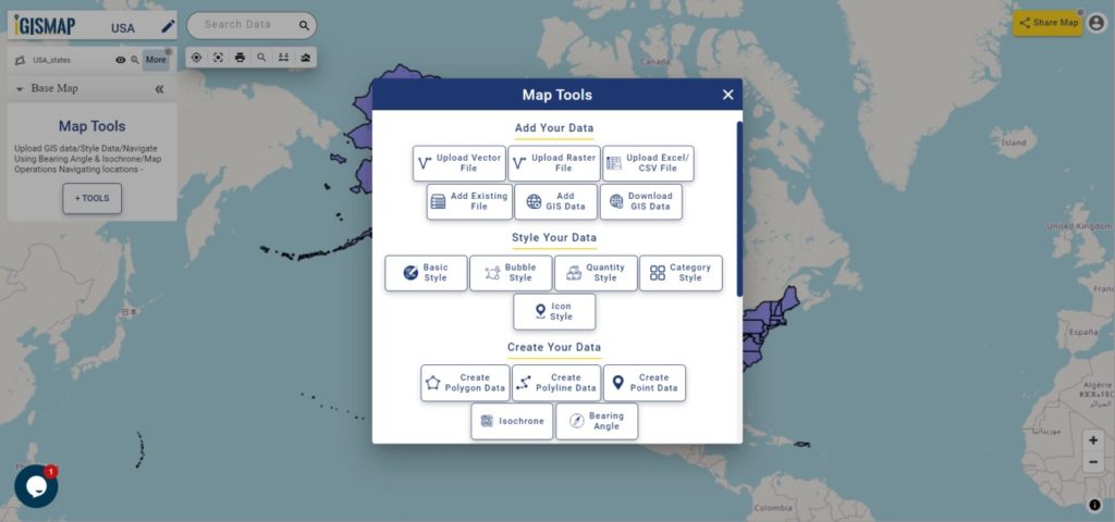
If you want to add the data from an existing map, click the Tools button below the layer list. This will open the list of all tools of IGISMap, as shown below.
In the section Add Your Data, click Add Existing File to open the tool.
Now Add Existing File tool is opened with the list of all images currently published in the maps of your IGISMap account. The data we added from Add GIS Data, which is administrative county boundaries data of USA is listed top of the list. Or you can search the data using Search Layer option.
You can click and preview the data like the following.
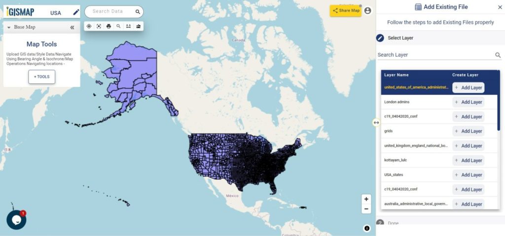
Click Add Layer button to publish this layer in your new map.