Geographic Information System is a system intends to capture, Store, manage, manipulate, analyze the data. GIS system integrate data and convert it into maps. And as we know visuals are more powerful than words so it makes our understanding of data fast.
What is GIS ?
GIS is a tool to acquire geographic data and produce Geographic information. And generally those information are stored in tabular form. GIS can be defined as a “computer information system that can input, store, manipulate, analyze, and display geographically referenced (spatial) data to support decision making processes”.
Simply GIS visualize your data as a map. And these visualization makes the study interesting with interactive maps. It saves the time and make the system decisiveness that is main requirement.
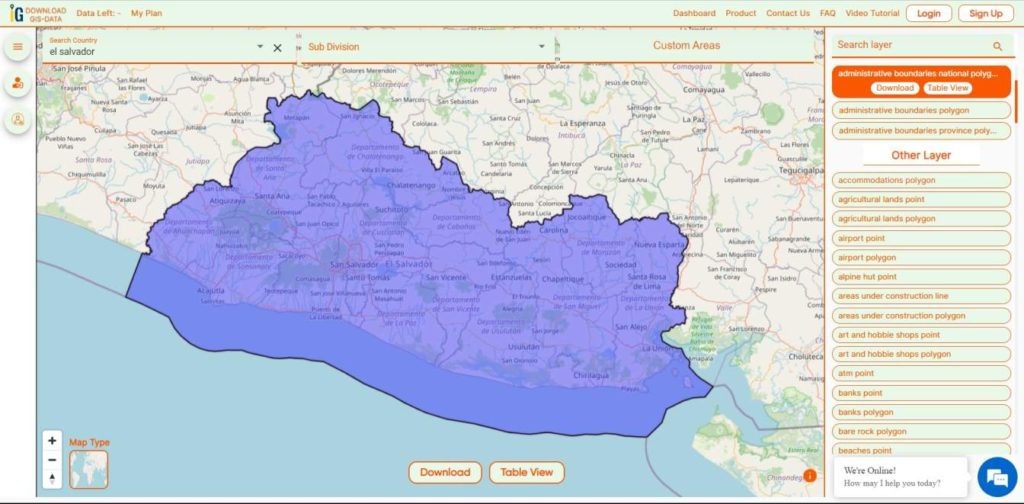
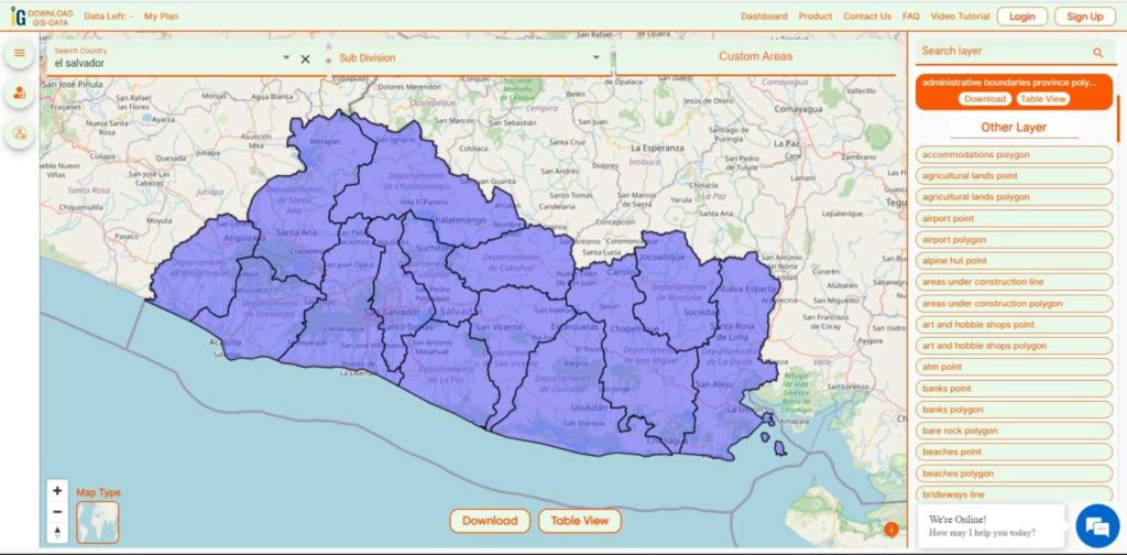
Download El Salvador administrative boundary shapefiles El Salvador national province and more
It’s fantastic to hear thatMAPOG has expanded its GIS data collection to include data for more than 100 new countries, bringing the total coverage to over 150 countries. This is undoubtedly a valuable resource for GIS enthusiasts and professionals around the world. The availability of detailed information on administrative divisions, rivers, roads, and airports can greatly enhance various geospatial projects and analyses.
The option to access the data through tools like “Download GIS Data” and “Add GIS Data” seems convenient and user-friendly. Providing data in different formats such as Shapefile, KML, GeoJSON, and CSV ensures compatibility with a wide range of GIS software and applications, making it easier for users to integrate the data into their workflows.
This article will walk you through downloading administrative-level GIS data for El Salvador using the Download GIS Data tool. Experience a seamless geospatial journey with IGISMAP as your trusted partner!
Note:
All data available are in GCS datum EPSG:4326 WGS84 CRS (Coordinate Reference System).
You need to login for downloading the shapefile.
Download El Salvador Shapefile Data
El Salvador lies in the isthmus of Central America between latitudes 13° and 15°N, and longitudes 87° and 91°W. It stretches 270 km (168 mi) from west-northwest to east-southeast and 142 km (88 mi) north to south, with a total area of 21,041 km2 (8,124 sq mi).
Disclaimer : If you find any shapefile data of country provided is incorrect do contact us or comment below, so that we will correct the same in our system as well we will try to correct the same in OpenStreetMap.
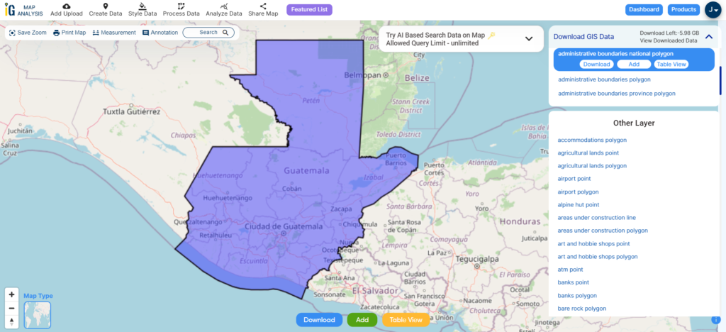
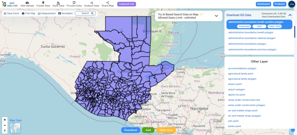
Elevate your mapping pursuits! IGISMAP presents a special offer: download Guatemala’s administrative boundary GIS data, including national, department, municipality, and more.
Discover Guatemala’s geographical features effortlessly through IGISMAP. Explore a diverse range of datasets, including comprehensive information on borders, rivers, roads, and airports. Using tools like Download GIS Data and Add GIS Data is straightforward. You have the flexibility to choose from formats such as Shapefile, KML, GeoJSON, and CSV using the Download GIS Data tool. Use IGISMAP with confidence to delve into the fascinating geography of Guatemala GIS Data.
We offer an extensive array of data formats, including KML, SHP, CSV, GeoJSON, Tab, SQL, Tiff, GML, KMZ, GPKZ, SQLITE, Dxf, MIF, TOPOJSON, XLSX, GPX, ODS, MID, and GPS, ensuring compatibility and accessibility for various applications and analyses.
Note:
All data available are in GCS datum EPSG:4326 WGS84 CRS (Coordinate Reference System).
You need to login for downloading the shapefile.
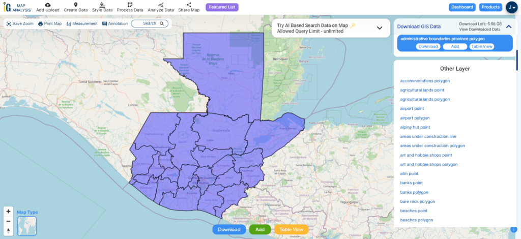
Download Shapefile Data of Guatemala
Guatemala, officially known as the Republic of Guatemala, is situated in Central America. It shares its borders with Mexico to the north and west, Belize to the northeast, Honduras to the east, and El Salvador to the southeast. To the south, it is bordered by the Pacific Ocean, and to the northeast, it is touched by the Gulf of Honduras. With an estimated population of approximately 17.6 million people, Guatemala stands as the most populous country in Central America and ranks as the 11th most populous nation in the Americas. Guatemala operates as a representative democracy, with its capital and largest city being Nueva Guatemala de la Asunción, also commonly known as Guatemala City, which happens to be the most populous city in Central America.
After successfully logging in with a legitimate email address, select the country you want to work with. Next, choose the specific layer you need and click on the download option. Once that’s done, pick the desired format to acquire the essential GIS data. Before proceeding with the data download, make sure to review the data table for any relevant information.
Download Guatemala departments Shapefile Data
Guatemala is divided into 22 administrative divisions known as “departments” (departamentos in Spanish). Each department is further subdivided into municipalities.
Here is a list of the 22 departments of Guatemala:
Alta Verapaz
Baja Verapaz
Chimaltenango
Chiquimula
El Progreso
Escuintla
Guatemala
Huehuetenango
Izabal
Jalapa
Jutiapa
Petén
Quetzaltenango
Quiché
Retalhuleu
Sacatepéquez
San Marcos
Santa Rosa
Sololá
Suchitepéquez
Totonicapán
Zacapa
Download Guatemala Municipalities Shapefile Data
Guatemala is divided into numerous municipalities, each of which falls within one of the country’s 22 departments. There are a total of 340 municipalities in Guatemala. These municipalities serve as the basic administrative divisions within the country.
Disclaimer : If you find any shapefile data of country provided is incorrect do contact us or comment below, so that we will correct the same in our system as well we will try to correct the same in openstreetmap.
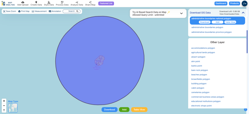
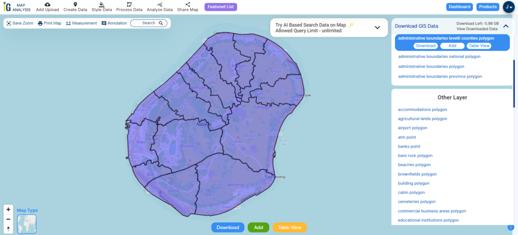
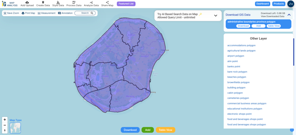
Elevate your mapping pursuits! IGISMAP presents a special offer: download Nauru’s administrative boundary GIS data, including national, districts, constituencies, and more.
Looking for accurate and reliable GIS data for Nauru? Look no further, as IGISMAP is here to help! We take pride in offering comprehensive GIS data specifically tailored for Nauru. Our platform provides a wide range of GIS datasets, ensuring you have access to the most precise and up-to-date information, especially regarding administrative divisions. Whether you need data on natural features like rivers or man-made features like roads, railway lines, and airport locations, we’ve got you covered. Accessing GIS data for Nauru is easy with our two essential tools: Download GIS Data and Add GIS Data. To learn more about the functionalities of our Add GIS Data tool, check out our informative article on adding GIS data from IGISMAP’s Nauru GIS data collection.
Here are the tools you can leverage within IGISMAP
We offer an extensive array of data formats, including KML, SHP, CSV, GeoJSON, Tab, SQL, Tiff, GML, KMZ, GPKZ, SQLITE, Dxf, MIF, TOPOJSON, XLSX, GPX, ODS, MID, and GPS, ensuring compatibility and accessibility for various applications and analyses.
Note:
All data available are in GCS datum EPSG:4326 WGS84 CRS (Coordinate Reference System).
Nauru, officially the Republic of Nauru, is a diminutive island country situated in the Central Pacific Ocean, within Micronesia, Oceania. It was once known as Pleasant Island during the colonial era. Nauru’s closest neighbor is Banaba Island in Kiribati, located approximately 300 kilometers (190 miles) to the east. This microstate is positioned northwest of Tuvalu, 1,300 kilometers (810 miles) northeast of the Solomon Islands, east-northeast of Papua New Guinea, southeast of the Federated States of Micronesia, and south of the Marshall Islands.
After successfully logging in with a legitimate email address, select the country you want to work with. Next, choose the specific layer you need and click on the download option. Once that’s done, pick the desired format to acquire the essential GIS data. Before proceeding with the data download, make sure to review the data table for any relevant information.
Download Nauru Districts Shapefile Data
Nauru is divided into 14 districts, each of which is further subdivided into smaller villages and communities. Here are the 14 districts of Nauru:
Aiwo
Anabar
Anetan
Anibare
Baiti
Boe
Buada
Denigomodu
Ewa
Ijuw
Meneng
Nibok
Uaboe
Yaren (Yaren is also the capital district and hosts the national government)
These districts are used for administrative and electoral purposes within the country. Each district elects representatives to the Parliament of Nauru, and they play a role in local governance as well.
Nauru had 8 electoral constituencies. These constituencies are used for the country’s parliamentary elections, and each constituency elects members to the Parliament of Nauru. Here are the 8 electoral constituencies in Nauru:
Disclaimer : If you find any shapefile data of country provided is incorrect do contact us or comment below, so that we will correct the same in our system as well we will try to correct the same in openstreetmap.
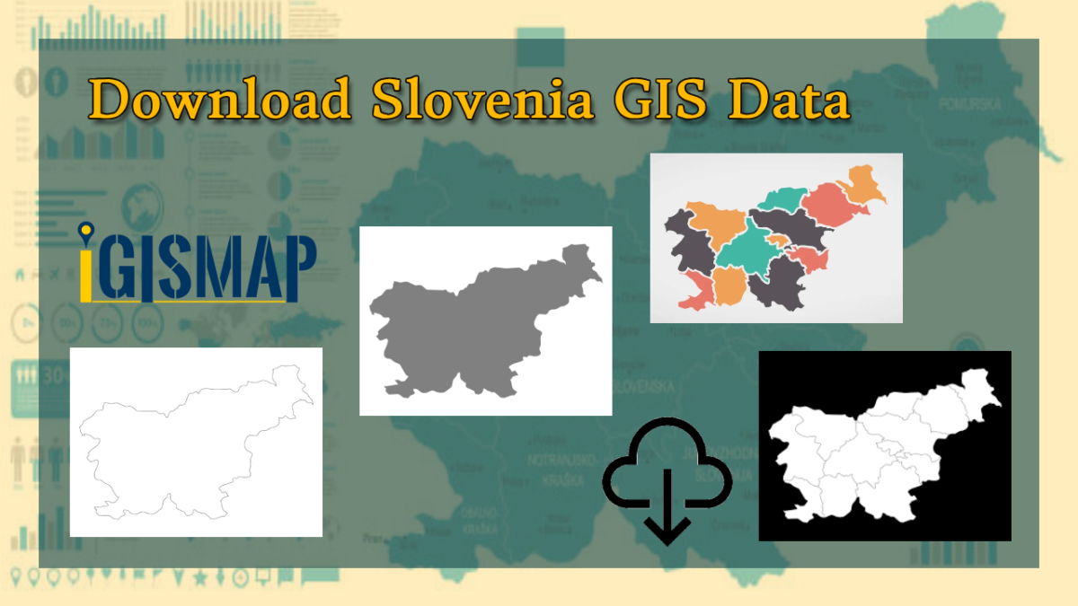
Step into the world of mapping possibilities! IGISMAP offers an exclusive chance: download Slovenia’s administrative boundary GIS data, covering national, municipality, and more.
Discover Slovenia’s geography effortlessly with IGISMAP. Access a wide range of datasets providing comprehensive information on national borders, rivers, road networks, and airports. Our user-friendly tools, such as Download GIS Data and Add GIS Data, make navigation a breeze. You can select from various formats like Shapefile, KML, GeoJSON, and CSV when using the Download GIS Data tool. For a step-by-step guide on effectively utilizing the Add GIS Data tool to access Slovenia’s GIS Data on IGISMap, If you want to know how to use Add GIS Data tool, check out this article Add GIS data from IGISMap GIS data collection. With IGISMAP, you can confidently explore and understand Slovenia’s captivating geography.
We offer an extensive array of data formats, including KML, SHP, CSV, GeoJSON, Tab, SQL, Tiff, GML, KMZ, GPKZ, SQLITE, Dxf, MIF, TOPOJSON, XLSX, GPX, ODS, MID, and GPS, ensuring compatibility and accessibility for various applications and analyses.
Note:
All data available are in GCS datum EPSG:4326 WGS84 CRS (Coordinate Reference System).
You need to login for downloading the shapefile.
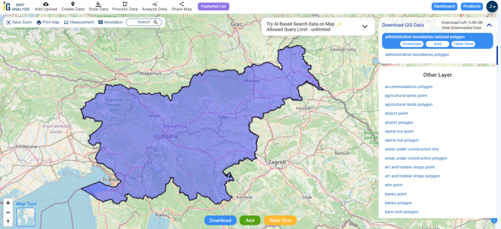
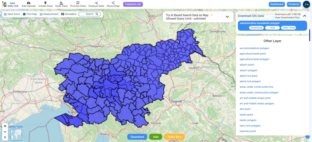
Download Shapefile Data of Slovenia
Slovenia, officially known as the Republic of Slovenia, is a country in southern Central Europe. It is bordered by Italy to the west, Austria to the north, Hungary to the northeast, Croatia to the southeast, and the Adriatic Sea to the southwest. Slovenia is a predominantly mountainous and forested nation covering 20,271 square kilometers with a population of 2.1 million. The official language is Slovene, and Ljubljana is the capital and largest city, located near the country’s center.
After successfully logging in with a legitimate email address, select the country you want to work with. Next, choose the specific layer you need and click on the download option. Once that’s done, pick the desired format to acquire the essential GIS data. Before proceeding with the data download, make sure to review the data table for any relevant information.
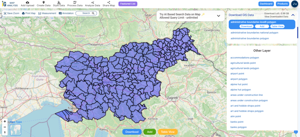
Download Slovenia Municipalities Shapefile Data
Slovenia’s administrative structure comprises 212 municipalities, known as “občine” in Slovene, with 12 of them holding urban or metropolitan status. These municipalities are organized into smaller units, including local communities and districts, to facilitate effective governance and service delivery.
Disclaimer : If you find any shapefile data of country provided is incorrect do contact us or comment below, so that we will correct the same in our system as well we will try to correct the same in openstreetmap.
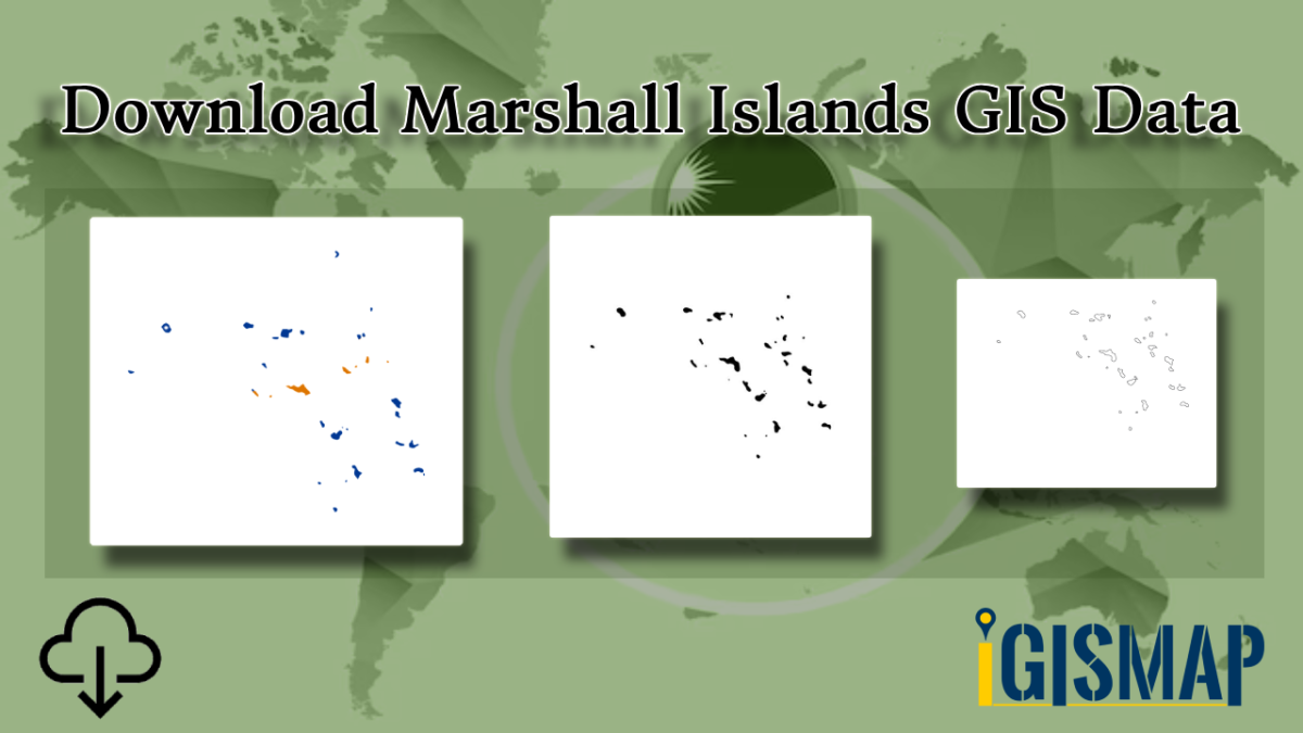
Step into the world of mapping possibilities! IGISMAP offers an exclusive chance: download Marshall Islands’ administrative boundary GIS data, covering national, atolls, and more.
MAPOG makes it easy to navigate through Marshall Islands’ GIS data. You can find over 150 detailed datasets about important geography like divisions, rivers, roads, and airports. There are two main tools: Download GIS Data and Add GIS Data. With Download GIS Data, you can get data in formats like Shapefile, KML, GeoJSON, or CSV, tailored to your needs. For help with Add GIS Data, check out the guide “Mastering MAPOG GIS Data Collection for the Marshall Islands.” It gives step-by-step instructions for getting administrative-level GIS data using Download GIS Data. Explore Marshall Islands’ landscape with MAPOG as your trusted guide.
We offer an extensive array of data formats, including KML, SHP, CSV, GeoJSON, Tab, SQL, Tiff, GML, KMZ, GPKZ, SQLITE, Dxf, MIF, TOPOJSON, XLSX, GPX, ODS, MID, and GPS, ensuring compatibility and accessibility for various applications and analyses.
Note:
All data available are in GCS datum EPSG:4326 WGS84 CRS (Coordinate Reference System).
You need to login for downloading the shapefile.
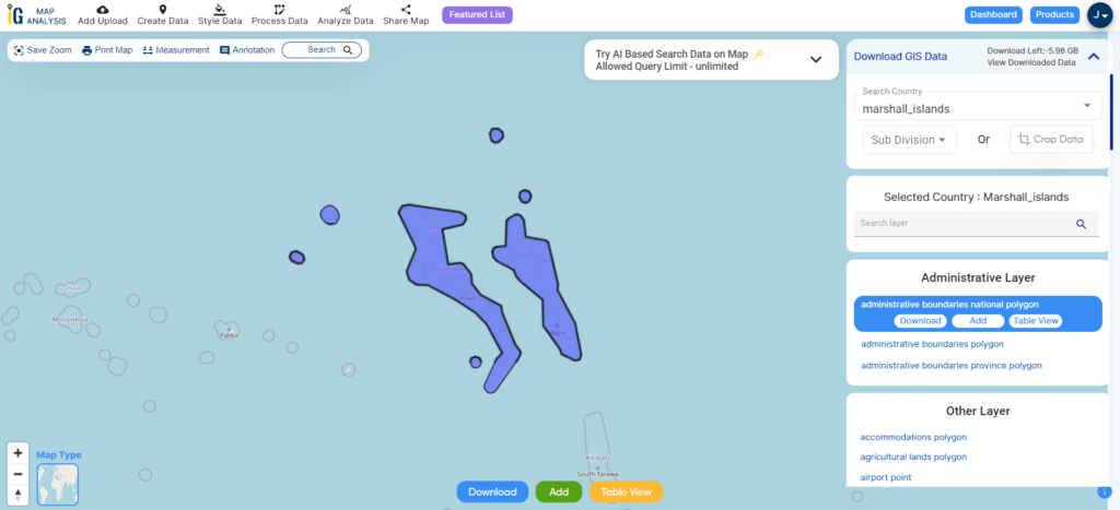
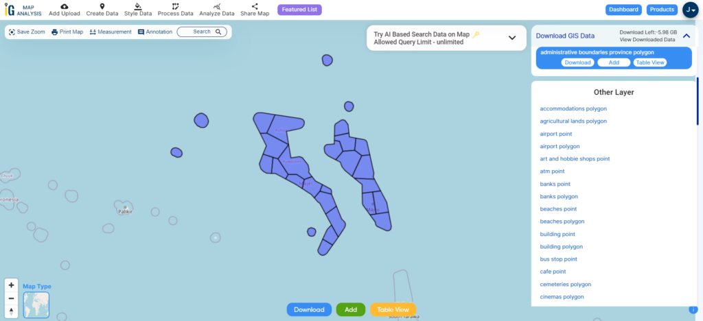
Download Shapefile Data of Marshall Islands
The Marshall Islands, known as Ṃajeḷ in Marshallese, is formally recognized as the Republic of the Marshall Islands. It stands as an island nation situated in the Pacific Ocean, in proximity to Kiribati, slightly west of the International Date Line. In terms of geography, this country is a constituent of the broader island cluster of Micronesia.
After successfully logging in with a legitimate email address, select the country you want to work with. Next, choose the specific layer you need and click on the download option. Once that’s done, pick the desired format to acquire the essential GIS data. Before proceeding with the data download, make sure to review the data table for any relevant information.
Download Marshall Island Atolls Shapefile Data
The Marshall Islands is a country located in the central Pacific Ocean, consisting of 29 atolls and 5 isolated islands. Atolls are ring-shaped coral reef formations that encircle a lagoon partially or completely.
Disclaimer : If you find any shapefile data of country provided is incorrect do contact us or comment below, so that we will correct the same in our system as well we will try to correct the same in openstreetmap.
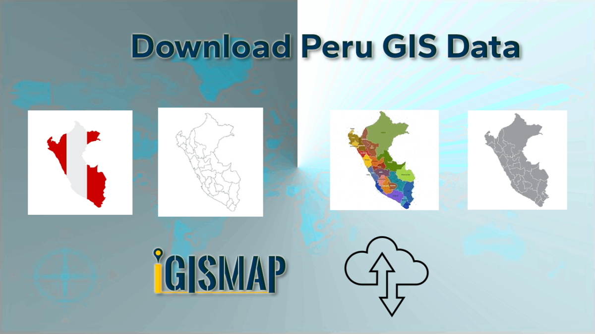
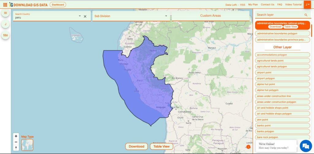
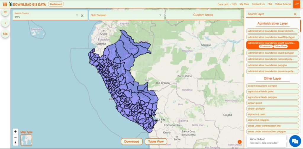
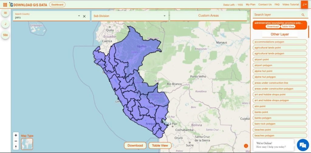
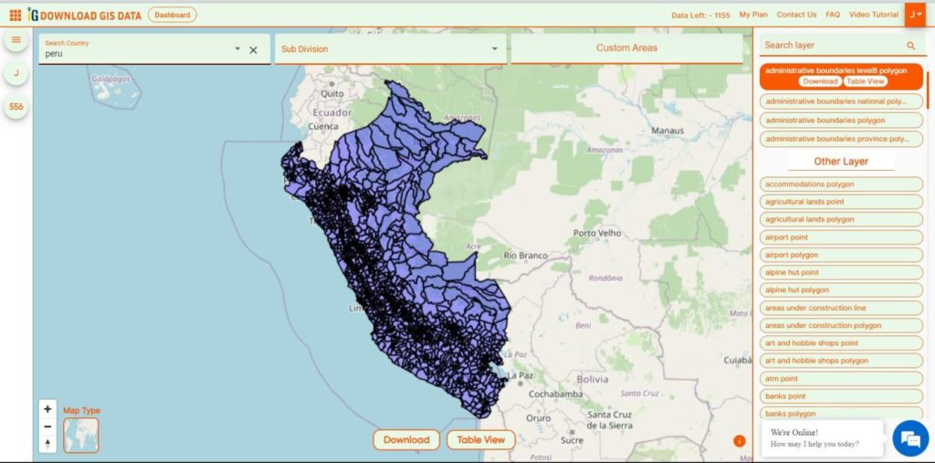
Download Peru administrative boundaries shapefiles Peru National , regions , provinces , districts and more.
It’s fantastic to hear that IGISMAP has expanded its GIS data collection to include data for more than 100 new countries, bringing the total coverage to over 150 countries. This is undoubtedly a valuable resource for GIS enthusiasts and professionals around the world. The availability of detailed information on administrative divisions, rivers, roads, and airports can greatly enhance various geospatial projects and analyses.
The option to access the data through tools like “Download GIS Data” and “Add GIS Data” seems convenient and user-friendly. Providing data in different formats such as Shapefile, KML, GeoJSON, and CSV ensures compatibility with a wide range of GIS software and applications, making it easier for users to integrate the data into their workflows.
This article will walk you through downloading administrative-level GIS data for Peru using the Download GIS Data tool. Experience a seamless geospatial journey with IGISMAP as your trusted partner!
Note:
All data available are in GCS datum EPSG:4326 WGS84 CRS (Coordinate Reference System).
You need to login for downloading the shapefile.
Download Shapefile Data of Peru
A virtual guide to Peru, the third largest country in South America, with a 2,400 km long coastline at the South Pacific Ocean (what a beach). Countries with international borders to Peru are Bolivia, Brazil, Chile, Colombia, and Ecuador.
The country extends along the Andes, the world’s longest exposed mountain range, it covers an area of 1,285,216 km², making it 2.5 times the size of Spain, or slightly smaller than Alaska.
There are 196 provinces in Peru, grouped into 25 regions, except for Lima Province which does not belong to any region. This makes an average of seven provinces per region.
Disclaimer : If you find any shapefile data of country provided is incorrect do contact us or comment below, so that we will correct the same in our system as well we will try to correct the same in OpenStreetMap.
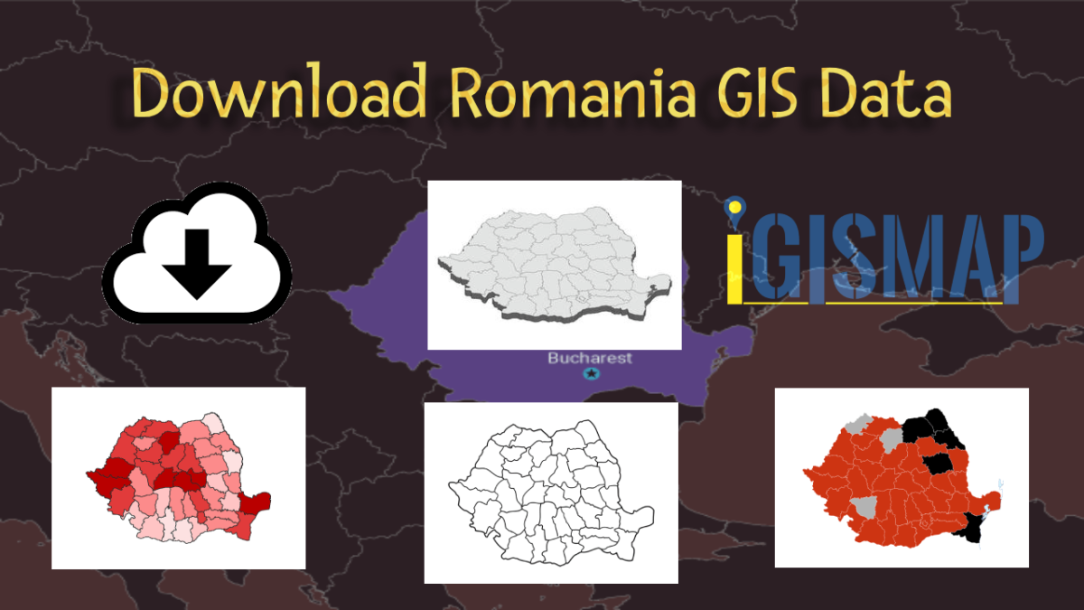
Download Romania’s administrative boundary GIS data, including national, county, and commune divisions. Access accurate geographic information for enhanced analysis and projects.
Easily explore Romania’s geographical data using MAPOG. Discover a wide range of datasets, including details about administrative boundaries, rivers, roads, and airports. Accessing this information is simple with the Download GIS Data and Add GIS Data tools. The Download GIS Data tool lets you choose formats like Shapefile, KML, GeoJSON, and CSV. For a more detailed guide on using the Add GIS Data tool, check out “Maximizing Romania’s GIS Data Collection from MAPOG.” This guide helps you step by step in getting administrative GIS data using the Download GIS Data tool. Explore Romania’s geography using MAPOG as your trusted guide.
We offer an extensive array of data formats, including KML, SHP, CSV, GeoJSON, Tab, SQL, Tiff, GML, KMZ, GPKZ, SQLITE, Dxf, MIF, TOPOJSON, XLSX, GPX, ODS, MID, and GPS, ensuring compatibility and accessibility for various applications and analyses.
Note:
All data available are in GCS datum EPSG:4326 WGS84 CRS (Coordinate Reference System).
You need to login for downloading the shapefile.
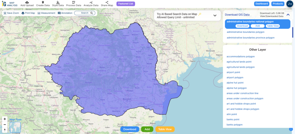
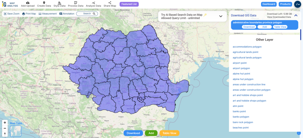
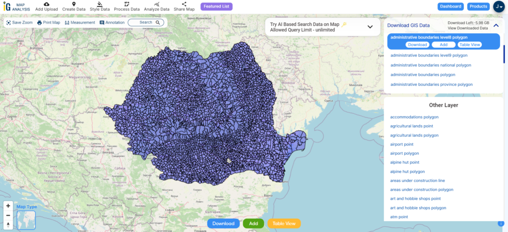
Download Shapefile Data of Romania
Nestled at the crossroads of Eastern, Southeastern, and Central Europe, Romania boasts a diverse geography. With Bulgaria to the south, Ukraine to the north, Hungary to the west, Serbia to the southwest, Moldova to the east, and the shimmering expanse of the Black Sea to the southeast, Romania is a country of striking contrasts. Spanning approximately 238,397 square kilometers (92,046 square miles), Romania hosts a population of 19,892,812 people as of 2023, a statistic meticulously recorded by Macrotrend and Worldometer. This positions Romania as the twelfth-largest European nation and a notable member of the European Union, ranking as the sixth-most populous.
After successfully logging in with a legitimate email address, select the country you want to work with. Next, choose the specific layer you need and click on the download option. Once that’s done, pick the desired format to acquire the essential GIS data. Before proceeding with the data download, make sure to review the data table for any relevant information.
Download Romania Counties Shapefile Data
Romania is divided into 41 counties (known as “județe” in Romanian), along with the municipality of Bucharest, which together form the recognized administrative divisions. These divisions correspond to NUTS-3 (Nomenclature of Territorial Units for Statistics – Level 3) categories within the European Union. Each county operates as an independent local government unit within its defined boundaries. The majority of counties derive their names from prominent rivers in the region, while a few are named after significant cities that serve as their administrative centers.
A commune (comună in Romanian) is the lowest level of administrative subdivision in Romania. There are 2,686 communes in Romania. The commune is the rural subdivision of a county. Urban areas, such as towns and cities within a county, are given the status of city or municipality.
Disclaimer : If you find any shapefile data of country provided is incorrect do contact us or comment below, so that we will correct the same in our system as well we will try to correct the same in openstreetmap.
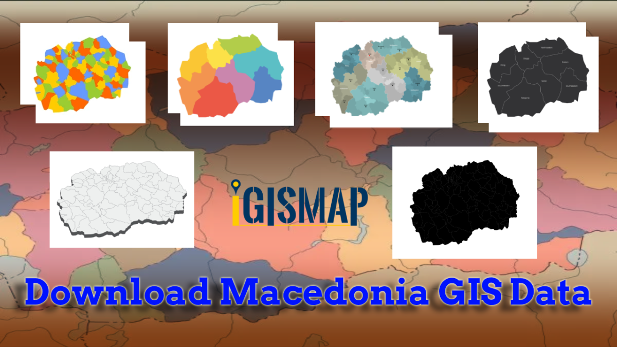
Download Macedonia administrative boundary shapefiles- Macedonia National , Regions , Villages Shapefile and more.
It’s fantastic to hear that IGISMAP has expanded its GIS data collection to include data for more than 100 new countries, bringing the total coverage to over 150 countries. This is undoubtedly a valuable resource for GIS enthusiasts and professionals around the world. The availability of detailed information on administrative divisions, rivers, roads, and airports can greatly enhance various geospatial projects and analyses.
The option to access the data through tools like “Download GIS Data” and “Add GIS Data” seems convenient and user-friendly. Providing data in different formats such as Shapefile, KML, GeoJSON, and CSV ensures compatibility with a wide range of GIS software and applications, making it easier for users to integrate the data into their workflows.
This article will walk you through downloading administrative-level GIS data for Macedonia using the Download GIS Data tool. Experience a seamless geospatial journey with IGISMAP as your trusted partner!
Note:
All data available are in GCS datum EPSG:4326 WGS84 CRS (Coordinate Reference System).
You need to login for downloading the shapefile.
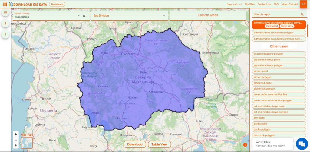
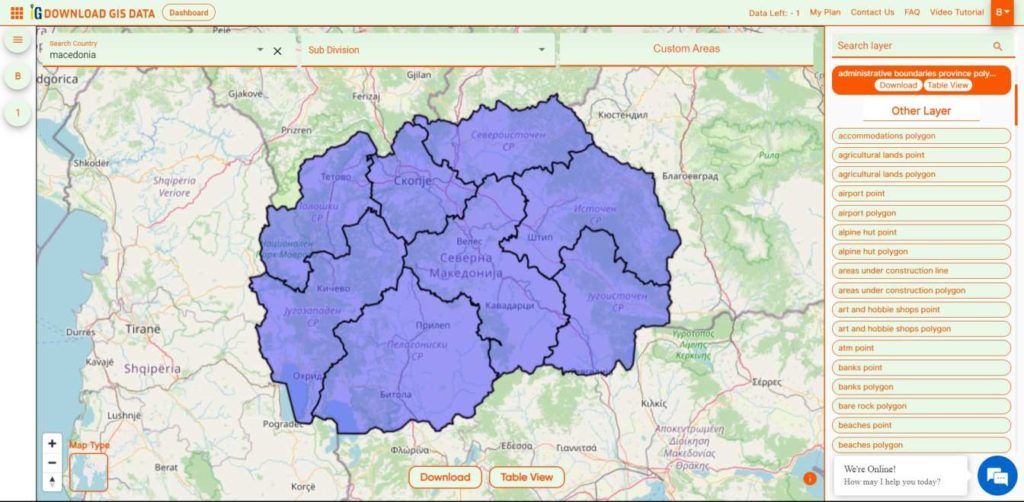
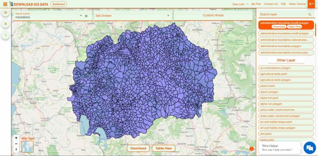
Download Shapefile Data of Macedonia
North Macedonia is a country situated in southeastern Europe with geographic coordinates 41°50′N 22°00′E, bordering Kosovo and Serbia to the north, Bulgaria to the east, Greece to the south and Albania to the west. The country is part of the wider region of Macedonia and makes up most of Vardar Macedonia. The country is a major transportation corridor from Western and Central Europe to Southern Europe and the Aegean Sea. North Macedonia is a landlocked country but has three major natural lakes: Lake Ohrid, Lake Prespa and Lake Dojran. It has a water area of 857 km2, while its land area is 24,856 km2.
Disclaimer : If you find any shapefile data of country provided is incorrect do contact us or comment below, so that we will correct the same in our system as well we will try to correct the same in OpenStreetMap.
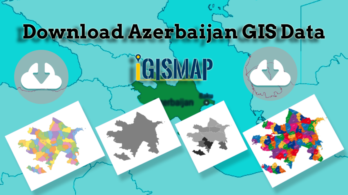
Step into the world of mapping possibilities! IGISMAP offers an exclusive chance: download Azerbaijan’s administrative boundary shapefile, encompassing regions, districts, and more. Elevate your mapping projects with these comprehensive GIS datasets. Don’t miss out on this opportunity for enriched exploration and mapping!
Are you tired of endless searching for accurate and reliable GIS data for your chosen country? Your search ends here, as IGISMAP comes to the rescue! We take pride in offering an all-inclusive GIS data collection covering 150+ countries. Within our platform, you’ll discover an extensive array of over 150 GIS datasets available for each nation. What sets our GIS data apart is its unparalleled accuracy, especially when it comes to representing administrative divisions. Furthermore, we provide a diverse range of data relating to natural and man-made geographic features, such as rivers, roads, railway lines, airport locations, and more. Anyone can access GIS data from IGISMAP through two important tools: Download GIS Data and Add GIS Data. For a deeper understanding of the Add GIS Data tool’s functionalities, refer to our informative article – Add GIS data from IGISMap GIS data collection.
In this comprehensive article, we’ll walk you through the essential administrative level GIS data available for Azerbaijan in Download GIS Data tool. Choose from a variety of formats, including ESRI Shapefile, KML, GeoJSON, or CSV, tailored to suit your needs. Leave the hassle of GIS data searching behind, and embark on a seamless geospatial journey with IGISMAP by your side!
Note:
All data available are in GCS datum EPSG:4326 WGS84 CRS (Coordinate Reference System).
You need to login for downloading the shapefile.
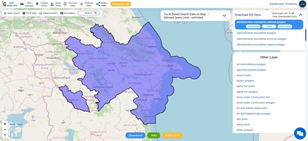
Download Shapefile Data of Azerbaijan
Azerbaijan, officially known as the Republic of Azerbaijan, is a unique transcontinental country situated at the crossroads of Eastern Europe and Western Asia. It forms part of the South Caucasus region and shares borders with various countries. To the east lies the beautiful Caspian Sea, while Russia (Republic of Dagestan) is situated to the north. Azerbaijan is bordered by Georgia to the northwest, Armenia and Turkey to the west, and Iran to the south. The bustling city of Baku serves as the capital and largest city of the country.
After successfully logging in with a legitimate email address, select the country you want to work with. Next, choose the specific layer you need and click on the download option. Once that’s done, pick the desired format to acquire the essential GIS data. Before proceeding with the data download, make sure to review the data table for any relevant information.
Download Azerbaijan GIS Data
Download Azerbaijan Economic regions and Subregion Shapefile Data
The economic regions of Azerbaijan consist of 14 distinct regions within the country. These regions are characterized by their unique economic and geographical positions, as well as their territorial and economic unity. They display a wide range of natural and economic conditions, each with its own specialized industries.
Before 2021, Azerbaijan was divided into 10 economic districts. However, a significant change occurred on July 7, 2021, when President Ilham Aliyev issued a decree that redefined the division of economic regions in Azerbaijan. This decree resulted in the abolition of some former regions and the establishment of new ones. As a result, the country now comprises a total of 14 economic districts.
This shapefile covers following Economic regions of Azerbaijan listed below:
Absheron
Ganja-Gazakh
Guba-Khachmaz
Shaki-Zaqatala
Lankaran
Shirvan
Upper Karabakh
Kalbajar-Lachin
Mountainous Shirvan
Nakhchivan
Upper Garabagh
Aran
Central Aran
Goychay-Zagatala
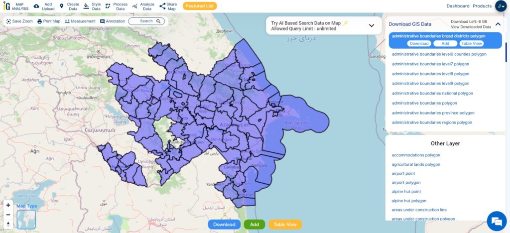
Download Azerbaijan Districts Shapefile Data
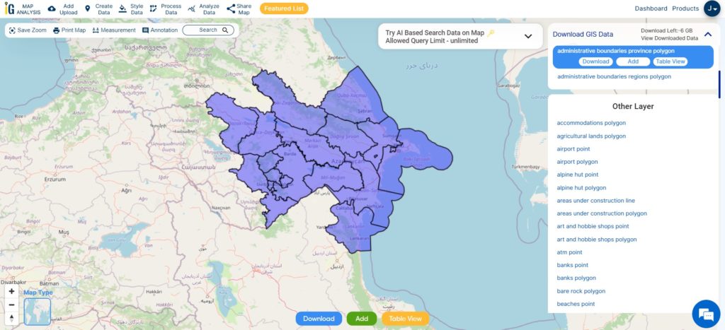
Azerbaijan, with its diverse territory, is organized into eight regions, one of which is the autonomous region of Naxcivan. Within these regions, there are a total of 59 districts, with eight districts falling under the jurisdiction of Naxcivan (Figure 4). The capital city of Baku, with a population of 2,725,000, is further divided into 10 districts and 48 municipalities. Notably, Baku is twinned with the city of Naples in Italy.
Disclaimer : If you find any shapefile data of country provided is incorrect do contact us or comment below, so that we will correct the same in our system as well we will try to correct the same in openstreetmap.
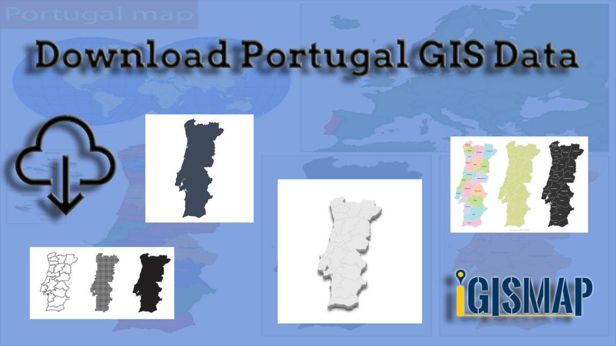
IGISMAP introduces a remarkable opportunity: download Portugal’s administrative boundary GIS data, encompassing regions, districts, and beyond. Elevate your mapping projects with these extensive GIS datasets.
Exhausted from the never-ending search for GIS data? Rejoice, for your quest has finally led you to the right place! Introducing IGISMAP GIS Data collection, your ultimate source for comprehensive GIS data spanning across 150+ countries, with a whopping 150+ datasets available for each country. What sets IGISMAP GIS data collection apart is its unparalleled accuracy in representing the administrative divisions of each nation. Unlocking this valuable data is made effortless through two powerful tools: Download GIS Data and Add GIS Data, both seamlessly integrated into the IGISMAP platform. Download your desired data in various formats, be it ESRI Shapefile, KML, GeoJSON or CSV, with just a few clicks.
This article will walk you through the GIS data collection for Portugal and how it can be accessed from Download GIS Data tool. For more insights into the Add GIS Data tool and its functionalities, delve into the dedicated article – “Add GIS data from IGISMap GIS data collection.” Embrace a whole new GIS data experience with IGISMAP today! Here we will focus on the administrative divisions GIS data available for Portugal.
Note:
All data available are in GCS datum EPSG:4326 WGS84 CRS (Coordinate Reference System).
You need to login for downloading the shapefile.
Here is the video tutorial to download data:
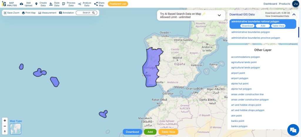
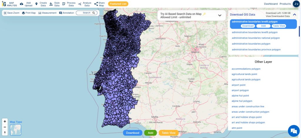
Download Shapefile Data of Portugal
Administratively, Portugal is divided into 18 districts, each with its own distinct charm and culture. Lisbon, the capital and largest city, lies in the Lisbon District, serving as the economic and cultural heart of the nation.
After successfully logging in with a legitimate email address, select the country you want to work with. Next, choose the specific layer you need and click on the download option. Once that’s done, pick the desired format to acquire the essential GIS data. Before proceeding with the data download, make sure to review the data table for any relevant information.
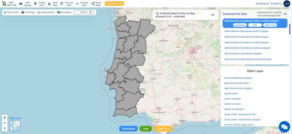
Download Portugal District Shapefile Data
The district serves as an administrative unit and is further divided into municipalities (concelhos) and parishes (freguesias). The district capitals are usually the largest cities within each district and serve as regional administrative centers.
This shapefile covers following districts of portugal listed below:
Aveiro
Beja
Braga
Bragança
Castelo Branco
Coimbra
Évora
Faro
Guarda
Leiria
Lisbon (Lisboa in Portuguese)
Portalegre
Porto
Santarém
Setúbal
Viana do Castelo
Vila Real
Viseu
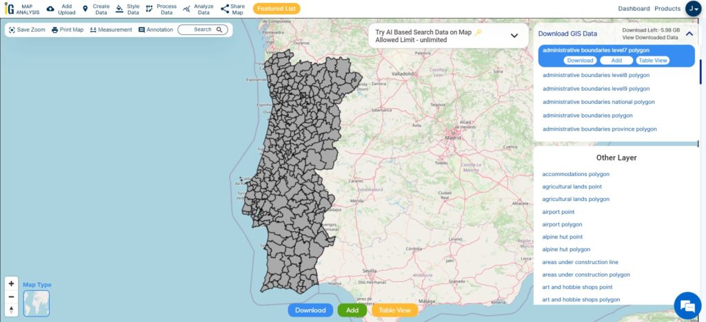
Download Portugal Municipality Shapefile Data
In Portugal’s administrative landscape, municipalities play a crucial role in local governance and empowering communities. Also known as “concelhos,” they represent the smallest territorial divisions in the country, with 308 spread throughout the nation.
In Portugal’s administrative framework, civil parishes, also known as “freguesias,” hold a vital place as the heart of local communities. With approximately 3,000 civil parishes spread throughout the country, these small territorial units play a significant role in fostering close connections and enhancing civic life.
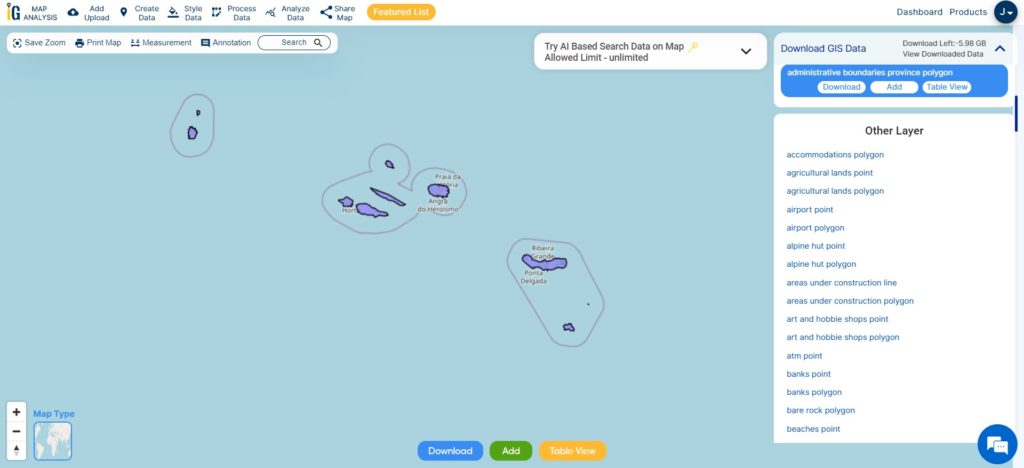
Portugal is home to several islands, with the two main island groups being the Azores and Madeira. Here is a brief overview of each:
Azores: The Azores archipelago consists of nine volcanic islands located in the North Atlantic Ocean. The islands are divided into three groups: the Eastern Group (São Miguel and Santa Maria), the Central Group (Terceira, Graciosa, São Jorge, Pico, and Faial), and the Western Group (Flores and Corvo). The Azores are known for their stunning natural landscapes, including lush greenery, volcanic craters, thermal hot springs, and picturesque lakes.
Madeira: Madeira is an autonomous region comprising the main island of Madeira and the smaller island of Porto Santo, both situated in the North Atlantic Ocean. Known as the “Pearl of the Atlantic,” Madeira is celebrated for its year-round mild climate, lush botanical gardens, and impressive levada trails. The archipelago also includes the uninhabited Desertas and Selvagens Islands, which are nature reserves known for their unique flora and fauna.
These islands offer a wide range of attractions and activities, making them popular destinations for travelers seeking natural beauty, outdoor adventures, and a taste of Portuguese culture and hospitality.
Disclaimer : If you find any shapefile data of country provided is incorrect do contact us or comment below, so that we will correct the same in our system as well we will try to correct the same in openstreetmap.
 Geographic Information System is a system intends to capture, Store, manage, manipulate, analyze the data.